The Merrick by Grainger · 11 Merrick Road, Southall, London UB2 4BF
Completing 2027
Grainger has 29 developments on Homello. Homes in Southall sold for a median £450,000 over the last year, £519 per sq ft; see house prices in Southall.
About The Merrick
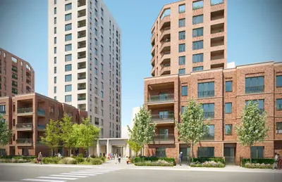
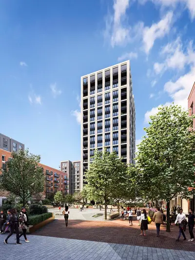
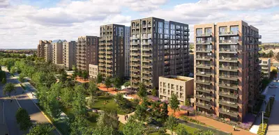
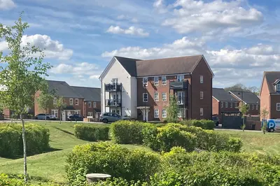
The Merrick is Grainger’s forthcoming rental development at 11 Merrick Road in Southall. It forms the 401-home build-to-rent component of the wider Merrick Place regeneration. Grainger’s latest published update confirms that the scheme remains on site, with completion expected in 2027; the current operator page invites registration rather than confirming homes ready to occupy.
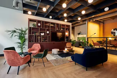
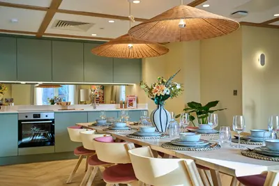
The advertised range spans studios and apartments with one, two or three bedrooms. Planned shared facilities include a gym, workspaces, a residents’ lounge and private dining space. Outdoor terraces and private balconies are also listed. The published offer includes an on-site team, bike and parcel storage, Wi-Fi and a pet-friendly approach. Planned car parking is limited and charged separately. Southall station provides Elizabeth line connections nearby.
- Developer
- Grainger
- City
- London
- Neighbourhood
- Southall
- Postcode
- UB2 4BF
- Address
- 11 Merrick Road
- Total homes
- 401
- Tenure
- Build to rent
Facilities
- Gym (Planned)
- Outdoor terrace (Planned)
- Co-working (Planned)
- Residents’ lounge (Planned)
- On-site management (Planned)
- Private dining (Planned)
- Broadband (Planned)
- Parcel storage (Planned)
- Bike storage (Planned)
- Pet friendly (Planned)
- Private balcony (Planned)
- Parking (Planned; limited spaces, extra charge and first-come allocation)
Questions about The Merrick
›Who is the developer of The Merrick?
The Merrick is a Grainger development in Southall, London. Grainger has 29 developments listed on Homello.
›Are homes available to rent at The Merrick?
The Merrick is marked "coming soon", completing 2027. Use the enquiry button to check current availability with Grainger.
›What are house prices like in Southall?
The median sold price in Southall was £450,000 over the last 12 months (238 sales, −3.2% on the year before), or £519 per square foot, from HM Land Registry data. The house prices in Southall page has the trend, prices by property type and every street.
Location
11 Merrick Road, UB2 4BF
Nearest stations
- Southall Station 0.1 milesElizabeth line · Great Western
- Hanwell Station 1.7 milesElizabeth line
- Hayes & Harlington Station 1.9 milesElizabeth line · Great Western
- Osterley Station 2.0 milesPiccadilly line
Nearest schools
- Ayesha Siddiqa Girls School 0.1 milesIndependent · ages 11–19
- Hambrough Primary School 0.2 milesPrimary · ages 3–11
- Villiers High School 0.3 milesSecondary · ages 11–18
- Beaconsfield Primary and Nursery School 0.3 milesPrimary · ages 3–11 Good
Nearest supermarkets
- Iceland Supermarket 0.2 miles
- Tesco Express Convenience store 0.4 miles
- Tesco Express Convenience store 1.0 miles
- Farmfoods Convenience store 1.1 miles
Eating out nearby
Within half a mile: 114 restaurants and cafes, 4 pubs and bars, 47 takeaways.
- The Centre By Bukhara <0.1 milesRestaurant or cafe
- Building Cafe @ Vistry Group 0.1 milesRestaurant or cafe
- Browns Cafe 0.1 milesRestaurant or cafe
- The Coffee Stop 0.1 milesTakeaway
Straight-line distances; actual routes will be longer. Stations from NaPTAN, with their lines powered by TfL Open Data; schools from the Department for Education register, with the latest Ofsted signal; supermarkets from Geolytix Retail Points; places to eat from the Food Standards Agency's register of food businesses.
Area insights
The Ealing neighbourhood around this development.
Sources: HM Land Registry price paid data, Police.uk, Historic England, ONS Census 2021, Ofcom Connected Nations, Environment Agency. Planning offices.

Register for launch pricing and availability.
Details last confirmed on 21 October 2026.