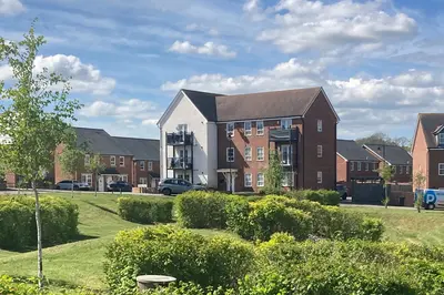
The Kimmeridge by Grainger · 2 Westminster Way, Oxford, Oxfordshire OX2 0FN
Completed
Grainger has 29 developments on Homello. Homes in Oxford sold for a median £460,000 over the last year, £507 per sq ft; see house prices in Oxford.
About The Kimmeridge
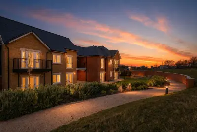
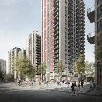
The Kimmeridge is Grainger’s rental development at 2 Westminster Way, west of Oxford city centre. It offers one- and two-bedroom apartments, with winter gardens advertised in many homes. These enclosed balconies provide private outdoor space, while the surrounding neighbourhood has independent shops and access to the A34.
Shared facilities include outdoor terraces, a residents’ lounge, co-working space and a meeting room. There is also a gym and private dining space for larger gatherings. The operator lists an on-site team, parcel storage, bike storage and Wi-Fi among the services available to residents. Pets are welcome. Parking is limited, costs extra and is offered on a first-come basis. Apartment layouts, winter-garden provision and parking availability should be checked for the individual home.
- Developer
- Grainger
- City
- Oxfordshire
- Neighbourhood
- Oxford
- Postcode
- OX2 0FN
- Address
- 2 Westminster Way
- Tenure
- Build to rent
Facilities
- Outdoor terrace
- Co-working
- Private dining
- Residents’ lounge
- Gym
- On-site management
- Meeting room
- Pet friendly
- Parcel storage
- Bike storage
- Broadband
- Private balcony (Confirm individual apartment specification)
- Parking (Extra charge; limited spaces, first come, first served)
Questions about The Kimmeridge
›Who is the developer of The Kimmeridge?
The Kimmeridge is a Grainger development in Oxford, Oxfordshire. Grainger has 29 developments listed on Homello.
›Are homes available to rent at The Kimmeridge?
The Kimmeridge is marked "now selling", completed. Use the enquiry button to check current availability with Grainger.
›What are house prices like in Oxford?
The median sold price in Oxford was £460,000 over the last 12 months (1,629 sales, +0.0% on the year before), or £507 per square foot, from HM Land Registry data. The house prices in Oxford page has the trend, prices by property type and every street.
Location
2 Westminster Way, OX2 0FN
Nearest stations
- Oxford Station 1.2 milesChiltern, CrossCountry, Great Western
- Oxford Parkway Station 3.7 milesChiltern
- Radley Station 5.1 milesGreat Western
- Islip Station 5.7 milesChiltern
Nearest schools
- Botley School 0.1 milesPrimary · ages 3–11
- North Hinksey Church of England Primary School 0.6 milesPrimary · ages 0–11 Good
- Matthew Arnold School 0.7 milesSecondary · ages 11–18 Good
- West Oxford Community Primary School 0.9 milesPrimary · ages 3–11 Good
Nearest supermarkets
- The Co-operative Food Convenience store <0.1 miles
- Morrisons Daily Convenience store 0.1 miles
- Iceland Convenience store 0.1 miles
- Tesco Express Convenience store 0.1 miles
Eating out nearby
Within half a mile: 9 restaurants and cafes, 1 pub or bar, 7 takeaways.
- Coffee #1 <0.1 milesRestaurant or cafe
- Noodle king <0.1 milesTakeaway
- Tempering Indian Restaurant & Bar <0.1 milesRestaurant or cafe
- Botley Seniors Luncheon Club <0.1 milesRestaurant or cafe
Straight-line distances; actual routes will be longer. Stations from NaPTAN, with their lines powered by TfL Open Data; schools from the Department for Education register, with the latest Ofsted signal; supermarkets from Geolytix Retail Points; places to eat from the Food Standards Agency's register of food businesses.
Area insights
The Vale of White Horse neighbourhood around this development.
Sources: HM Land Registry price paid data, Police.uk, Historic England, ONS Census 2021, Ofcom Connected Nations, Environment Agency. Planning offices.

Register for launch pricing and availability.
Details last confirmed on 21 October 2026.