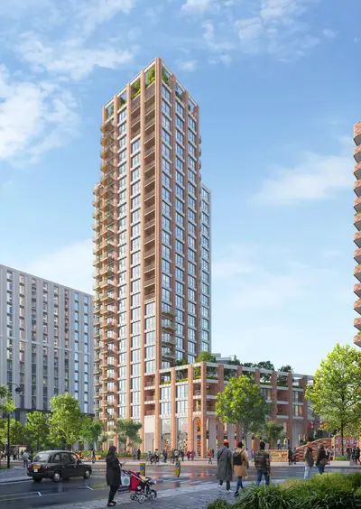
Southall Sidings by Connected Living London / Grainger · 121 Park Avenue, Southall, London UB1 3AF
Planned
Connected Living London / Grainger has 2 developments on Homello. Homes in Southall sold for a median £450,000 over the last year, £519 per sq ft; see house prices in Southall.
About Southall Sidings
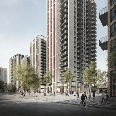
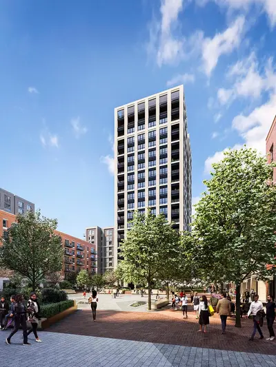
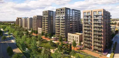
Southall Sidings is a planned rental neighbourhood on Park Avenue in Southall, proposed by Connected Living London, the partnership between Grainger and Places for London. The scheme is designed to provide 460 homes, including 40% affordable housing, on land beside the railway that has been used for storage and railway works. The design combines lower courtyard buildings facing Park Avenue with taller buildings set farther from the road.
Shared spaces are planned to connect the buildings and give residents places to meet, work and relax. Published proposals include a gym, residents’ lounge, co-working space and roof terrace. Southall station provides nearby Elizabeth Line and National Rail connections, and Southall Park is within the surrounding neighbourhood. These are proposed homes and facilities; a construction start or opening date has not been confirmed.
- Developer
- Connected Living London / Grainger
- City
- London
- Neighbourhood
- Southall
- Postcode
- UB1 3AF
- Address
- 121 Park Avenue
- Total homes
- 460
- Tenure
- Build to rent
Facilities
- Gym (Planned)
- Residents’ lounge (Planned)
- Co-working (Planned)
- Roof terrace (Planned)
Questions about Southall Sidings
›Who is the developer of Southall Sidings?
Southall Sidings is a Connected Living London / Grainger development in Southall, London. Connected Living London / Grainger has 2 developments listed on Homello.
›Are homes available to rent at Southall Sidings?
Southall Sidings: planned. Use the enquiry button to check current availability with Connected Living London / Grainger.
›What are house prices like in Southall?
The median sold price in Southall was £450,000 over the last 12 months (238 sales, −3.2% on the year before), or £519 per square foot, from HM Land Registry data. The house prices in Southall page has the trend, prices by property type and every street.
Location
121 Park Avenue, UB1 3AF
Nearest stations
- Southall Station 0.4 milesElizabeth line · Great Western
- Hanwell Station 1.4 milesElizabeth line
- Drayton Green Station 1.8 milesGreat Western
- Castle Bar Park Station 1.9 milesGreat Western
Nearest schools
- Villiers High School 0.2 milesSecondary · ages 11–18
- Grove House Nursery School & Children's Centre 0.3 milesNursery · ages 3–5 Outstanding
- Hambrough Primary School 0.4 milesPrimary · ages 3–11
- Ayesha Siddiqa Girls School 0.4 milesIndependent · ages 11–19
Nearest supermarkets
- Iceland Supermarket 0.3 miles
- Tesco Express Convenience store 0.8 miles
- Tesco Express Convenience store 1.2 miles
- Farmfoods Convenience store 1.3 miles
Eating out nearby
Within half a mile: 64 restaurants and cafes, 3 pubs and bars, 33 takeaways.
- Roti Shack <0.1 milesTakeaway
- The Terrace 0.2 milesPub or bar
- Steve's Goan Foods 0.2 milesRestaurant or cafe
- Shahi Nan Kebab 0.2 milesRestaurant or cafe
Straight-line distances; actual routes will be longer. Stations from NaPTAN, with their lines powered by TfL Open Data; schools from the Department for Education register, with the latest Ofsted signal; supermarkets from Geolytix Retail Points; places to eat from the Food Standards Agency's register of food businesses.
Area insights
The Ealing neighbourhood around this development.
Sources: HM Land Registry price paid data, Police.uk, Historic England, ONS Census 2021, Ofcom Connected Nations, Environment Agency. Planning offices.
Register for launch pricing and availability.
Details last confirmed on 21 October 2026.