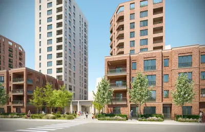
Chiswick Reach by Connected Living London / Grainger · Phase 1, 200 Bollo Lane, Acton, Greater London W3 8QU
Under construction
Connected Living London / Grainger has 2 developments on Homello. Homes in Hounslow sold for a median £495,000 over the last year, £581 per sq ft; see house prices in Hounslow.
About Chiswick Reach
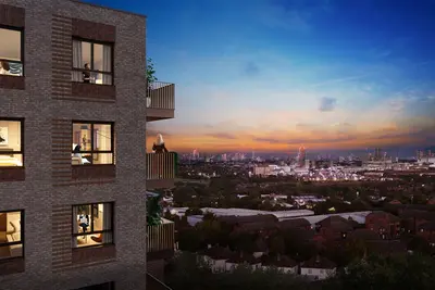
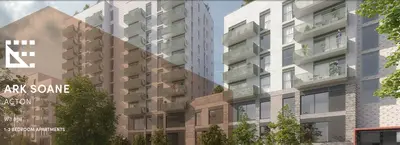
Chiswick Reach is the 195-home rental phase of the Bollo Lane regeneration in Acton, west London. Connected Living London, the partnership between Grainger and Places for London, is acquiring the homes from Barratt London. The rental phase includes 95 discounted-market-rent homes alongside private rental apartments.
Construction has started, and Grainger’s programme targets a launch in early 2029. Planned resident facilities include a gym and co-working space within dedicated indoor amenity accommodation. These spaces are proposed features of the completed building rather than facilities currently open to residents. The wider Bollo Lane neighbourhood will also provide public green space, commercial premises and improved walking connections. Separate phases of the wider neighbourhood will contain homes for sale and other housing tenures. Nearby stations include Acton Town, Chiswick Park and South Acton.
- Developer
- Connected Living London / Grainger
- City
- Greater London
- Neighbourhood
- Acton
- Postcode
- W3 8QU
- Address
- Phase 1, 200 Bollo Lane
- Total homes
- 195
- Tenure
- Build to rent
Facilities
- Gym (Planned; subject to delivery and operator terms)
- Co-working (Planned; subject to delivery and operator terms)
Questions about Chiswick Reach
›Who is the developer of Chiswick Reach?
Chiswick Reach is a Connected Living London / Grainger development in Acton, Greater London. Connected Living London / Grainger has 2 developments listed on Homello.
›Are homes available to rent at Chiswick Reach?
Chiswick Reach is marked "coming soon", under construction. Use the enquiry button to check current availability with Connected Living London / Grainger.
›What are house prices like in Hounslow?
The median sold price in Hounslow was £495,000 over the last 12 months (1,913 sales, −1.0% on the year before), or £581 per square foot, from HM Land Registry data. The house prices in Hounslow page has the trend, prices by property type and every street.
Location
Phase 1, 200 Bollo Lane, W3 8QU
Nearest stations
- Acton Town Station 0.2 milesDistrict & Piccadilly lines
- South Acton Station 0.4 milesMildmay line
- Chiswick Park Station 0.6 milesDistrict line
- Gunnersbury Station 0.7 milesDistrict & Mildmay lines
Nearest schools
- Acton Gardens Primary School 0.3 milesPrimary · ages 3–11 Good
- South Acton Childrens Centre 0.3 milesNursery · ages 3–5 Good
- Eagle Park Independent School 0.3 milesSpecial · ages 6–19
- Ark Acton Academy 0.3 milesSecondary · ages 11–18
Nearest supermarkets
- Sainsburys Local Convenience store 0.2 miles
- Budgens Convenience store 0.2 miles
- Sainsburys Local Convenience store 0.3 miles
- Marks and Spencer BP Convenience store 0.3 miles
Eating out nearby
Within half a mile: 35 restaurants and cafes, 4 pubs and bars, 20 takeaways.
- The Foundry Bar 0.1 milesPub or bar
- JJ's Coffee Corner 0.1 milesRestaurant or cafe
- MUNCH By Modos 0.1 milesRestaurant or cafe
- Mez’s Kitchen 0.2 milesTakeaway
Straight-line distances; actual routes will be longer. Stations from NaPTAN, with their lines powered by TfL Open Data; schools from the Department for Education register, with the latest Ofsted signal; supermarkets from Geolytix Retail Points; places to eat from the Food Standards Agency's register of food businesses.
Area insights
The Ealing neighbourhood around this development.
Sources: HM Land Registry price paid data, Police.uk, Historic England, ONS Census 2021, Ofcom Connected Nations, Environment Agency. Planning offices.
Register for launch pricing and availability.
Details last confirmed on 21 October 2026.