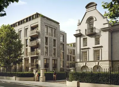
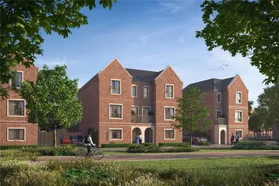
Pearson Building by London Square · 6–44 Station Road, Croydon, Greater London CR0 2RB
Completed
London Square has 5 developments on Homello. Homes in Croydon sold for a median £430,000 over the last year, £467 per sq ft; see house prices in Croydon.
About Pearson Building
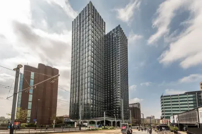
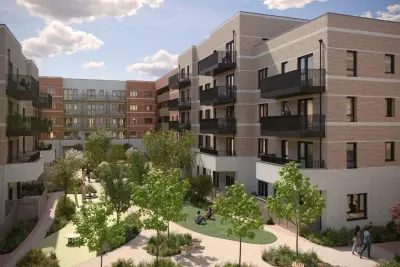
Pearson Building is London Square’s completed apartment development on Station Road in Croydon, with a final selection of new homes still offered for private sale. The current release focuses on one-bedroom apartments, while the wider development also includes two-bedroom homes. Residents have a 24-hour concierge, shared rooftop terraces, a landscaped podium garden and a lounge with Wi-Fi.
Bike storage is provided within the development. The building sits between Croydon’s main rail connections and the town centre, with shops, cafés and other everyday services in the surrounding neighbourhood. Buyers can view the remaining apartments by appointment at the on-site show home. Availability varies by apartment, with completed homes currently marketed as ready to move into.
- Developer
- London Square
- City
- Greater London
- Neighbourhood
- Croydon
- Postcode
- CR0 2RB
- Address
- 6–44 Station Road, Croydon
- Tenure
- For sale
Facilities
- Concierge (24-hour service)
- Roof terrace (Shared rooftop terraces)
- Garden (Landscaped podium garden)
- Residents’ lounge (Shared lounge with Wi-Fi)
- Bike storage
Questions about Pearson Building
›Who is the developer of Pearson Building?
Pearson Building is a London Square development in Croydon, Greater London. London Square has 5 developments listed on Homello.
›Is Pearson Building still selling?
Pearson Building is marked "final few", completed. Use the enquiry button to check current availability with London Square.
›What are house prices like in Croydon?
The median sold price in Croydon was £430,000 over the last 12 months (3,288 sales, +1.8% on the year before), or £467 per square foot, from HM Land Registry data. The house prices in Croydon page has the trend, prices by property type and every street.
Location
6–44 Station Road, Croydon, CR0 2RB
Nearest stations
- West Croydon Station <0.1 milesWindrush, Tram · Southern
- Centrale Station 0.2 milesTram
- Reeves Corner Station 0.3 milesTram
- Wellesley Road Station 0.3 milesTram
Nearest schools
- Harris Invictus Academy Croydon 0.2 milesSecondary · ages 11–18 Outstanding
- Al-Khair School Preparatory School 0.2 milesIndependent · ages 4–11
- St Mary's Catholic High School 0.3 milesSecondary · ages 11–19 Good
- St Mary's Catholic Infant School 0.3 milesPrimary · ages 3–7
Nearest supermarkets
- Marks and Spencer Superstore <0.1 miles
- Sainsburys Local Convenience store 0.1 miles
- Tesco Express Convenience store 0.1 miles
- Tesco Express Convenience store 0.2 miles
Eating out nearby
Within half a mile: 106 restaurants and cafes, 12 pubs and bars, 65 takeaways.
- Everydays Restaurant <0.1 milesRestaurant or cafe
- Clip 'N Climb Croydon <0.1 milesRestaurant or cafe
- Biters <0.1 milesTakeaway
- Croydon Shawarma <0.1 milesTakeaway
Straight-line distances; actual routes will be longer. Stations from NaPTAN, with their lines powered by TfL Open Data; schools from the Department for Education register, with the latest Ofsted signal; supermarkets from Geolytix Retail Points; places to eat from the Food Standards Agency's register of food businesses.
Area insights
The Croydon neighbourhood around this development.
Sources: HM Land Registry price paid data, Police.uk, Historic England, ONS Census 2021, Ofcom Connected Nations, Environment Agency. Planning offices.
Register for launch pricing and availability.
Details last confirmed on 22 October 2026.