The Draper by Way of Life · 2 Caversham Road, Colindale, Greater London NW9 4GR
Completed
Way of Life has 4 developments on Homello. Homes in Barnet sold for a median £585,000 over the last year, £603 per sq ft; see house prices in Barnet.
About The Draper
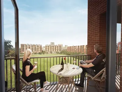
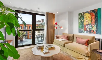
The Draper is Way of Life’s rental development at 2 Caversham Road in Colindale, north-west London. Its current letting page offers apartments ready to move into and publishes example studio, one-, two- and three-bedroom floorplans. Furnished apartments are available, and balconies or terraces appear among the advertised home features.
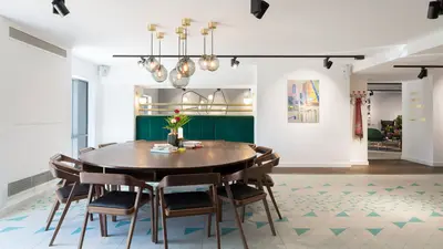
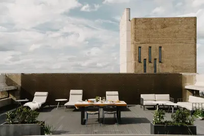
Residents have access to a gym, swimming pool, roof terrace and co-working spaces. Wi-Fi is included and pets are allowed under the operator’s policy. A programme of resident events provides opportunities to meet neighbours. The operator lists Colindale Underground station and nearby bus routes among the local connections. Apartment layouts, outdoor space, furnishing options and any access arrangements for the shared facilities should be checked for the individual home.
- Developer
- Way of Life
- City
- Greater London
- Neighbourhood
- Colindale
- Postcode
- NW9 4GR
- Address
- 2 Caversham Road
- Tenure
- Build to rent
Facilities
- Gym
- Pool
- Roof terrace
- Co-working
- Broadband (Included)
- Pet friendly
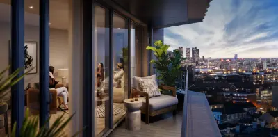
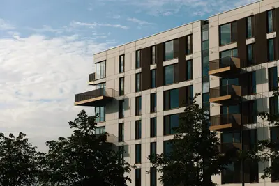
- Private balcony (Balcony or terrace; confirm individual apartment specification)
Questions about The Draper
›Who is the developer of The Draper?
The Draper is a Way of Life development in Colindale, Greater London. Way of Life has 4 developments listed on Homello.
›Are homes available to rent at The Draper?
The Draper is marked "now selling", completed. Use the enquiry button to check current availability with Way of Life.
›What are house prices like in Barnet?
The median sold price in Barnet was £585,000 over the last 12 months (2,429 sales, +2.5% on the year before), or £603 per square foot, from HM Land Registry data. The house prices in Barnet page has the trend, prices by property type and every street.
Location
2 Caversham Road, NW9 4GR
Nearest stations
- Colindale Station 0.4 milesNorthern line
- Hendon Central Station 1.0 milesNorthern line
- Hendon Station 1.0 milesThameslink
- Burnt Oak Station 1.2 milesNorthern line
Nearest schools
- North London Grammar School 0.3 milesIndependent · ages 4–18
- Sunnyfields Primary School 0.4 milesPrimary · ages 3–11 Good
- St James' Catholic High School 0.4 milesSecondary · ages 11–18 Good
- Blessed Dominic Catholic Primary School 0.4 milesPrimary · ages 3–11
Nearest supermarkets
- Tesco Express Convenience store 0.2 miles
- Sainsburys Local Convenience store 0.3 miles
- The Co-operative Food Convenience store 0.4 miles
- Sainsburys Local Convenience store 0.5 miles
Eating out nearby
Within half a mile: 15 restaurants and cafes, 2 pubs and bars, 1 takeaway.
- Dear Coco @ The Draper <0.1 milesRestaurant or cafe
- Moes Peri Peri 0.2 milesRestaurant or cafe
- JM Oriental 0.2 milesRestaurant or cafe
- Saag 0.2 milesRestaurant or cafe
Straight-line distances; actual routes will be longer. Stations from NaPTAN, with their lines powered by TfL Open Data; schools from the Department for Education register, with the latest Ofsted signal; supermarkets from Geolytix Retail Points; places to eat from the Food Standards Agency's register of food businesses.
Area insights
The Barnet neighbourhood around this development.
Sources: HM Land Registry price paid data, Police.uk, Historic England, ONS Census 2021, Ofcom Connected Nations, Environment Agency. Planning offices.

Register for launch pricing and availability.
Details last confirmed on 21 October 2026.