The Avenue at Thorpe Park, Leeds by Redrow Homes · Barrington Way, off William Parkin Way, Leeds, West Yorkshire LS15 8AD
Completed
Redrow Homes has 199 developments on Homello. Homes in Leeds sold for a median £245,000 over the last year, £278 per sq ft; see house prices in Leeds.
About The Avenue at Thorpe Park, Leeds
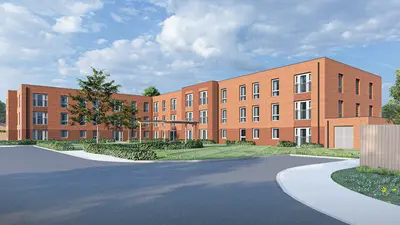
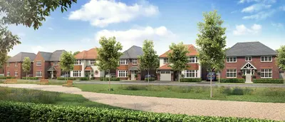
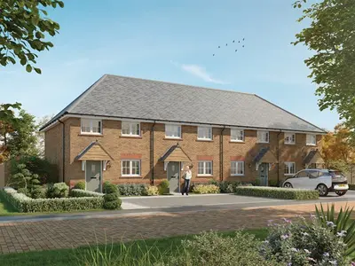
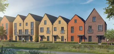
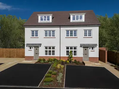
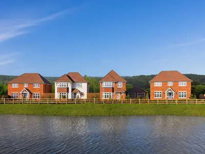
The Avenue at Thorpe Park is a new build homes development by Redrow Homes, located at Barrington Way, off William Parkin Way, Leeds, West Yorkshire, LS15 8AD. This residential phase is a core part of the larger Thorpe Park Leeds masterplan, which integrates commercial, residential, and extensive leisure facilities into a single, comprehensive community to the east of Leeds city centre. The development features a selection of two, three, and four-bedroom properties, primarily drawn from Redrow’s Arts and Crafts inspired Heritage Collection, alongside a small number of contemporary designs.
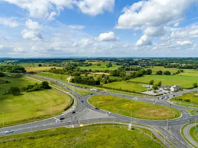
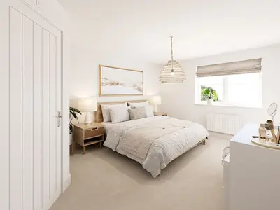
Properties at The Avenue have been available as two, three, and four-bedroom houses, including specific styles like the three-bedroom detached 'Amberley' and the two-bedroom 'Buxton'. The homes are generally characterised by spacious layouts, such as the three-bedroom detached styles featuring an open-plan kitchen and dining area extending the full width of the property, separate lounges, and main bedrooms with en-suite facilities. A focus on modern specification is evident, with some properties designated as 'Eco Electric' homes, incorporating energy-efficient features such as air source heat pumps, underfloor heating, and pre-installed ultrafast broadband connectivity. Redrow Homes is a large-scale developer with a reputation for high-quality design, having consistently received a high star rating for customer satisfaction, though potential buyers should review individual site-specific feedback regarding post-sale service and snagging. The development’s location offers exceptional connectivity and immediate access to substantial local amenities. For motorists, the site is ideally situated just off Junction 46 of the M1 motorway, providing seamless access to the national road network and being a key part of the East Leeds Orbital Road. Public transport is supported by frequent bus services (Routes 163, 164, 165, 19/19A by Arriva and First Leeds) running through the business park, with direct bus journeys to Leeds City Centre taking approximately 31-33 minutes. Cross Gates railway station is situated just over a mile away, offering an 8-minute train journey to Leeds and around 30 minutes to York. Furthermore, a new Thorpe Park Railway Station is anticipated to open in 2024, providing a short walk to enhanced rail links. Residents benefit from 'The Springs' retail and leisure complex located on the doorstep. Specific amenities include a 10-screen ODEON Luxe cinema, a PureGym, and a range of named dining options such as Wagamama, Nando’s, and Pret a Manger. Shopping is provided by popular high-street brands including NEXT, H&M, TK Maxx, and M&S. The wider Thorpe Park area also incorporates 140 acres of public parkland and open green spaces. The area offers access to outstanding local schools at all age levels; prospective homeowners should verify current catchment information with the local authority. The Avenue at Thorpe Park development is nearing completion and the Customer Experience Suite at the Barrington Way location is now closed. Interested homebuyers must note that remaining new build homes are being sold from the nearby Redrow development, Centurion Fields, Manston Lane, LS15 8ST. Current and definitive pricing for available two, three, and four-bedroom properties, along with information on specific completion schedules, must be obtained by contacting the Redrow Homes sales team at the Centurion Fields office. The developer offers the 'Help to Sell' scheme to assist buyers with existing properties.
- Developer
- Redrow Homes
- City
- West Yorkshire
- Neighbourhood
- Leeds
- Postcode
- LS15 8AD
- Address
- Barrington Way, off William Parkin Way, Leeds, West Yorkshire
- Tenure
- For sale
Questions about The Avenue at Thorpe Park, Leeds
›Who is the developer of The Avenue at Thorpe Park, Leeds?
The Avenue at Thorpe Park, Leeds is a Redrow Homes development in Leeds, West Yorkshire. Redrow Homes has 199 developments listed on Homello.
›Can I still buy a home at The Avenue at Thorpe Park, Leeds?
The Avenue at Thorpe Park, Leeds is sold out, and Redrow Homes is no longer marketing homes there.
›What are house prices like in Leeds?
The median sold price in Leeds was £245,000 over the last 12 months (7,342 sales, +1.0% on the year before), or £278 per square foot, from HM Land Registry data. The house prices in Leeds page has the trend, prices by property type and every street.
Location
Barrington Way, off William Parkin Way, Leeds, West Yorkshire, LS15 8AD
Nearest stations
- Cross Gates Station 1.3 milesNorthern, TransPennine
- Garforth Station 1.7 milesNorthern, TransPennine
- East Garforth Station 2.3 milesNorthern, TransPennine
- Woodlesford Station 3.5 milesNorthern
Nearest schools
- Austhorpe Primary School 0.8 milesPrimary · ages 4–11 Good
- John Smeaton Academy 0.9 milesSecondary · ages 11–18
- Manston St James Primary Academy 1.1 milesPrimary · ages 4–11
- Colton Primary School 1.1 milesPrimary · ages 3–11
Nearest supermarkets
- Marks and Spencer Foodhall Supermarket 0.4 miles
- Cook Convenience store 0.4 miles
- Sainsburys Superstore 1.0 miles
- Heron Convenience store 1.2 miles
Eating out nearby
Within half a mile: 12 restaurants and cafes, 1 pub or bar.
- Caffe Nero 0.3 milesRestaurant or cafe
- Lowell 0.4 milesRestaurant or cafe
- Hotel Chocolat 0.4 milesRestaurant or cafe
- Costa Coffee 0.4 milesRestaurant or cafe
Straight-line distances; actual routes will be longer. Stations from NaPTAN, with their lines powered by TfL Open Data; schools from the Department for Education register, with the latest Ofsted signal; supermarkets from Geolytix Retail Points; places to eat from the Food Standards Agency's register of food businesses.
Area insights
The Leeds neighbourhood around this development.
Sources: HM Land Registry price paid data, Police.uk, Historic England, ONS Census 2021, Ofcom Connected Nations, Environment Agency. Planning offices.
Resales appear under "On the market now" when listed; sold prices below.
Details last confirmed on 4 September 2026.