St George's Park by Bellway Homes · Suttons Lane, Hornchurch, Essex RM12 6RS
Bellway Homes has 236 developments on Homello. Homes in Hornchurch sold for a median £490,000 over the last year, £493 per sq ft; see house prices in Hornchurch.
About St George's Park
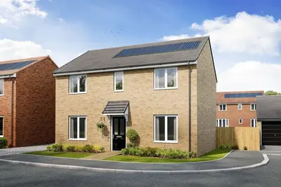
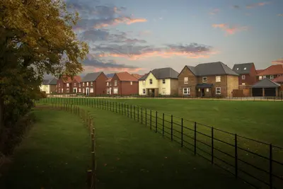
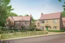
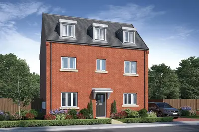
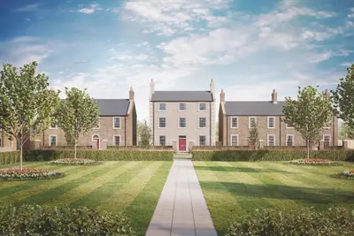
St George’s Park is a major new build property development by Bellway Homes, located on the site of the former St George’s Hospital on Suttons Lane, Hornchurch, Essex RM12 6RS. This 29-acre site, notable for its historic role housing RAF airmen, is being transformed into a residential community delivering a total of 356 new homes across two phases. The development is situated approximately one mile from the heart of Hornchurch town centre, placing residents close to local amenities while retaining access to significant green open spaces.
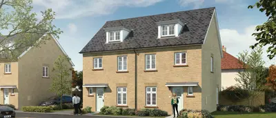
Bellway Homes, a FTSE 250 listed developer, has an established track record, being awarded 5-star builder status by the Home Builders Federation (HBF) for nine consecutive years, although prospective buyers should note the mixed customer feedback regarding aftercare and snagging, typical of major national housebuilders. St George’s Park offers a mixed portfolio of new homes, primarily comprising 1 and 2-bedroom apartments, alongside 3 and 4-bedroom houses. A smaller number of 5-bedroom detached houses were offered in earlier releases. A specific offering includes four unique, semi-detached ‘Gatehouse’ homes at the development entrance, designed to reflect the site’s heritage. For buyers requiring immediate occupancy, 'Good to Go' homes, such as the two-bedroom 'The Rose' apartment, are available on selected plots. The development's specification includes a 10-year NHBC warranty, energy-efficient boilers, and contemporary interiors. Kitchens are fitted with integrated appliances, including an oven, ceramic hob, and fridge/freezer. Bathrooms feature white sanitary ware and ceramic floor tiling. Apartments benefit from balconies, while houses feature private rear gardens, and all properties come with allocated car parking, with electric vehicle (EV) charging points available on certain plots. The location provides strong connectivity for London commuters. Hornchurch Underground Station (District Line) is within an 8-10 minute walk (0.5 miles) of the development. District Line services offer direct travel into the city, with estimated journey times of approximately 30 minutes to Tower Hill and 49 minutes to Embankment. Road access is also convenient, with the A12 and A13 both around four miles away, and the M25 London Orbital motor-way reachable within a 15-minute drive. London City Airport is a 25-minute drive for international travel. Local amenities are comprehensive, centred around Hornchurch town centre, which is approximately a mile away. Residents have access to major supermarkets, banks, a post office, and local GP/dental surgeries. Cultural and leisure facilities include The Queen's Theatre, an extensive library on North Street, and proximity to green spaces like Hornchurch Country Park and Harrow Lodge Park. The development is served by well-regarded local schools, including Suttons, Hacton, and Scotts Primary Schools, and secondary education at Gaynes School. Current Indicative Pricing: One-bedroom apartments start from £315,000, two-bedroom apartments are available (e.g., Plot 315 at £375,000), and the available semi-detached Gatehouse homes are priced from £620,000. Availability is nearing completion for some phases, with limited house types remaining. Incentives, including savings of up to £12,500 on deposit or cashback, are available on selected plots (subject to terms and conditions). Prospective buyers are advised to contact the Bellway Homes sales team for the most current availability, specific plot measurements, and completion dates.
- Developer
- Bellway Homes
- City
- Essex
- Neighbourhood
- Hornchurch
- Postcode
- RM12 6RS
- Address
- Suttons Lane, Hornchurch, Essex
- Tenure
- For sale
Questions about St George's Park
›Who is the developer of St George's Park?
St George's Park is a Bellway Homes development in Hornchurch, Essex. Bellway Homes has 236 developments listed on Homello.
›How much do homes at St George's Park cost?
Prices at St George's Park start from around £315,000 (taken from the developer's marketing, so treat it as a guide).
›What are house prices like in Hornchurch?
The median sold price in Hornchurch was £490,000 over the last 12 months (810 sales, +5.4% on the year before), or £493 per square foot, from HM Land Registry data. The house prices in Hornchurch page has the trend, prices by property type and every street.
Location
Suttons Lane, Hornchurch, Essex, RM12 6RS
Nearest stations
- Hornchurch Station 0.5 miles
- Elm Park Station 0.8 miles
- Upminster Bridge Station 1.1 miles
- Emerson Park Station 1.5 miles
Nearest schools
- Suttons Primary School 0.2 milesPrimary · ages 2–11 Good
- Sanders Draper 0.2 milesSecondary · ages 11–16
- Scotts Primary School 0.3 milesPrimary · ages 4–11
- Hacton Primary School 0.6 milesPrimary · ages 3–11 Outstanding
Straight-line distances; actual routes will be longer. Stations from NaPTAN; schools from the Department for Education register, with the latest Ofsted signal.
Area insights
The Havering neighbourhood around this development.
Sources: HM Land Registry price paid data, EPC register, Police.uk, Historic England, ONS Census 2021, Ofcom Connected Nations, Environment Agency. Planning offices.
Register for launch pricing and availability.