Sanderling Park by Redrow Homes · Andrews Lane, Formby, Liverpool, Merseyside L37 2EP
Completed 2021
Redrow Homes has 199 developments on Homello. Homes in Formby sold for a median £307,500 over the last year, £285 per sq ft; see house prices in Formby.
About Sanderling Park
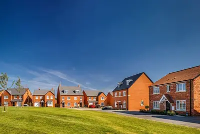
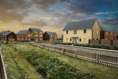
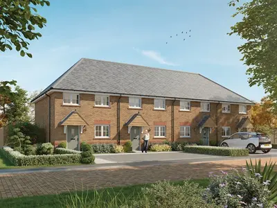
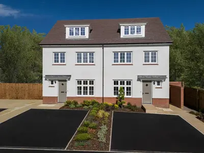
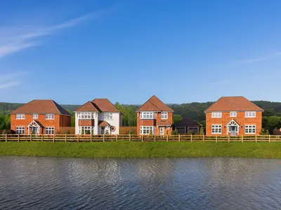
Development Overview Sanderling Park is an established new build development by Redrow Homes, located on Andrews Lane, Formby, Liverpool, Merseyside, L37 2EP. The site is a community of energy-efficient new build homes, with the earliest phases commencing construction around 2019/2021. The development features properties from Redrow’s award-winning Heritage Collection, known for blending traditional exterior designs with contemporary, spacious interiors.
Redrow Homes maintains a strong track record, having consistently achieved a five-star customer satisfaction rating from the Home Builders Federation (HBF) for 16 consecutive years, as recognised in the 2025 survey. Property Details The development comprises a diverse mix of residences, catering to a range of buyers, from first-time homeowners to large families. The property range includes two-bedroom apartments, such as 'The Alton' style, and two, three, and four-bedroom detached houses. Specific house types within the development or similar Redrow Formby sites include the two-bedroom Ledbury, three-bedroom detached homes like the Ludlow and Amberley, and four-bedroom detached properties such as the Cambridge and Harrogate. Resale data provides an indicative pricing structure for the completed properties. For example, two-bedroom apartments within Sanderling Park have been marketed with offers over £196,000, typically featuring a stylish open-plan kitchen/living/dining area, two allocated parking spaces, and fitted mirrored wardrobes in the main bedroom. Larger family homes, such as a three-bedroom detached house with three en-suites and a south-facing garden, have been successfully marketed at £475,000. All properties benefit from features like ultrafast broadband connectivity and are designed to modern energy efficiency standards. Location Benefits and Connectivity Sanderling Park is situated in the highly desirable Formby area, known for its proximity to significant natural amenities. Residents are within walking distance of Formby Beach, famous for its sweeping sands, dramatic dunes, and the National Trust-managed pine forests, home to the rare red squirrel. Transport links are practical for commuters. Freshfield Train Station is located nearby, providing direct Merseyrail services to Liverpool Central, with a journey time of approximately 35 minutes. Road connections offer easy access to the regional motorway network and place Liverpool city centre approximately 12 miles away. Locally, Formby boasts superb amenities, including a selection of shops and restaurants on its tree-lined avenues, as well as access to excellent educational institutions, including two local high schools rated as outstanding. Practical Information While indicative resale prices range from approximately £196,000 for apartments to £475,000 for detached family homes, prospective buyers are advised to contact the Redrow Homes sales team for current pricing and availability of new build plots. The development offers a mix of freehold and leasehold properties, with new build sales potentially utilising buying schemes (subject to availability and scheme terms). Viewing appointments for available new homes should be arranged directly with the developer.
- Developer
- Redrow Homes
- City
- Merseyside
- Neighbourhood
- Formby
- Postcode
- L37 2EP
- Address
- Andrews Lane, Formby, Liverpool, Merseyside
- Bedrooms
- 2–4
- Total homes
- 99
- Completed
- 2021
- Tenure
- For sale
Facilities
- Green space
- Parking
Sold prices at Sanderling Park
Since first completions in 2019, 5 homes here have resold, at a median of £460,000 (£332 per sq ft), +23% on their first-sale prices.That is 16% above the Formby median of £285 per sq ft.
| Address | Sold | Kind | Price |
|---|---|---|---|
| 49, Andrews Lane L37 2EP | May 2026 | Resale +33% | £460,000 · £375/sq ft |
| 61, Andrews Lane L37 2EP | Mar 2026 | Resale +28% | £493,100 · £382/sq ft |
| 33, Andrews Lane L37 2EP | Mar 2025 | Sale | £350,000 · £256/sq ft |
| 45, Andrews Lane L37 2EP | Aug 2024 | Resale +23% | £405,000 · £336/sq ft |
| 47, Andrews Lane L37 2EP | Apr 2024 | Resale +19% | £470,000 · £341/sq ft |
| 15, Andrews Lane L37 2EP | Mar 2024 | Sale | £800,000 · £232/sq ft |
| 19, Andrews Lane L37 2EP | Apr 2022 | Sale | £385,000 · £259/sq ft |
| 49, Andrews Lane L37 2EP | Jan 2022 | Resale +17% | £403,000 · £328/sq ft |
All sold prices in Liverpool →
Sales at the development's postcode and its listings' postcodes, as recorded by HM Land Registry; neighbouring addresses in the same postcode can be included.
Questions about Sanderling Park
›Who is the developer of Sanderling Park?
Sanderling Park is a Redrow Homes development in Formby, Merseyside. Redrow Homes has 199 developments listed on Homello.
›Can I still buy a home at Sanderling Park?
Sanderling Park is sold out, and Redrow Homes is no longer marketing homes there. 5 homes here have resold, at a median of £460,000.
›What have homes at Sanderling Park sold for?
5 homes at Sanderling Park have been resold since first completions in 2019, at a median of £460,000 (£332 per square foot), up 23% on what they first sold for. That is 16% above the Formby median of £285 per square foot.
›What are house prices like in Formby?
The median sold price in Formby was £307,500 over the last 12 months (146 sales, −0.8% on the year before), or £285 per square foot, from HM Land Registry data. The house prices in Formby page has the trend, prices by property type and every street.
›What type of homes are at Sanderling Park?
Sanderling Park offers houses and apartments, 2–4 bedroom homes, 99 homes in total, completed 2021. Homes are sold outright by Redrow Homes.
Location
Andrews Lane, Formby, Liverpool, Merseyside, L37 2EP
Nearest stations
- Formby Station 0.5 milesMerseyrail
- Freshfield Station 1.3 milesMerseyrail
- Hightown Station 1.6 milesMerseyrail
- Hall Road Station 3.5 milesMerseyrail
Nearest schools
- St Luke's Church of England Primary School 0.4 milesPrimary · ages 4–11
- Range High School 0.5 milesSecondary · ages 11–18 Expected standard
- Woodlands Primary School 0.7 milesPrimary · ages 3–11 Good
- Redgate Community Primary School 0.8 milesPrimary · ages 2–11 Good
Nearest supermarkets
- The Co-operative Food Convenience store 0.4 miles
- Marks and Spencer BP Convenience store 0.7 miles
- Iceland Supermarket 0.8 miles
- Marks and Spencer Simply Food Supermarket 0.8 miles
Eating out nearby
Within half a mile: 3 restaurants and cafes, 1 pub or bar, 3 takeaways.
- Crispy Cod 0.3 milesTakeaway
- Queens Road Social 0.3 milesRestaurant or cafe
- The Railway Hotel 0.4 milesPub or bar
- Cafe Kalila 0.4 milesRestaurant or cafe
Straight-line distances; actual routes will be longer. Stations from NaPTAN, with their lines powered by TfL Open Data; schools from the Department for Education register, with the latest Ofsted signal; supermarkets from Geolytix Retail Points; places to eat from the Food Standards Agency's register of food businesses.
Area insights
The Sefton neighbourhood around this development.
Sources: HM Land Registry price paid data, Police.uk, Historic England, ONS Census 2021, Ofcom Connected Nations, Environment Agency. Planning offices.

Resales appear under "On the market now" when listed; sold prices below.
Details last confirmed on 3 September 2026.