Brackenway by Taylor Wimpey · Brackenway, Formby, Merseyside, L37 7HF
Taylor Wimpey has 252 developments on Homello. Homes in Formby sold for a median £307,500 over the last year, £285 per sq ft; see house prices in Formby.
About Brackenway
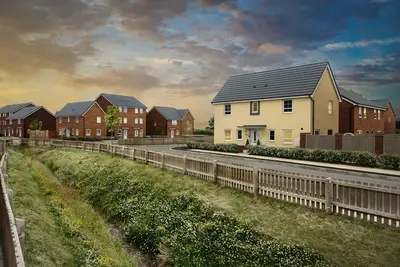
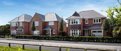
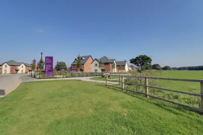
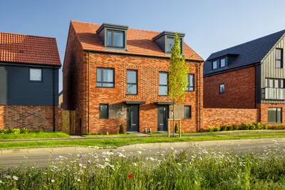
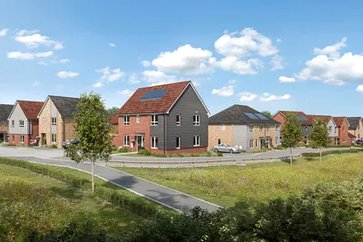
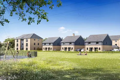
Brackenway is a new build development by Taylor Wimpey, located in the highly desirable residential area of Formby, Merseyside (L37 7HF). The development is slated to deliver a total of 262 high-quality new homes, comprising a mix of two-storey mews, semi-detached, and detached properties. The site was acquired in October 2024, with groundwork and construction expected to commence in early 2025.
The developer, Taylor Wimpey, holds a Home Builders Federation (HBF) 5-star rating for customer satisfaction, based on 9 out of 10 customers stating they would recommend the builder to a friend. This new development is planned to offer a range of energy-efficient homes across 2, 3, and 4 bedrooms, catering to a wide spectrum of buyers, from first-time movers to growing families. The property mix includes various architectural styles, confirmed as two-storey in design, encompassing mews, semi-detached, and detached house types. As part of the planning consent, the scheme will incorporate 79 residences designated as affordable housing. A key feature of the Brackenway development is the focus on integrated green space; Taylor Wimpey plans to deliver between 31 and 36 acres of open green space, including new grassland and balancing ponds, which will also contribute to an extension of the local nature reserve. Improved local amenities will also include a newly installed local play area, dedicated pedestrian and cycle connections, and upgrades to the Formby bridleway network. Brackenway’s location in Formby provides strong regional transport links and access to high-performing local services. The site is situated off Brackenway, with new access being constructed directly off the A565 Formby Bypass, facilitating efficient vehicular access to the wider Merseyside and Lancashire road network. For rail commuters, Formby Station (Merseyrail) provides frequent, direct services. The fastest train journey time to Liverpool Stations, including Liverpool Central and Moorfields, is approximately 27 to 30 minutes. For bus users, direct services from Formby to Liverpool are available, with an approximate journey time of 56 minutes. The local area is well-served by schools, making it attractive for families. Nearby primary schools include Trinity St Peter's CofE Primary School, which holds an 'Outstanding' Ofsted rating, and Redgate Community Primary School. For secondary education, Formby High School and Range High School (for 11-18 year olds) are local options, with Range High School previously noted as one of England’s top 100 non-selective comprehensive schools. The development also borders the Lancashire Wildlife Trust’s Freshfield Dune Heath Reserve, offering local residents direct access to a valuable natural environment and public open space. The development is managed by Taylor Wimpey North West. Specific, live pricing for the 2, 3, and 4-bedroom new build homes at Brackenway is currently to be confirmed. Interested parties should contact the Taylor Wimpey sales team directly for the latest plot releases, pricing schedules, and information regarding viewing arrangements, as physical show homes are pending the commencement of construction (expected early 2025). A significant portion of the site (79 homes) is allocated for affordable housing, with the remaining plots available for general sale. The overall masterplan includes contributions to the Sefton Coast Mitigation Scheme and infrastructure improvements, confirming Taylor Wimpey's investment in the local community.
- Developer
- Taylor Wimpey
- City
- Merseyside
- Neighbourhood
- Formby
- Postcode
- L37 7HF
- Address
- Brackenway, Formby, Merseyside, L37 7HF
- Total homes
- 262
- Tenure
- For sale
Facilities
- Green space
- Play area
- Bike storage
- Parking
Questions about Brackenway
›Who is the developer of Brackenway?
Brackenway is a Taylor Wimpey development in Formby, Merseyside. Taylor Wimpey has 252 developments listed on Homello.
›What are house prices like in Formby?
The median sold price in Formby was £307,500 over the last 12 months (146 sales, −0.8% on the year before), or £285 per square foot, from HM Land Registry data. The house prices in Formby page has the trend, prices by property type and every street.
›What type of homes are at Brackenway?
Brackenway offers houses, 262 homes in total. Homes are sold outright by Taylor Wimpey.
Location
Brackenway, Formby, Merseyside, L37 7HF
Nearest stations
- Freshfield Station 0.7 milesMerseyrail
- Formby Station 1.3 milesMerseyrail
- Ainsdale Station 2.3 milesMerseyrail
- Hightown Station 3.1 milesMerseyrail
Nearest schools
- Trinity St Peter's CofE Primary School 0.2 milesPrimary · ages 3–11 Good
- Freshfield Primary School 0.6 milesPrimary · ages 3–11
- Formby High School 0.8 milesSecondary · ages 11–18
- Our Lady of Compassion Catholic Primary School 0.9 milesPrimary · ages 3–11
Nearest supermarkets
- Spar Convenience store 0.4 miles
- Spar Convenience store 0.4 miles
- Marks and Spencer Simply Food Supermarket 0.9 miles
- Waitrose Large supermarket 0.9 miles
Eating out nearby
Within half a mile: 4 restaurants and cafes, 3 pubs and bars, 2 takeaways.
- Formby Hockey and Squash Club 0.3 milesPub or bar
- Grapes Hotel Formby - K-Town, Chik Box, Locked & Loaded, 88th Street 0.4 milesPub or bar
- Jungle Play Formby 0.4 milesRestaurant or cafe
- The Udder Guys 0.4 milesRestaurant or cafe
Straight-line distances; actual routes will be longer. Stations from NaPTAN, with their lines powered by TfL Open Data; schools from the Department for Education register, with the latest Ofsted signal; supermarkets from Geolytix Retail Points; places to eat from the Food Standards Agency's register of food businesses.
Area insights
The Sefton neighbourhood around this development.
Sources: HM Land Registry price paid data, Police.uk, Historic England, ONS Census 2021, Ofcom Connected Nations, Environment Agency. Planning offices.

Register for launch pricing and availability.