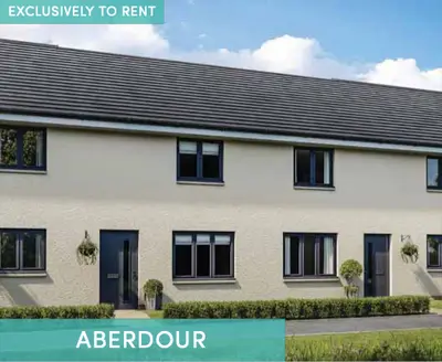
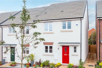
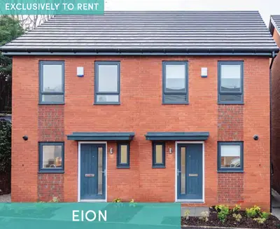
Reynolds Place by Simple Life · Worsley Road North, Greater Manchester M28 3GJ
Simple Life has 61 developments on Homello. Homes in Manchester sold for a median £250,000 over the last year, £291 per sq ft; see house prices in Manchester.
About Reynolds Place
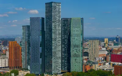
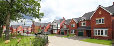
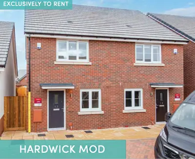
Discover Reynolds Place, a modern rental development by Simple Life in the desirable area of Worsley, Greater Manchester. This thoughtfully designed community offers a superb collection of high-quality, unfurnished homes, perfect for families and professionals seeking a blend of suburban tranquility and excellent connectivity. The development features a wide range of properties, from one and two-bedroom apartments to spacious two, three, and four-bedroom houses, ensuring a perfect fit for every lifestyle.
Each home at Reynolds Place is finished to a high standard, featuring: Fully integrated modern kitchens with appliances including a dishwasher, fridge/freezer, and washer/dryer. Contemporary bathrooms, with en-suites available in many properties. Secure by Design windows, multipoint locking system doors, and fitted alarm systems for complete peace of mind. Private turfed rear gardens for houses and allocated parking for residents. Perfectly located, the development is situated next to the beautiful Blackleach Country Park, a designated Local Nature Reserve. For commuters, Walkden train station is just a mile away, and the M61 motorway is within easy reach, providing straightforward access across the North West. The local area is well-served with amenities, including the Walkden Town Centre shopping area, a Tesco Extra, a medical centre, and a library. With a selection of highly-rated schools nearby, Reynolds Place is an ideal setting for modern, convenient living.
- Developer
- Simple Life
- City
- Greater Manchester
- Neighbourhood
- Worsley
- Postcode
- M28 3GJ
- Address
- Worsley Road North
- Total homes
- 148
- Tenure
- Build to rent
Facilities
- 24H Maintenance
- Pet Friendly
- Resident Events
- Bike Storage
- Professionally Managed
- Keyless Entry
- Courtyard Gardens
- Underground Parking
Questions about Reynolds Place
›Who is the developer of Reynolds Place?
Reynolds Place is a Simple Life development in Worsley, Greater Manchester. Simple Life has 61 developments listed on Homello.
›What are house prices like in Manchester?
The median sold price in Manchester was £250,000 over the last 12 months (10,345 sales, +0.0% on the year before), or £291 per square foot, from HM Land Registry data. The house prices in Manchester page has the trend, prices by property type and every street.
›What type of homes are at Reynolds Place?
Reynolds Place offers houses and apartments, 148 homes in total. Homes are let by the operator by Simple Life.
Location
Worsley Road North, M28 3GJ
Nearest stations
- Farnworth Station 1.0 milesNorthern
- Kearsley Station 1.1 milesNorthern
- Walkden Station 1.3 milesNorthern
- Moses Gate Station 1.3 milesNorthern
Nearest schools
- North Walkden Primary School 0.3 milesPrimary · ages 3–11 Needs attention
- St Peter's CofE Primary School 0.4 milesPrimary · ages 4–11 Outstanding
- Kearsley Academy 0.5 milesSecondary · ages 11–16 Strong standard
- Kearsley West Primary School 0.6 milesPrimary · ages 3–11
Nearest supermarkets
- Tesco Superstore 0.4 miles
- Asda Express Convenience store 0.4 miles
- Lidl Supermarket 0.6 miles
- Iceland Supermarket 0.7 miles
Eating out nearby
Within half a mile: 3 restaurants and cafes, 3 pubs and bars, 5 takeaways.
- Fowl Play 0.2 milesRestaurant or cafe
- Vulcan Inn 0.2 milesPub or bar
- Tesco Family Dining 0.3 milesRestaurant or cafe
- Bridgewater Hotel 0.3 milesPub or bar
Straight-line distances; actual routes will be longer. Stations from NaPTAN, with their lines powered by TfL Open Data; schools from the Department for Education register, with the latest Ofsted signal; supermarkets from Geolytix Retail Points; places to eat from the Food Standards Agency's register of food businesses.
Area insights
The Salford neighbourhood around this development.
Sources: HM Land Registry price paid data, Police.uk, Historic England, ONS Census 2021, Ofcom Connected Nations, Environment Agency. Planning offices.

Register for launch pricing and availability.