Radford's Meadow by Avant Homes · Church Lane, Micklefield, West Yorkshire LS25 4AX
Avant Homes has 63 developments on Homello. Homes in Leeds sold for a median £245,000 over the last year, £278 per sq ft; see house prices in Leeds.
About Radford's Meadow
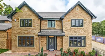
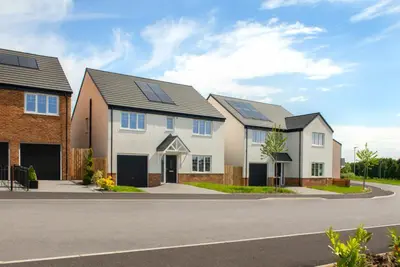
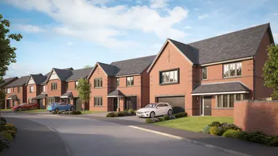
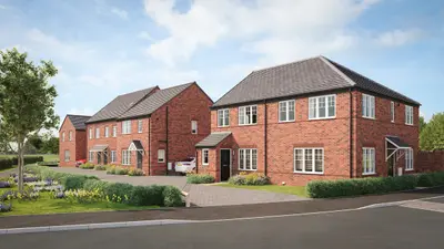
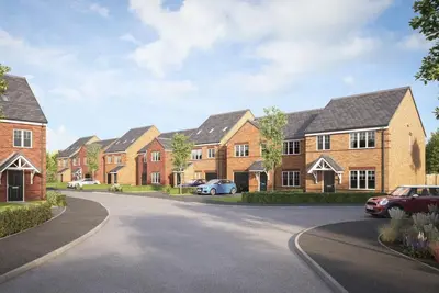
Radford's Meadow is a new build homes development by Avant Homes, located on Church Lane in the village of Micklefield, West Yorkshire (LS25 4AX). 3 million. The site offers a mix of 2, 3, 4, and 5-bedroom new build homes, designed to be practically focused and energy-efficient family residences.
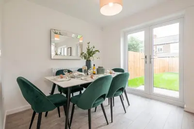
The development is nearing completion, with the final eight plots released for sale as of late 2024. Approximately 15% of the total homes have been designated as affordable housing. House types range from two-bedroom terraces to five-bedroom detached family homes. The final release of properties includes specific house types with concrete pricing. All homes feature Avant Homes' signature internal specification, which typically includes designer kitchens with integrated appliances, fashionable tiling, classic French doors, and spacious rooms designed for modern, open-plan living. All properties include dedicated off-street parking. The build quality adheres to modern energy-efficiency standards, potentially offering significant annual savings on energy bills for homeowners. Micklefield offers a balance of semi-rural living with excellent commuter access. The development benefits from close proximity to major road links, including the A1 and M1. Leeds city centre is approximately a 12-mile drive. Crucially for commuters, Micklefield train station is within walking distance (approximately 15 minutes) and provides regular services with journey times to Leeds and York in under 20 minutes. Local bus services also run through the village, connecting to areas such as Selby, Wakefield, and Castleford. Local amenities include a village convenience store. For comprehensive retail, major supermarkets like Tesco, Sainsbury's, and Co-op are within a 10-minute drive. The Springs retail and leisure destination is just a seven-minute drive away, offering a 10-screen Odeon Luxe Cinema, bowling, and a range of high street brands. For leisure, the Micklefield Recreation Ground (less than a mile away) offers a skate park and playground, while the historic Temple Newsam stately home and museum is under 15 minutes away, providing a working rare breed farm and extensive grounds. School provision is strong, with local primary schools holding a mix of Outstanding and Good Ofsted ratings, and the local secondary option, Garforth Academy, boasting an Outstanding Ofsted rating. Available incentives on selected plots may include part exchange or deposit contributions; prospective buyers should contact the sales office for plot-specific offers. Avant Homes, the developer, is registered with the New Homes Quality Board and adheres to the New Homes Quality Code. Buyer feedback on Avant Homes is mixed, with praise for property design and overall development standards countered by criticisms regarding quality control and post-completion customer service response times for snagging issues. Buyers are advised to review the developer's New Homes Quality Code commitments and investigate current customer service standards independently. 1m has been committed by the developer towards local infrastructure and transport.
- Developer
- Avant Homes
- City
- West Yorkshire
- Neighbourhood
- Micklefield
- Postcode
- LS25 4AX
- Address
- Church Lane, Micklefield, West Yorkshire
- Tenure
- For sale & shared ownership
Questions about Radford's Meadow
›Who is the developer of Radford's Meadow?
Radford's Meadow is an Avant Homes development in Micklefield, West Yorkshire. Avant Homes has 63 developments listed on Homello.
›What are house prices like in Leeds?
The median sold price in Leeds was £245,000 over the last 12 months (7,342 sales, +1.0% on the year before), or £278 per square foot, from HM Land Registry data. The house prices in Leeds page has the trend, prices by property type and every street.
Location
Church Lane, Micklefield, West Yorkshire, LS25 4AX
Nearest stations
- Micklefield Station 0.6 milesNorthern, TransPennine
- East Garforth Station 1.5 milesNorthern, TransPennine
- Garforth Station 2.0 milesNorthern, TransPennine
- South Milford Station 3.5 milesNorthern, TransPennine
Nearest schools
- Micklefield Church of England Primary Academy 0.3 milesPrimary · ages 2–11
- East Garforth Primary Academy 1.4 milesPrimary · ages 3–11
- Green Lane Primary Academy 1.4 milesPrimary · ages 3–11
- Ninelands Primary School 1.9 milesPrimary · ages 3–11 Good
Nearest supermarkets
- Lidl Supermarket 1.8 miles
- Tesco Large supermarket 2.0 miles
- Tesco Express Convenience store 2.1 miles
- The Co-operative Food Convenience store 2.2 miles
Eating out nearby
Within half a mile: 1 restaurant or cafe, 1 pub or bar, 1 takeaway.
- The Blands Arms 0.1 milesPub or bar
- Bengal Cottage 0.1 milesRestaurant or cafe
- Snack Box (Micklefield) 0.4 milesTakeaway
- Aagrah Restaurant 1.4 milesRestaurant or cafe
Straight-line distances; actual routes will be longer. Stations from NaPTAN, with their lines powered by TfL Open Data; schools from the Department for Education register, with the latest Ofsted signal; supermarkets from Geolytix Retail Points; places to eat from the Food Standards Agency's register of food businesses.
Area insights
The Leeds neighbourhood around this development.
Sources: HM Land Registry price paid data, Police.uk, Historic England, ONS Census 2021, Ofcom Connected Nations, Environment Agency. Planning offices.

We have not been able to confirm current prices here recently.