1/20
New home
£575,000
Detached · 4 beds · 2 baths · 1,711 sq ft
Palin Road, Sutton Coldfield, B75
Freehold
Added on 20/10/2026 
Taylor Wimpey has 252 developments on Homello. Homes in Sutton Coldfield sold for a median £371,000 over the last year, £351 per sq ft; see house prices in Sutton Coldfield.
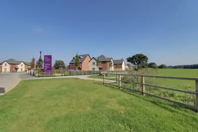
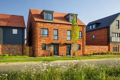
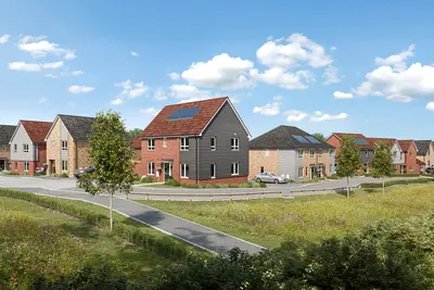
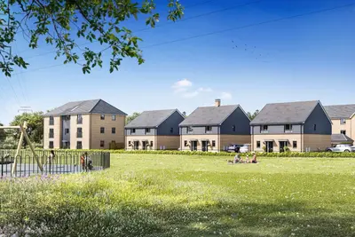
Lindridge Chase is a new build homes development by Taylor Wimpey, located on Lindridge Road in Sutton Coldfield, West Midlands (B75 7HY). The development, comprising 178 new properties, sits near the administrative border of Birmingham and Warwickshire. The overall offering includes a collection of 2, 3, and 4-bedroom homes, suitable for a range of buyers from first-time movers to growing families and downsizers.
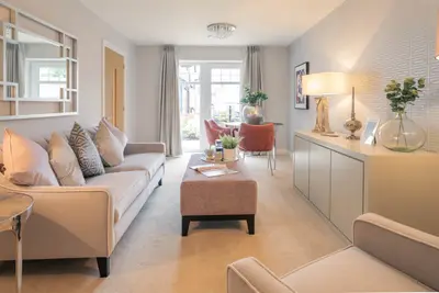
Taylor Wimpey, the developer, holds a prestigious 5-Star rating for customer satisfaction from the Home Builders Federation (HBF), indicating that over 90% of their customers would recommend them to a friend. The properties at Lindridge Chase consist of 2-bedroom apartments, alongside 3-bedroom semi-detached and detached houses, and 4-bedroom detached homes. These new build properties are designed with modern living in mind, featuring open-plan layouts and enhanced storage solutions. A focus on sustainability is evident through the inclusion of Photovoltaic (PV) panels, triple glazing, waste water heat recovery systems, and external electric vehicle (EV) charging sockets. The site itself incorporates significant biodiversity measures, including a peaceful pond, open green spaces, a children's play area, and wildlife-friendly features such as bat/bird boxes and hedgehog highways. Lindridge Chase is situated to provide access to both urban amenities and green spaces. Local shopping is facilitated by an ALDI and an Asda Minworth Supercentre, both approximately 2.2 miles from the development. The Gracechurch Shopping Centre in Sutton Coldfield town centre is also nearby at 2.3 miles. Transport Links are excellent. The development is well-connected to the road network, offering straightforward access to the A38 and national motorways. For public transport, bus routes 110, X14, X4, 71, and 77S serve nearby stops such as Barnard Road and St Georges Close. The West Midlands Railway network provides connections to major destinations from nearby stations. Local Education includes New Hall Primary School, which is situated approximately 0.4 miles away, and Plantsbrook School, a secondary option 2 miles distant. Note for prospective residents: Due to the site's location on the border, while local secondary schools like Fairfax and John Willmott are barely one mile away, Section 106 contributions for secondary education were allocated to improve Coleshill School, approximately eight miles distant. A specific bus service subsidy has been allocated to transport children to the Coleshill school route. 82 per annum for maintenance of shared communal areas. Incentives are available on selected new build plots, including Taylor Wimpey's 'Deposit Top Up' scheme, which provides a developer contribution of 5% on a 10% customer deposit. Viewing of the show homes is available, though prospective buyers are advised to contact the developer for specific opening hours and to arrange a viewing appointment.
Estate agents list one home for sale and 3 to rent at Lindridge Chase. Agent listings do not say whether a home is new or a resale, so this may be either.
Lindridge Chase is a Taylor Wimpey development in Sutton Coldfield, West Midlands. Taylor Wimpey has 252 developments listed on Homello.
The median sold price in Sutton Coldfield was £371,000 over the last 12 months (1,495 sales, +0.8% on the year before), or £351 per square foot, from HM Land Registry data. The house prices in Sutton Coldfield page has the trend, prices by property type and every street.
Lindridge Road, Sutton Coldfield, West Midlands, B75 7HY
Straight-line distances; actual routes will be longer. Stations from NaPTAN, with their lines powered by TfL Open Data; schools from the Department for Education register, with the latest Ofsted signal; supermarkets from Geolytix Retail Points; places to eat from the Food Standards Agency's register of food businesses.
The North Warwickshire neighbourhood around this development.
Sources: HM Land Registry price paid data, Police.uk, Historic England, ONS Census 2021, Ofcom Connected Nations, Environment Agency. Planning offices.

We have not been able to confirm current prices here recently.