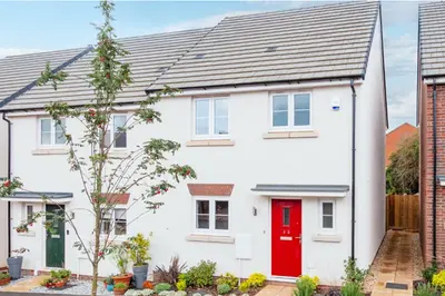
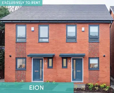
Holyoake Road by Simple Life · Holyoake Road, Walkden, Greater Manchester M28 3DL
Simple Life has 61 developments on Homello. Homes in Manchester sold for a median £250,000 over the last year, £291 per sq ft; see house prices in Manchester.
About Holyoake Road
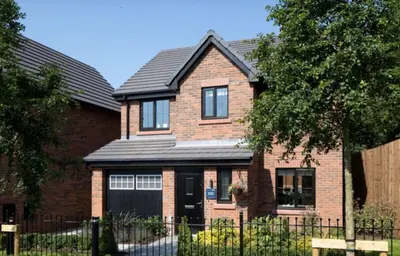
Discover a superior rental experience at Holyoake Road, a thoughtfully designed development by Simple Life, offering a blend of modern homes and apartments in the heart of Walkden. This community is tailored for those seeking high-quality, unfurnished homes with the security of a professional landlord, creating a perfect setting for individuals, couples, and families. The development features a mix of contemporary two-bedroom apartments alongside spacious three and four-bedroom family homes.
Each property is finished to a high standard, providing a neutral "blank canvas" for you to make your own. Interiors boast light-washed wood-effect flooring downstairs, plush grey carpets in bedrooms, and modern fitted kitchens with fully integrated appliances, including a dishwasher, fridge/freezer, and washer/dryer. Select homes feature en-suite bathrooms, fitted wardrobes in the main bedroom, and private turfed rear gardens. For peace of mind, all properties are equipped with modern security features like entrance alarms and multipoint locking systems. Pet-friendly properties for your furry family members. Dedicated resident team and 24/7 customer care. Hassle-free maintenance and repairs service. Off-road and allocated parking available. Regular community events to foster a friendly neighbourhood spirit. Located just a stone's throw from Walkden town centre, residents have easy access to a great selection of shops, restaurants, and leisure facilities. The development's prime position is a commuter's dream, with Walkden train station situated just behind the site, offering regular services to Manchester Victoria in approximately 20 minutes. For those travelling by car, Manchester city centre is only a 25-minute drive away. The local area is also well-served by numerous bus routes connecting to Bolton, Manchester, and surrounding areas. The Holyoake Road development is perfect for those who value both a peaceful residential setting and excellent connectivity. With several schools rated 'Good' or 'Outstanding' by Ofsted within a few miles, it's an ideal choice for families. Enjoy the convenience of modern living and the benefits of a professionally managed community, designed to make your life simpler.
- Developer
- Simple Life
- City
- Greater Manchester
- Neighbourhood
- Walkden
- Postcode
- M28 3DL
- Address
- Holyoake Road
- Tenure
- Build to rent
Facilities
- 24H Maintenance
- Courtyard Gardens
- Pet Friendly
- Professionally Managed
- Resident Events
- Bike Storage
- Keyless Entry
- On site Security
Questions about Holyoake Road
›Who is the developer of Holyoake Road?
Holyoake Road is a Simple Life development in Walkden, Greater Manchester. Simple Life has 61 developments listed on Homello.
›What are house prices like in Manchester?
The median sold price in Manchester was £250,000 over the last 12 months (10,345 sales, +0.0% on the year before), or £291 per square foot, from HM Land Registry data. The house prices in Manchester page has the trend, prices by property type and every street.
Location
Holyoake Road, M28 3DL
Nearest stations
- Walkden Station 0.1 milesNorthern
- Moorside Station 1.7 milesNorthern
- Kearsley Station 1.8 milesNorthern
- Farnworth Station 2.1 milesNorthern
Nearest schools
- Christ The King RC Primary School 0.2 milesPrimary · ages 3–11
- Mesne Lea Primary School 0.3 milesPrimary · ages 3–11 Needs attention
- St Paul's CofE Primary School 0.3 milesPrimary · ages 3–11
- St Paul's CofE Primary School 0.4 milesPrimary · ages 3–11 Good
Nearest supermarkets
- Spar Convenience store 0.2 miles
- Tesco Extra Superstore 0.5 miles
- Aldi Supermarket 0.5 miles
- Marks and Spencer Foodhall Supermarket 0.6 miles
Eating out nearby
Within half a mile: 21 restaurants and cafes, 2 pubs and bars, 15 takeaways.
- The Walkden Bar 0.1 milesTakeaway
- Jaynes Sandwich Corner 0.1 milesTakeaway
- Cubanacho 0.2 milesRestaurant or cafe
- The Welcome, Walkden Bar 2 0.2 milesTakeaway
Straight-line distances; actual routes will be longer. Stations from NaPTAN, with their lines powered by TfL Open Data; schools from the Department for Education register, with the latest Ofsted signal; supermarkets from Geolytix Retail Points; places to eat from the Food Standards Agency's register of food businesses.
Area insights
The Salford neighbourhood around this development.
Sources: HM Land Registry price paid data, Police.uk, Historic England, ONS Census 2021, Ofcom Connected Nations, Environment Agency. Planning offices.

We have not been able to confirm current prices here recently.
Details last confirmed on 19 October 2026.