Ferry Island by Related Argent · 1 Heart of Hale Lane, Tottenham Hale, Greater London N17 9LA
Completed
Related Argent has 2 developments on Homello. Homes in Hackney sold for a median £575,500 over the last year, £808 per sq ft; see house prices in Hackney.
About Ferry Island
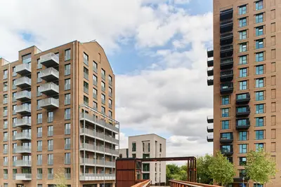
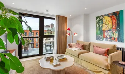
Ferry Island is Related Argent’s rental development beside Tottenham Hale station, with its address on Heart of Hale Lane. The scheme provides 484 homes across two buildings within the wider Tottenham Hale regeneration. The current operator markets studios and apartments with one, two or three bedrooms, furnished and designed around generous windows and shared resident spaces.
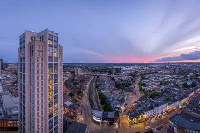
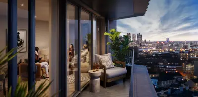
Facilities include a gym and studio, cinema, games room, music room and residents’ lounges. Co-working areas support working away from home, while three roof terraces offer outdoor social space. A concierge operates around the clock, with included Wi-Fi and on-site maintenance also advertised. Pets are welcome. Walthamstow Wetlands and walks along the River Lea are nearby, while station connections support journeys around London.
- Developer
- Related Argent
- City
- Greater London
- Neighbourhood
- Tottenham Hale
- Postcode
- N17 9LA
- Address
- 1 Heart of Hale Lane
- Total homes
- 484
- Tenure
- Build to rent
Facilities
- Concierge (Available 24 hours)
- Gym
- Co-working
- Pet friendly
- Residents’ lounge
- Music room
- Games room
- Broadband (Included)
- On-site maintenance
- Cinema
- Roof terrace (Three terraces)
Questions about Ferry Island
›Who is the developer of Ferry Island?
Ferry Island is a Related Argent development in Tottenham Hale, Greater London. Related Argent has 2 developments listed on Homello.
›Are homes available to rent at Ferry Island?
Ferry Island is marked "now selling", completed. Use the enquiry button to check current availability with Related Argent.
›What are house prices like in Hackney?
The median sold price in Hackney was £575,500 over the last 12 months (1,402 sales, −0.8% on the year before), or £808 per square foot, from HM Land Registry data. The house prices in Hackney page has the trend, prices by property type and every street.
Location
1 Heart of Hale Lane, N17 9LA
Nearest stations
- Tottenham Hale Station 0.1 milesVictoria line · Greater Anglia
- Bruce Grove Station 0.5 milesWeaver line · Greater Anglia
- South Tottenham Station 0.7 milesSuffragette line
- Seven Sisters Station 0.7 milesVictoria & Weaver lines · Greater Anglia
Nearest schools
- Harris Academy Tottenham 0.2 milesAll-through · ages 4–19 Outstanding
- Welbourne Primary School 0.2 milesPrimary · ages 2–11 Expected standard
- Ferry Lane Primary School 0.3 milesPrimary · ages 3–11
- Holy Trinity CofE Primary School 0.3 milesPrimary · ages 3–11
Nearest supermarkets
- Asda Living Large supermarket 0.1 miles
- Tesco Express Convenience store 0.1 miles
- Asda Express Convenience store 0.1 miles
- Lidl Supermarket 0.1 miles
Eating out nearby
Within half a mile: 44 restaurants and cafes, 8 pubs and bars, 24 takeaways.
- London Tottenham Hale Premier Inn <0.1 milesRestaurant or cafe
- Holy Grain & Brew 0.1 milesRestaurant or cafe
- Starbucks Coffee Company 0.1 milesRestaurant or cafe
- Subway 0.1 milesRestaurant or cafe
Straight-line distances; actual routes will be longer. Stations from NaPTAN, with their lines powered by TfL Open Data; schools from the Department for Education register, with the latest Ofsted signal; supermarkets from Geolytix Retail Points; places to eat from the Food Standards Agency's register of food businesses.
Area insights
The Haringey neighbourhood around this development.
Sources: HM Land Registry price paid data, Police.uk, Historic England, ONS Census 2021, Ofcom Connected Nations, Environment Agency. Planning offices.
Register for launch pricing and availability.
Details last confirmed on 21 October 2026.