Abbotsfield by Simple Life · Reginald Road, St Helens, Merseyside WA9 4HZ
Simple Life has 61 developments on Homello. Homes in St Helens sold for a median £178,000 over the last year, £208 per sq ft; see house prices in St Helens.
About Abbotsfield
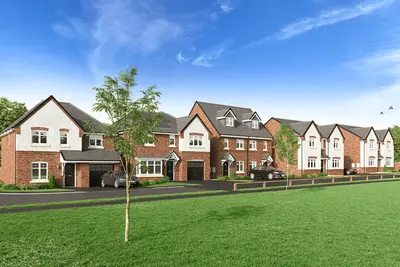
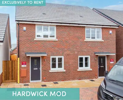
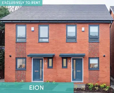
Discover Abbotsfield, a contemporary rental development by Simple Life, offering a refreshing approach to modern living in St Helens. Located on Reginald Road, this community is designed for those seeking high-quality, secure, and professionally managed homes. Abbotsfield provides the perfect blend of suburban tranquillity and urban convenience, making it an ideal choice for families and commuting professionals.
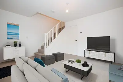
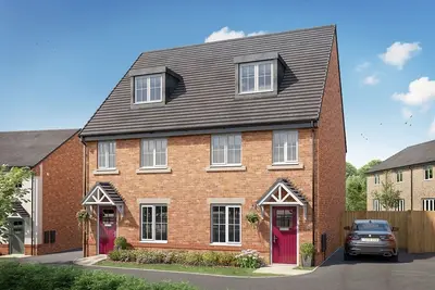
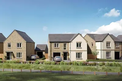
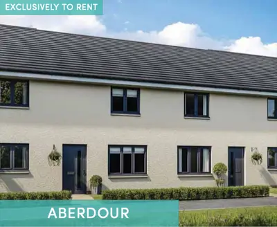
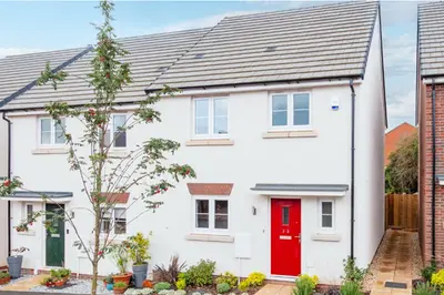
The development features a mix of two, three, and four-bedroom houses, thoughtfully designed with modern living in mind. Each home boasts high-quality fixtures and fittings, including integrated appliances, secure multi-point locking systems, and private, turfed rear gardens. Some properties also benefit from landscaped front gardens with off-road parking, maintained by a dedicated landscaping team to ensure the community always looks its best. Residents at Abbotsfield enjoy an array of amenities designed to enhance their lifestyle. These include: A dedicated on-site maintenance team and a 24/7 customer service line for peace of mind. A user-friendly residents' app, 'My Simple Life', for easy communication and service requests. Regular resident events to foster a strong sense of community. Pet-friendly policies, so your four-legged family members are welcome. Ample car parking, bike and bin stores, and well-maintained communal green spaces. The location of Abbotsfield is a significant advantage. St Helens town centre offers a wide range of retail and leisure opportunities, while major cities are easily accessible. The local train station is just a seven-minute walk away, providing direct services to Liverpool and Manchester, perfect for commuters. For leisure and recreation, the beautiful Sherdley Park is nearby, offering a fantastic natural escape. Daily essentials are covered with Ravenshead Retail Park only a short drive away. The area is also well-served by schools, with 14 primary and secondary schools within a three-mile radius. Developed by Simple Life, a leading UK build-to-rent provider, Abbotsfield is built with a focus on creating long-term, secure homes where residents can truly put down roots. Experience a new standard of renting in a vibrant, well-connected, and welcoming neighbourhood.
- Developer
- Simple Life
- City
- Merseyside
- Neighbourhood
- St Helens
- Postcode
- WA9 4HZ
- Address
- Reginald Road
- Tenure
- Build to rent
Facilities
- 24H Maintenance
- Courtyard Gardens
- Pet Friendly
- Professionally Managed
- Resident Events
- Bike Storage
- Keyless Entry
- Electric Vehicle Charging Points
Questions about Abbotsfield
›Who is the developer of Abbotsfield?
Abbotsfield is a Simple Life development in St Helens, Merseyside. Simple Life has 61 developments listed on Homello.
›What are house prices like in St Helens?
The median sold price in St Helens was £178,000 over the last 12 months (1,484 sales, −1.1% on the year before), or £208 per square foot, from HM Land Registry data. The house prices in St Helens page has the trend, prices by property type and every street.
Location
Reginald Road, WA9 4HZ
Nearest stations
- St Helens Junction Station 0.2 milesNorthern
- Lea Green Station 1.0 milesNorthern, TransPennine
- St Helens Central Station 1.9 milesNorthern, TransPennine
- Thatto Heath Station 2.4 milesNorthern
Nearest schools
- St Anne's Catholic Primary School 0.3 milesPrimary · ages 3–11
- Sutton Oak CofE Primary School 0.5 milesPrimary · ages 3–11 Good
- Sherdley Primary School 0.8 milesPrimary · ages 3–11 Good
- Eaves Primary School 0.8 milesPrimary · ages 3–11 Good
Nearest supermarkets
- Morrisons Daily Convenience store 0.4 miles
- Morrisons Daily Convenience store 0.8 miles
- Morrisons Superstore 0.9 miles
- Aldi Supermarket 1.0 miles
Eating out nearby
Within half a mile: 3 restaurants and cafes, 6 pubs and bars, 11 takeaways.
- Station House Cafe 0.2 milesRestaurant or cafe
- Junction Inn 0.2 milesPub or bar
- Pinkeez 0.3 milesTakeaway
- King Chef 0.3 milesTakeaway
Straight-line distances; actual routes will be longer. Stations from NaPTAN, with their lines powered by TfL Open Data; schools from the Department for Education register, with the latest Ofsted signal; supermarkets from Geolytix Retail Points; places to eat from the Food Standards Agency's register of food businesses.
Area insights
The St. Helens neighbourhood around this development.
Sources: HM Land Registry price paid data, Police.uk, Historic England, ONS Census 2021, Ofcom Connected Nations, Environment Agency. Planning offices.

We have not been able to confirm current prices here recently.