The Ironworks by Property Sense · Scotland Street, Sheffield, South Yorkshire S3 7BX
Property Sense has 3 developments on Homello. Homes in Sheffield sold for a median £217,000 over the last year, £253 per sq ft; see house prices in Sheffield.
About The Ironworks
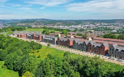
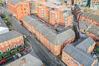
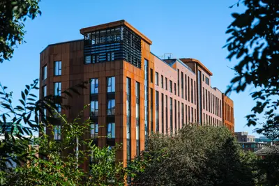
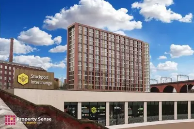
Discover contemporary urban living at The Ironworks, a landmark rental development on Scotland Street in the vibrant heart of Sheffield. This thoughtfully regenerated site, formerly the Queen's Hotel, now offers a stylish and sustainable living experience crafted by the award-winning developer Rise Homes. The development is designed for a modern lifestyle, blending high-quality furnished apartments with an exceptional array of communal facilities.
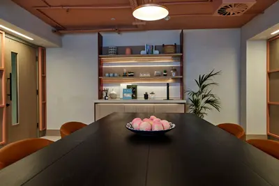
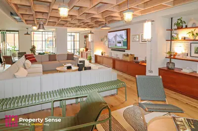
The Ironworks features a total of 229 homes, providing a range of options to suit different needs. Accommodation includes: One-bedroom apartments Two-bedroom apartments Stunning two-bedroom duplex apartments Every apartment is furnished to a high standard with a focus on comfort and practicality, featuring ample storage and instantly available high-speed broadband. A key feature of the development is its commitment to sustainability, utilising a central biomass boiler to provide cost-effective and energy-efficient heating for all homes. Life at The Ironworks extends far beyond your apartment, with an impressive suite of resident amenities designed to foster community and convenience. Enjoy exclusive access to a spacious rooftop garden with city views, a serene internal courtyard, and a residents' lounge complete with a kitchen and coffee machine. For those who work from home, there are dedicated co-working spaces and bookable meeting rooms. Leisure facilities are equally impressive, featuring: A residents' gym A private movie room A bookable private dining room for entertaining guests Secure bike storage and available car parking Perfectly positioned in Sheffield, The Ironworks offers outstanding connectivity. Sheffield Railway Station is just over half a mile away, and the area is well-serviced by numerous bus routes on Scotland Street and nearby West Street, providing easy access across the city. The development is ideally located for professionals and students, with universities, hospitals, and major businesses within easy reach. The surrounding area is rich with culture and convenience. You are a short distance from the acclaimed Millennium Gallery, the Winter Gardens, and the renowned Crucible theatre. For a unique local experience, the vibrant Kelham Island district, with its independent shops, breweries, and museums, is nearby. For outdoor enthusiasts, the glorious Peak District National Park is also easily accessible for weekend escapes.
- Developer
- Property Sense
- City
- South Yorkshire
- Neighbourhood
- Sheffield
- Postcode
- S3 7BX
- Address
- Scotland Street
- Total homes
- 229
- Tenure
- Build to rent
Facilities
- Cinema Room
- Co-working Space
- Courtyard Gardens
- Fitness Centre
- Free Wi-Fi
- Pet Friendly
- Private Dining Room
- Professionally Managed
- Residents' Lounge
- Resident Events
- Rooftop Terrace
- CCTV Coverage in All Common Areas
- Bike Storage
- Communal Kitchen
- Meeting Rooms
Questions about The Ironworks
›Who is the developer of The Ironworks?
The Ironworks is a Property Sense development in Sheffield, South Yorkshire. Property Sense has 3 developments listed on Homello.
›What are house prices like in Sheffield?
The median sold price in Sheffield was £217,000 over the last 12 months (6,685 sales, −2.5% on the year before), or £253 per square foot, from HM Land Registry data. The house prices in Sheffield page has the trend, prices by property type and every street.
›What type of homes are at The Ironworks?
The Ironworks offers apartments, 229 homes in total. Homes are let by the operator by Property Sense.
Location
Scotland Street, S3 7BX
Nearest stations
- Kelham Island Station 0.3 milesSheffield Supertram
- City Hall Station 0.3 milesSheffield Supertram
- Cathedral Station 0.3 milesSheffield Supertram
- Netherthorpe Road Station 0.3 milesSheffield Supertram
Nearest schools
- Netherthorpe Primary School 0.3 milesPrimary · ages 3–11 Needs attention
- Bethany School 0.4 milesIndependent · ages 4–16
- Springfield Primary School 0.6 milesPrimary · ages 4–11
- Astrea Academy Sheffield 0.6 milesAll-through · ages 2–18
Nearest supermarkets
- The Co-operative Food Convenience store 0.2 miles
- Asda Express Convenience store 0.2 miles
- Tesco Express Convenience store 0.2 miles
- Tesco Express Convenience store 0.3 miles
Eating out nearby
Within half a mile: 244 restaurants and cafes, 65 pubs and bars, 38 takeaways.
- K Max Karaoke Bar 0.1 milesPub or bar
- Front Room 0.1 milesRestaurant or cafe
- The Crow Inn 0.1 milesPub or bar
- Solly Street Cafe 0.1 milesRestaurant or cafe
Straight-line distances; actual routes will be longer. Stations from NaPTAN, with their lines powered by TfL Open Data; schools from the Department for Education register, with the latest Ofsted signal; supermarkets from Geolytix Retail Points; places to eat from the Food Standards Agency's register of food businesses.
Area insights
The Sheffield neighbourhood around this development.
Sources: HM Land Registry price paid data, Police.uk, Historic England, ONS Census 2021, Ofcom Connected Nations, Environment Agency. Planning offices.
Register for launch pricing and availability.