Gell Street by Placefirst · Gell Street, Sheffield, South Yorkshire S3 7QT
Completed
Placefirst has 14 developments on Homello. Homes in Sheffield sold for a median £217,000 over the last year, £253 per sq ft; see house prices in Sheffield.
About Gell Street
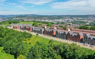
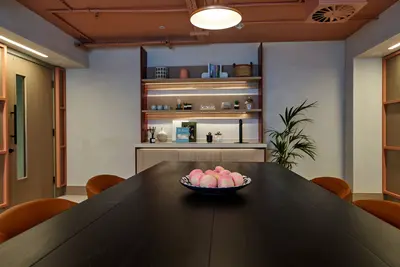
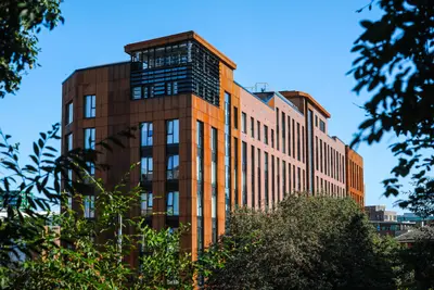
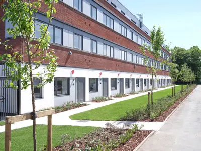
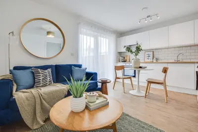
Gell Street is Placefirst’s managed rental apartment development in Sheffield city centre. Its published range comprises modern two-bedroom apartments, close to cafés, restaurants, bars and public transport. The setting is suited to residents who want everyday services within walking distance while renting from an operator that manages the homes for the long term.
The current scheme page offers enquiries and availability checks through Placefirst. Parking is listed among the development’s facilities, with its allocation and any charges to be confirmed for the individual apartment. Maintenance support forms part of the rental service. A named Resident Services Manager supports residents from the first viewing through moving in and throughout their tenancy. Further apartment specifications should be checked directly rather than inferred from other Placefirst developments.
- Developer
- Placefirst
- City
- South Yorkshire
- Neighbourhood
- Sheffield
- Postcode
- S3 7QT
- Address
- Gell Street
- Tenure
- Build to rent
Facilities
- Parking (Confirm availability and charges)
- Maintenance and repairs
Questions about Gell Street
›Who is the developer of Gell Street?
Gell Street is a Placefirst development in Sheffield, South Yorkshire. Placefirst has 14 developments listed on Homello.
›Are homes available to rent at Gell Street?
Gell Street is marked "now selling", completed. Use the enquiry button to check current availability with Placefirst.
›What are house prices like in Sheffield?
The median sold price in Sheffield was £217,000 over the last 12 months (6,685 sales, −2.5% on the year before), or £253 per square foot, from HM Land Registry data. The house prices in Sheffield page has the trend, prices by property type and every street.
Location
Gell Street, S3 7QT
Nearest stations
- University of Sheffield Station 0.1 milesSheffield Supertram
- West Street Station 0.2 milesSheffield Supertram
- Netherthorpe Road Station 0.4 milesSheffield Supertram
- City Hall Station 0.4 milesSheffield Supertram
Nearest schools
- Springfield Primary School 0.1 milesPrimary · ages 4–11
- Broomhall Nursery School 0.3 milesNursery · ages 3–5 Outstanding
- Bethany School 0.5 milesIndependent · ages 4–16
- Netherthorpe Primary School 0.5 milesPrimary · ages 3–11 Needs attention
Nearest supermarkets
- Tesco Express Supermarket 0.2 miles
- The Co-operative Food Convenience store 0.3 miles
- Tesco Express Convenience store 0.3 miles
- Budgens Convenience store 0.4 miles
Eating out nearby
Within half a mile: 183 restaurants and cafes, 42 pubs and bars, 32 takeaways.
- Bath Hotel <0.1 milesPub or bar
- Turkish Baths 1877 <0.1 milesRestaurant or cafe
- Pepper Greenhouse 0.1 milesRestaurant or cafe
- Maveli Restaurant 0.1 milesRestaurant or cafe
Straight-line distances; actual routes will be longer. Stations from NaPTAN, with their lines powered by TfL Open Data; schools from the Department for Education register, with the latest Ofsted signal; supermarkets from Geolytix Retail Points; places to eat from the Food Standards Agency's register of food businesses.
Area insights
The Sheffield neighbourhood around this development.
Sources: HM Land Registry price paid data, Police.uk, Historic England, ONS Census 2021, Ofcom Connected Nations, Environment Agency. Planning offices.

Register for launch pricing and availability.
Details last confirmed on 21 October 2026.