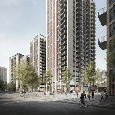
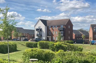
The Barnum by Grainger · 23 Queens Road, Nottingham, Nottinghamshire NG2 3FJ
Completed
Grainger has 29 developments on Homello. Homes in Nottingham sold for a median £240,000 over the last year, £268 per sq ft; see house prices in Nottingham.
About The Barnum
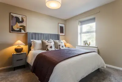
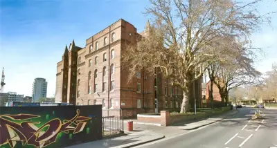
The Barnum is Grainger’s rental development at 23 Queens Road in Nottingham, beside the city’s railway station. It offers one-, two- and three-bedroom apartments with a range of layouts and furnished options. The current operator page markets rental homes and invites prospective residents to arrange viewings.
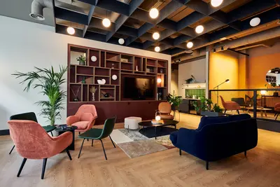
Shared facilities include a residents’ lounge, co-working spaces and a fully equipped gym. A private dining room provides space for gatherings, while a games room offers another place to spend time with neighbours. The building also has bike storage, parcel storage and Wi-Fi, with an on-site team supporting day-to-day life. Pets are welcome. Parking costs extra, has limited availability and is allocated on a first-come basis. Nottingham city centre is nearby.
- Developer
- Grainger
- City
- Nottinghamshire
- Neighbourhood
- Nottingham
- Postcode
- NG2 3FJ
- Address
- 23 Queens Road
- Tenure
- Build to rent
Facilities
- Residents’ lounge
- Co-working
- Gym
- Private dining
- Games room
- On-site management
- Bike storage
- Broadband
- Parking (Extra charge; limited spaces, first come, first served)
- Parcel storage
- Pet friendly
Questions about The Barnum
›Who is the developer of The Barnum?
The Barnum is a Grainger development in Nottingham, Nottinghamshire. Grainger has 29 developments listed on Homello.
›Are homes available to rent at The Barnum?
The Barnum is marked "now selling", completed. Use the enquiry button to check current availability with Grainger.
›What are house prices like in Nottingham?
The median sold price in Nottingham was £240,000 over the last 12 months (8,980 sales, +0.0% on the year before), or £268 per square foot, from HM Land Registry data. The house prices in Nottingham page has the trend, prices by property type and every street.
Location
23 Queens Road, NG2 3FJ
Nearest stations
- Nottingham Station 0.2 milesCrossCountry, East Midlands, Northern · Nottingham Express Transit
- Queens Walk Station 0.4 milesNottingham Express Transit
- Lace Market Station 0.4 milesNottingham Express Transit
- Old Market Square Station 0.5 milesNottingham Express Transit
Nearest schools
- Stone Soup Academy 0.3 milesages 11–19
- Welbeck Primary School 0.4 milesPrimary · ages 3–11
- Greenfields Community School 0.4 milesPrimary · ages 3–11
- Nottingham College 0.4 miles16 plus · ages 16–99
Nearest supermarkets
- The Co-operative Food Convenience store 0.2 miles
- Tesco Express Convenience store 0.2 miles
- Heron Convenience store 0.3 miles
- The Food Warehouse Supermarket 0.4 miles
Eating out nearby
Within half a mile: 103 restaurants and cafes, 50 pubs and bars, 18 takeaways.
- Hooters 0.1 milesRestaurant or cafe
- Bean Culture Cafe 0.1 milesRestaurant or cafe
- Brew Tavern 0.2 milesPub or bar
- Starbucks 0.2 milesRestaurant or cafe
Straight-line distances; actual routes will be longer. Stations from NaPTAN, with their lines powered by TfL Open Data; schools from the Department for Education register, with the latest Ofsted signal; supermarkets from Geolytix Retail Points; places to eat from the Food Standards Agency's register of food businesses.
Area insights
The Nottingham neighbourhood around this development.
Sources: HM Land Registry price paid data, Police.uk, Historic England, ONS Census 2021, Ofcom Connected Nations, Environment Agency. Planning offices.

Register for launch pricing and availability.
Details last confirmed on 21 October 2026.