Swinnow Park by Taylor Wimpey · Racecourse Approach, Wetherby, West Yorkshire, LS22 5EG
Taylor Wimpey has 193 developments on Homello. Homes in Wetherby sold for a median £420,000 over the last year, £360 per sq ft; see house prices in Wetherby.
About Swinnow Park
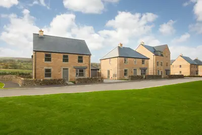
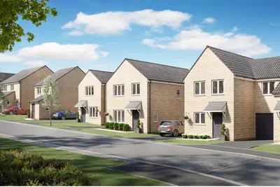
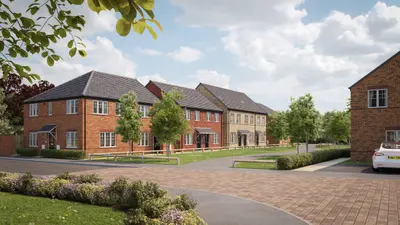
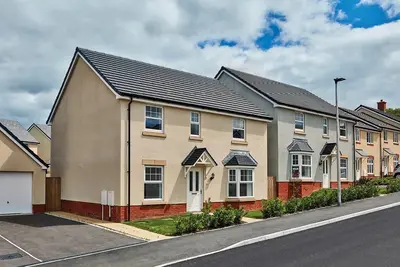
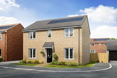
Swinnow Park is a new build development by Taylor Wimpey, located on Racecourse Approach, Wetherby, West Yorkshire, LS22 5EG. Situated directly opposite Wetherby Racecourse, the site is planned to deliver approximately 726 new homes, forming a significant extension to the town on the eastern side of the A1(M). The development offers a diverse mix of energy-efficient properties, comprising 2, 3, 4, and 5-bedroom homes, including semi-detached and detached house types, as well as two-bedroom apartments.
Current available homes and reserved properties are priced from approximately £394,995 to £579,995. The Wetherby location places the development within Yorkshire’s 'Golden Triangle,' offering connectivity to Leeds, York, and Harrogate. The properties at Swinnow Park feature modern designs with a strong emphasis on energy efficiency. The development is notable for being Taylor Wimpey Yorkshire's first to incorporate a community heat hub, alongside a suite of sustainable features intended to lower utility costs. Specific energy-saving elements include triple glazing, smart heating systems, Electric Vehicle (EV) charging points, and wastewater heat recovery units. House types vary in size and layout; for example, the three-bedroom 'Riston' semi-detached home offers approximately 1173 sq ft of space, with specific plots (e.g., Plot 14) currently marketed with an upgraded kitchen included. The four-bedroom detached 'Kingdale' home type provides a sociable kitchen/diner layout. The development has been designed with a landscape-led approach, incorporating allotments, a nature reserve, orchards, and extensive green space with internal footpaths. Swinnow Park benefits significantly from its direct access to major road networks, including the nearby A1(M) motorway, facilitating rapid commuting to the wider region. While Wetherby does not have its own railway station, key rail links are accessible via Leeds and York. Leeds Bradford Airport (LBA) is located approximately 15 miles away. Local public transport is served by bus routes 412, 7, and 8, with the nearest stop, Swinnow Lodge, a short walk from the Racecourse Approach entrance. The town itself offers a close-knit community atmosphere with an historic centre, featuring a range of independent shops, cafés, pubs, and markets. Local green spaces include the Wetherby Railway Path and scenic walks along the River Wharfe. Primary school options in the area include St James' CE Primary School (Ofsted-rated 'Good') and St Joseph's Catholic Primary School. Taylor Wimpey is one of the UK's largest volume housebuilders and holds a 5-star customer satisfaction rating from the Home Builders Federation. This indicates that over 90% of customers would recommend them. However, prospective buyers should note that third-party reviews for national developers can be mixed, with some customers reporting concerns over aftercare or build quality on specific sites. Current available homes range from the lower end of the pricing structure at £394,995 for 3-bedroom semi-detached units to up to £579,995 for larger 4-bedroom detached homes. Completion dates for individual plots vary, with some 4-bedroom units having projected availability in August 2025. Interested parties should contact the developer directly for detailed information on current plot availability, specific floorplans, service charges, and viewing arrangements at the Racecourse Approach sales office.
- Developer
- Taylor Wimpey
- City
- West Yorkshire
- Neighbourhood
- Wetherby
- Postcode
- LS22 5EG
- Address
- Racecourse Approach, Wetherby, West Yorkshire, LS22 5EG
- Tenure
- For sale
Questions about Swinnow Park
›Who is the developer of Swinnow Park?
Swinnow Park is a Taylor Wimpey development in Wetherby, West Yorkshire. Taylor Wimpey has 193 developments listed on Homello.
›How much do homes at Swinnow Park cost?
Prices at Swinnow Park start from £299,995.
›What are house prices like in Wetherby?
The median sold price in Wetherby was £420,000 over the last 12 months (409 sales, +5.0% on the year before), or £360 per square foot, from HM Land Registry data. The house prices in Wetherby page has the trend, prices by property type and every street.
Location
Racecourse Approach, Wetherby, West Yorkshire, LS22 5EG
Nearest stations
- Cattal Station 4.6 miles
- Hammerton Station 5.2 miles
- Knaresborough Station 6.7 miles
- Starbeck Station 7.2 miles
Nearest schools
- St James' Church of England Voluntary Controlled Primary School 0.8 milesPrimary · ages 3–11
- Wetherby High School 0.9 milesSecondary · ages 11–16 Good
- Deighton Gates Primary School 1.2 milesPrimary · ages 4–11 Good
- Crossley Street Primary School 1.2 milesPrimary · ages 3–11
Straight-line distances; actual routes will be longer. Stations from NaPTAN; schools from the Department for Education register, with the latest Ofsted signal.
Area insights
The Leeds neighbourhood around this development.
Sources: HM Land Registry price paid data, EPC register, Police.uk, Historic England, ONS Census 2021, Ofcom Connected Nations, Environment Agency. Planning offices.
Register for launch pricing and availability.