Rothwells Farm by Taylor Wimpey · Lowton Road, Golborne, Wigan, Lancashire, WA3 3EG
Taylor Wimpey has 252 developments on Homello. Homes in Warrington sold for a median £255,000 over the last year, £277 per sq ft; see house prices in Warrington.
About Rothwells Farm
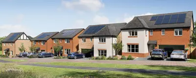
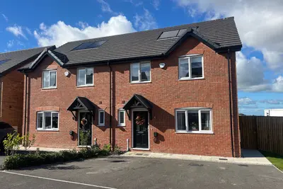
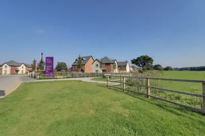
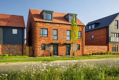
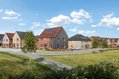
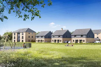
Rothwells Farm is a substantial new build homes community in Golborne, Wigan, developed by Taylor Wimpey, a 5-star rated housebuilder recognized by the Home Builders Federation for having over 90% of customers who would recommend them to a friend. This thriving development comprises over 400 homes and offers a mix of traditional-look properties with modern, energy-efficient interiors. The scheme has progressed significantly, with the final new-build opportunities now available.
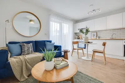
The remaining availability is highly limited, focusing on larger family homes. Current immediate availability includes The Teasdale, a 4-bedroom detached house, priced at £379,995, which includes over £7,400 worth of added upgrades. The development features a range of 3-bedroom and 4-bedroom properties, offering flexible living spaces often across two or two-and-a-half storeys. The design caters specifically to families, providing sociable living areas and neutral decoration for personal customisation from day one. Properties such as the 4-bedroom detached Teasdale offer 1272 sq ft of living space, two bathrooms, and two parking spaces. Other house types sold on the development include the 3-bedroom detached Aldenham, which often features three bathrooms and a driveway. A number of properties on the site are sold with a freehold title and still retain the remainder of their NHBC warranty, providing assurance on build quality. The developer, Taylor Wimpey, has been noted for their reasonable but occasionally inconsistent quality, though they are a major volume housebuilder with a good overall HBF rating. Rothwells Farm is strategically positioned for commuters, offering easy access to major regional and national road networks. The development is close to the M6 and M62 motorways, as well as the A580 (East Lancashire Road), linking the area to key employment hubs. Wigan is reachable by road within 15 minutes, with the cities of Manchester and Liverpool both less than 20 miles away. Public transport links are well-established, with the Rothwell Gardens bus stop located approximately one minute’s walk from the development, serving routes like the 35 (to Piccadilly Gardens) and the 360 (Wigan to Warrington). Newton-Le-Willows Train Station is the nearest rail link, approximately a 45-minute walk. Local amenities are comprehensive, including a supermarket, post office, convenience store, and local bakers and butchers within Golborne/Lowton Villages. Families benefit from highly-rated educational facilities, with Golborne High School (renowned for its outstanding Ofsted rating) just 0.1 miles away, and St Lukes C Of E Junior & Infant within one mile. Leisure facilities include the nearby Pennington Flash Country Park (a 10-minute drive) and both Leigh Sports Village and Ashton Leisure Centre under five miles away. The Rothwells Farm development is nearing completion, with the final open-market new build homes now available. Interested parties should note that the on-site sales office and show homes are now closed. All enquiries, including viewing arrangements for the last remaining new build properties, should be made by appointment only, and prospective buyers are advised to contact the Taylor Wimpey Manchester sales team directly for the latest availability and any applicable incentive offers. Resale properties are priced between £300,000 and £314,999 for 3-bedroom townhouses and detached homes.
- Developer
- Taylor Wimpey
- City
- Lancashire
- Neighbourhood
- Golborne
- Postcode
- WA3 3EG
- Address
- Lowton Road, Golborne, Wigan, Lancashire, WA3 3EG
- Total homes
- 400
- Tenure
- For sale
Questions about Rothwells Farm
›Who is the developer of Rothwells Farm?
Rothwells Farm is a Taylor Wimpey development in Golborne, Lancashire. Taylor Wimpey has 252 developments listed on Homello.
›What are house prices like in Warrington?
The median sold price in Warrington was £255,000 over the last 12 months (2,872 sales, +2.0% on the year before), or £277 per square foot, from HM Land Registry data. The house prices in Warrington page has the trend, prices by property type and every street.
›What type of homes are at Rothwells Farm?
Rothwells Farm offers houses, 400 homes in total. Homes are sold outright by Taylor Wimpey.
Location
Lowton Road, Golborne, Wigan, Lancashire, WA3 3EG
Nearest stations
- Newton-le-Willows Station 2.2 milesNorthern, TransPennine, Transport for Wales
- Bryn Station 2.6 milesNorthern
- Earlestown Station 2.8 milesNorthern, Transport for Wales
- Garswood Station 3.3 milesNorthern
Nearest schools
- Golborne High School 0.2 milesSecondary · ages 11–16 Good
- St Thomas CofE Junior and Infant School 0.2 milesPrimary · ages 4–11
- All Saints Catholic Primary School, Golborne, Wigan 0.4 milesPrimary · ages 3–11
- Golborne Community Primary School 0.5 milesPrimary · ages 3–11
Nearest supermarkets
- Asda Superstore Superstore 0.6 miles
- The Co-operative Food Convenience store 0.7 miles
- Lidl Supermarket 0.7 miles
- Morrisons Daily Convenience store 1.4 miles
Eating out nearby
Within half a mile: 10 restaurants and cafes, 2 pubs and bars, 12 takeaways.
- Bestone Hootons 0.1 milesRestaurant or cafe
- O Kuma 0.1 milesRestaurant or cafe
- Church Street Chippy 0.2 milesTakeaway
- Wok's Cooking 0.3 milesTakeaway
Straight-line distances; actual routes will be longer. Stations from NaPTAN, with their lines powered by TfL Open Data; schools from the Department for Education register, with the latest Ofsted signal; supermarkets from Geolytix Retail Points; places to eat from the Food Standards Agency's register of food businesses.
Area insights
The Wigan neighbourhood around this development.
Sources: HM Land Registry price paid data, Police.uk, Historic England, ONS Census 2021, Ofcom Connected Nations, Environment Agency. Planning offices.

Register for launch pricing and availability.