Douglas Vale by Lovell Homes · Off Rossendale Drive, Adlington, Chorley, Lancashire PR6 9AB
Under construction
Lovell Homes has 47 developments on Homello. Homes in Chorley sold for a median £222,000 over the last year, £242 per sq ft; see house prices in Chorley.
About Douglas Vale
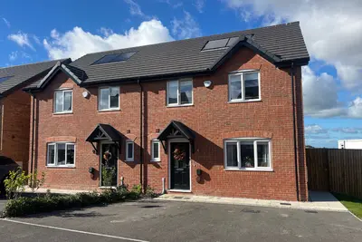
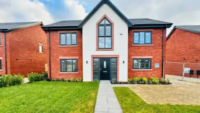
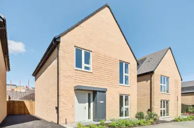
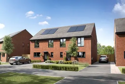
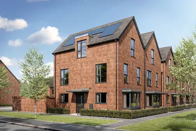
Douglas Vale is a Lovell Homes development off Rossendale Drive in Adlington, a Lancashire village near Chorley. Its private-sale collection includes two, three, four and five-bedroom homes, giving buyers a choice of sizes within the same neighbourhood. The layout incorporates mature trees and public open space, with a children’s play area included in the plans.
The homes use materials intended to fit the surrounding area, including red brick, and the design places an emphasis on energy performance. Adlington provides village services and a railway station, with road connections towards Chorley and the wider North West. The development is being built in stages, so buyers should confirm the specification, outdoor space and availability of their chosen plot with Lovell.
- Developer
- Lovell Homes
- City
- Lancashire
- Neighbourhood
- Adlington
- Postcode
- PR6 9AB
- Address
- Off Rossendale Drive, Adlington, Chorley, Lancashire
- Tenure
- For sale
Facilities
- Garden (Planned public open space incorporating retained mature trees; delivery varies with the development programme.)
- Play area (Planned children’s play area within the development; opening date not confirmed.)
Questions about Douglas Vale
›Who is the developer of Douglas Vale?
Douglas Vale is a Lovell Homes development in Adlington, Lancashire. Lovell Homes has 47 developments listed on Homello.
›Is Douglas Vale still selling?
Douglas Vale is marked "now selling", under construction. Use the enquiry button to check current availability with Lovell Homes.
›What are house prices like in Chorley?
The median sold price in Chorley was £222,000 over the last 12 months (1,376 sales, +3.3% on the year before), or £242 per square foot, from HM Land Registry data. The house prices in Chorley page has the trend, prices by property type and every street.
Location
Off Rossendale Drive, Adlington, Chorley, Lancashire, PR6 9AB
Nearest stations
- Adlington Station 0.4 milesNorthern
- Blackrod Station 1.8 milesNorthern
- Chorley Station 3.0 milesNorthern
- Horwich Parkway Station 3.3 milesNorthern
Nearest schools
- St Joseph's Catholic Primary School, Anderton 0.2 milesPrimary · ages 5–11 Good
- Anderton Primary School 0.3 milesPrimary · ages 4–11
- Adlington St Paul's Church of England Primary School 0.3 milesPrimary · ages 5–11
- Adlington Primary School 0.6 milesPrimary · ages 5–11
Nearest supermarkets
- The Co-operative Food Supermarket 0.3 miles
- Tesco Express Convenience store 0.3 miles
- Spar Convenience store 1.3 miles
- Spar Convenience store 1.3 miles
Eating out nearby
Within half a mile: 4 restaurants and cafes, 3 pubs and bars, 7 takeaways.
- The Top Spinners 0.3 milesPub or bar
- Elephant And Castle 0.3 milesPub or bar
- Greenhalgh's Craft Bakery 0.3 milesTakeaway
- Adlington Community Food Club (Cafe) 0.4 milesRestaurant or cafe
Straight-line distances; actual routes will be longer. Stations from NaPTAN, with their lines powered by TfL Open Data; schools from the Department for Education register, with the latest Ofsted signal; supermarkets from Geolytix Retail Points; places to eat from the Food Standards Agency's register of food businesses.
Area insights
The Chorley neighbourhood around this development.
Sources: HM Land Registry price paid data, Police.uk, Historic England, ONS Census 2021, Ofcom Connected Nations, Environment Agency. Planning offices.

Register for launch pricing and availability.
Details last confirmed on 22 October 2026.