Merchants Yard by Packaged Living · Grafton Way, Ipswich, Suffolk IP1 1UZ
Completed 2026
Built by Packaged Living. Homes in Ipswich sold for a median £272,000 over the last year, £294 per sq ft; see house prices in Ipswich.
About Merchants Yard
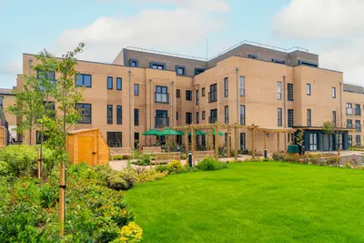
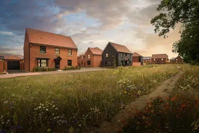
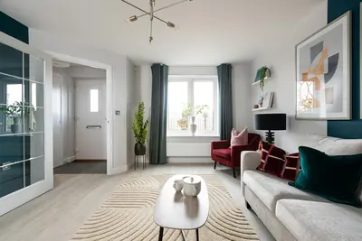
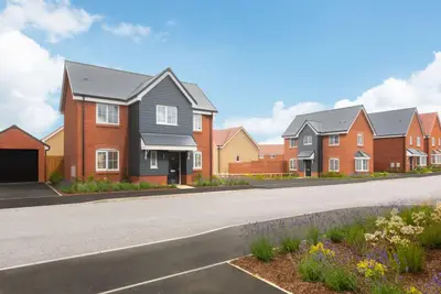
Merchants Yard is a collection of 163 rental homes on Grafton Way beside the River Orwell in Ipswich. Developed by Packaged Living with Galliard Homes, the neighbourhood occupies the former Great Eastern Railway Goods Station site. Two-, three- and four-bedroom houses provide an alternative to a city-centre apartment, with private gardens and layouts designed for everyday family living.
The homes use air-source heat pumps and include broadband without a separate service contract. Published facilities include parking, electric-vehicle charging and an on-site play park. Maintenance and repairs are professionally managed, with a residents’ app providing a way to raise requests. Pets are welcome. The waterfront location places the town centre, restaurants and shops within reach, while nearby Ipswich station offers onward rail connections.
- Developer
- Packaged Living
- City
- Suffolk
- Neighbourhood
- Ipswich
- Postcode
- IP1 1UZ
- Address
- Grafton Way
- Total homes
- 163
- Completed
- 2026
- Tenure
- Build to rent
Facilities
- Garden (Private gardens)
- Broadband (Contract-free service; confirm charges with operator)
- Parking (Confirm allocation and charges)
- EV charging (Confirm allocation and charges)
- Play area (On-site play park)
- Maintenance and repairs
- Pet friendly
Questions about Merchants Yard
›Who is the developer of Merchants Yard?
Merchants Yard is a Packaged Living development in Ipswich, Suffolk.
›Are homes available to rent at Merchants Yard?
Merchants Yard is marked "now selling", completed 2026. Use the enquiry button to check current availability with Packaged Living.
›What are house prices like in Ipswich?
The median sold price in Ipswich was £272,000 over the last 12 months (2,636 sales, −2.9% on the year before), or £294 per square foot, from HM Land Registry data. The house prices in Ipswich page has the trend, prices by property type and every street.
›What type of homes are at Merchants Yard?
Merchants Yard offers 163 homes in total, completed 2026. Homes are let by the operator by Packaged Living.
Location
Grafton Way, IP1 1UZ
Nearest stations
- Ipswich Station 0.1 milesGreater Anglia
- Derby Road Station 1.5 milesGreater Anglia
- Westerfield Station 2.2 milesGreater Anglia
Nearest schools
- Hillside Primary School 0.4 milesPrimary · ages 3–11 Needs attention
- St Matthew's Church of England Primary School, Ipswich 0.5 milesPrimary · ages 4–11
- Stoke High School - Ormiston Academy 0.6 milesSecondary · ages 11–16 Needs attention
- Westbridge Academy 0.6 milesages 14–16 Good
Nearest supermarkets
- The Co-operative Food Convenience store 0.1 miles
- The Co-operative Food Convenience store 0.4 miles
- Sainsburys Supermarket 0.5 miles
- Marks and Spencer Superstore 0.5 miles
Eating out nearby
Within half a mile: 72 restaurants and cafes, 13 pubs and bars, 10 takeaways.
- Costa Coffee 0.1 milesRestaurant or cafe
- Greggs 0.1 milesRestaurant or cafe
- Starbucks 0.1 milesTakeaway
- Mcdonald's 0.2 milesRestaurant or cafe
Straight-line distances; actual routes will be longer. Stations from NaPTAN, with their lines powered by TfL Open Data; schools from the Department for Education register, with the latest Ofsted signal; supermarkets from Geolytix Retail Points; places to eat from the Food Standards Agency's register of food businesses.
Area insights
The Ipswich neighbourhood around this development.
Sources: HM Land Registry price paid data, Police.uk, Historic England, ONS Census 2021, Ofcom Connected Nations, Environment Agency. Planning offices.
Register for launch pricing and availability.
Details last confirmed on 21 October 2026.