Lighthaus by Starlight Investments · 2 William Jessop Way, Liverpool, Merseyside L3 1EW
Completed 2025
Built by Starlight Investments. Homes in Birkenhead sold for a median £145,000 over the last year, £148 per sq ft; see house prices in Birkenhead.
About Lighthaus
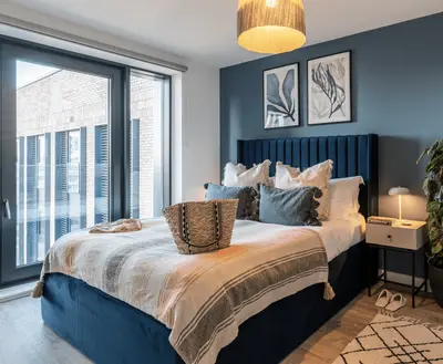
Lighthaus is a 278-home rental tower at Princes Dock, within the Liverpool Waters neighbourhood. Its address on William Jessop Way places residents between the waterfront and Liverpool city centre. The apartment range includes studios and one-, two- and three-bedroom homes, with large windows and furnished interiors.
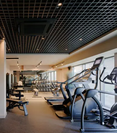
Construction completed in late 2025 and the building has since welcomed residents. Shared facilities include a gym, co-working spaces and a meeting room, giving residents options for exercising and working beyond their apartments. A roof terrace overlooks the waterfront, while lounges and a private dining room provide indoor places to relax or host guests. The scheme also advertises a sky bar and lounge, a residents’ coffee bar and a concierge service operating 24 hours a day.
- Developer
- Starlight Investments
- City
- Merseyside
- Neighbourhood
- Liverpool
- Postcode
- L3 1EW
- Address
- 2 William Jessop Way
- Total homes
- 278
- Completed
- 2025
- Tenure
- Build to rent
Facilities
- Gym
- Co-working (Includes meeting room)
- Roof terrace
- Residents’ lounge (Includes sky bar, lounge and residents’ coffee bar)
- Private dining
- Concierge (24 hours)
Questions about Lighthaus
›Who is the developer of Lighthaus?
Lighthaus is a Starlight Investments development in Liverpool, Merseyside.
›Are homes available to rent at Lighthaus?
Lighthaus is marked "now selling", completed 2025. Use the enquiry button to check current availability with Starlight Investments.
›What are house prices like in Birkenhead?
The median sold price in Birkenhead was £145,000 over the last 12 months (491 sales, +11.5% on the year before), or £148 per square foot, from HM Land Registry data. The house prices in Birkenhead page has the trend, prices by property type and every street.
›What type of homes are at Lighthaus?
Lighthaus offers 278 homes in total, completed 2025. Homes are let by the operator by Starlight Investments.
Location
2 William Jessop Way, L3 1EW
Nearest stations
- Moorfields Station 0.4 milesMerseyrail
- Liverpool James Street Station 0.5 milesMerseyrail
- Liverpool Lime Street Station 0.9 milesAvanti West Coast, East Midlands, Merseyrail, Northern, TransPennine, Transport for Wales, West Midlands
- Liverpool Central Station 0.9 milesMerseyrail
Nearest schools
- Nazene Danielle School of Performing Arts 0.5 milesIndependent · ages 6–16
- Holy Cross Catholic Primary School 0.6 milesPrimary · ages 3–11 Good
- The Trinity Catholic Academy 0.8 milesPrimary · ages 3–11
- Riverside Primary School 0.9 milesPrimary · ages 2–11
Nearest supermarkets
- Sainsburys Local Convenience store 0.1 miles
- Tesco Express Convenience store 0.2 miles
- Sainsburys Local Convenience store 0.2 miles
- Costco Superstore 0.3 miles
Eating out nearby
Within half a mile: 56 restaurants and cafes, 27 pubs and bars, 10 takeaways.
- Moose Coffee <0.1 milesRestaurant or cafe
- Hatchet Harry's Axe Throwing 0.1 milesPub or bar
- Cargo Seafood 0.1 milesRestaurant or cafe
- Bean 0.1 milesRestaurant or cafe
Straight-line distances; actual routes will be longer. Stations from NaPTAN, with their lines powered by TfL Open Data; schools from the Department for Education register, with the latest Ofsted signal; supermarkets from Geolytix Retail Points; places to eat from the Food Standards Agency's register of food businesses.
Area insights
The Liverpool neighbourhood around this development.
Sources: HM Land Registry price paid data, Police.uk, Historic England, ONS Census 2021, Ofcom Connected Nations, Environment Agency. Planning offices.
Register for launch pricing and availability.
Details last confirmed on 21 October 2026.