Milliners Yard by Allsop / Columbia Threadneedle · Stafford Street, Liverpool, Merseyside L3 8JA
Completed
Built by Allsop / Columbia Threadneedle. Homes in Liverpool sold for a median £210,000 over the last year, £230 per sq ft; see house prices in Liverpool.
About Milliners Yard
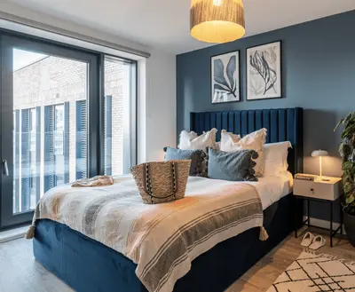
Milliners Yard is a professionally managed rental development on Stafford Street in Liverpool’s Fabric District. The operator advertises studios and apartments with one or two bedrooms, including accessible options. The neighbourhood’s textile and millinery history informs the scheme’s identity, while local streets connect with the city centre and Liverpool Lime Street station.
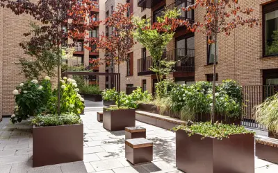
Residents have a gym, lounge and co-working space, together with a communal garden and a private roof terrace. Bike storage and secure parcel and post storage are also advertised. The published offer includes Wi-Fi, a 24-hour concierge, resident activities and pet-friendly homes. Parking and electric vehicle charging are available subject to arrangements. Individual apartment layouts, current availability, parking allocation and any terms for shared facilities should be checked directly with the letting team.
- Developer
- Allsop / Columbia Threadneedle
- City
- Merseyside
- Neighbourhood
- Liverpool
- Postcode
- L3 8JA
- Address
- Stafford Street
- Tenure
- Build to rent
Facilities
- Gym
- Residents’ lounge
- Co-working
- Garden
- Roof terrace
- Bike storage
- Parcel storage
- Broadband
- Concierge (24 hours)
- Pet friendly
- Parking (Confirm availability and charges)
- EV charging (Confirm availability and charges)
Questions about Milliners Yard
›Who is the developer of Milliners Yard?
Milliners Yard is an Allsop / Columbia Threadneedle development in Liverpool, Merseyside.
›Are homes available to rent at Milliners Yard?
Milliners Yard is marked "now selling", completed. Use the enquiry button to check current availability with Allsop / Columbia Threadneedle.
›What are house prices like in Liverpool?
The median sold price in Liverpool was £210,000 over the last 12 months (6,771 sales, +5.0% on the year before), or £230 per square foot, from HM Land Registry data. The house prices in Liverpool page has the trend, prices by property type and every street.
Location
Stafford Street, L3 8JA
Nearest stations
- Liverpool Lime Street Station 0.3 milesAvanti West Coast, East Midlands, Merseyrail, Northern, TransPennine, Transport for Wales, West Midlands
- Liverpool Central Loop Line Station 0.5 milesMerseyrail
- Liverpool Central Station 0.5 milesMerseyrail
- Moorfields Station 0.7 milesMerseyrail
Nearest schools
- St Nicholas Catholic Academy 0.3 milesPrimary · ages 3–11
- The City of Liverpool College 0.4 miles16 plus · ages 16–99
- Pleasant Street Primary School 0.4 milesPrimary · ages 3–11
- Sacred Heart Catholic Primary School and Nursery 0.5 milesPrimary · ages 3–11
Nearest supermarkets
- Lidl Supermarket 0.1 miles
- Spar Convenience store 0.1 miles
- Tesco Express Convenience store 0.1 miles
- Marks and Spencer Travel SF Convenience store 0.3 miles
Eating out nearby
Within half a mile: 59 restaurants and cafes, 30 pubs and bars, 33 takeaways.
- Bee Bees <0.1 milesRestaurant or cafe
- Crispy Cod & The Famous Sotos Greek Taverna <0.1 milesTakeaway
- Mr Chilli <0.1 milesRestaurant or cafe
- Thaihee Korean Restaurant 0.1 milesTakeaway
Straight-line distances; actual routes will be longer. Stations from NaPTAN, with their lines powered by TfL Open Data; schools from the Department for Education register, with the latest Ofsted signal; supermarkets from Geolytix Retail Points; places to eat from the Food Standards Agency's register of food businesses.
Area insights
The Liverpool neighbourhood around this development.
Sources: HM Land Registry price paid data, Police.uk, Historic England, ONS Census 2021, Ofcom Connected Nations, Environment Agency. Planning offices.
Register for launch pricing and availability.
Details last confirmed on 21 October 2026.