Kingsgate Park by Bellway Homes · Billet Road, Romford, Essex RM6 5SX
Bellway Homes has 241 developments on Homello. Homes in Romford sold for a median £430,000 over the last year, £465 per sq ft; see house prices in Romford.
About Kingsgate Park
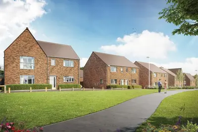
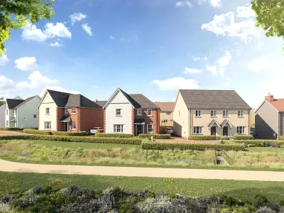
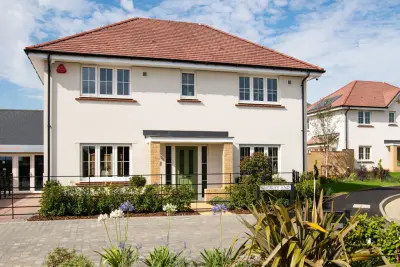
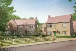
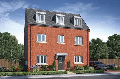
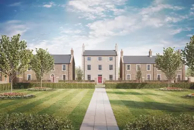
Kingsgate Park is a major new build community by Bellway Homes, located off Billet Road in Romford, Essex (RM6 5SX), within the London Borough of Redbridge. The masterplan for this site, which transforms a former unlicensed tip, anticipates the delivery of approximately 1,300 contemporary new homes and apartments. The initial phase of the development comprises a mix of 1, 2, and 3-bedroom apartments, alongside 3 and 4-bedroom houses, designed to cater to a diverse range of buyers, from first-time homeowners to families and commuters.
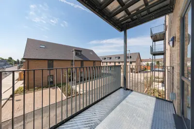
The wider scheme includes three hectares of parkland, public open space, new retail space, and a community hub, fundamentally establishing a new neighbourhood. The Redbridge Council has endorsed the masterplan and approved detailed proposals for the first phases. The homes are designed with energy efficiency in mind, utilising all-electric heating systems, including individual air source heat pumps for houses and heat pump cylinders for apartments. The current release will feature a selection of new build homes, including eight four and five-storey apartment buildings and 20 cottage-style houses in the first phase (Site A). Apartment units range from 1 to 3 bedrooms, and houses offer 3 or 4 bedrooms, ensuring a variety of options for different household sizes. A key feature is the provision of private outdoor space for every home: apartments include private balconies, while houses benefit from terraces or gardens. Parking facilities are available to selected properties, with the added benefit of electric vehicle (EV) charging points to support sustainable living. Furthermore, 159 homes across the development are designated as ‘affordable’, split between London Affordable Rent and London Shared Ownership tenures. Kingsgate Park is positioned for excellent transport accessibility. Chadwell Heath station is approximately an eight-minute drive (1.8 miles), providing Elizabeth Line services that connect commuters to Central London in just 26 minutes. Romford Railway Station, roughly 4.5 miles away, offers alternative rail access with journey times to London Liverpool Street in 17 minutes. Road links are comprehensive, with easy access to the A12, M11, and M25, and London City Airport is only 9.6 miles away. Local bus services are available from the Red House Farm Bus Stop, a short five-minute walk, with routes running to Ilford and Romford Station. Specific local amenities include Rose Lane Primary School and St Bedes Catholic Primary School, both within a five-minute drive, and Little Heath Primary School situated just half a mile away. Secondary education options include Ilford County High School and Oaks Park High School. For green space and leisure, Fairlop Waters Country Park, offering water sports and walking routes, is an eight-minute drive, and the development borders Hainault Forest Country Park. Major retail is accessible at Ilford High Street (15-minute drive), The Liberty Shopping Centre in Romford, and Westfield Stratford City, which is around 10 miles away. Kingsgate Park is a coming soon new build homes development. Current official pricing for the 1, 2, 3, and 4-bedroom properties is to be confirmed. Prospective buyers are advised that the development is not yet launched and is not currently accepting site visits. Interested parties should register their interest directly with Bellway Homes (a 5-star builder as per HBF) via the development contact number (02034 116 532) or the official website for updates on launch dates and sales release.
- Developer
- Bellway Homes
- City
- Essex
- Neighbourhood
- Romford
- Postcode
- RM6 5SX
- Address
- Billet Road, Romford, Essex
- Bedrooms
- 1–3
- Total homes
- 692
- Tenure
- For sale & shared ownership
Facilities
- Parking
- EV charging
- Garden
- Green space
- Play area
Questions about Kingsgate Park
›Who is the developer of Kingsgate Park?
Kingsgate Park is a Bellway Homes development in Romford, Essex. Bellway Homes has 241 developments listed on Homello.
›What are house prices like in Romford?
The median sold price in Romford was £430,000 over the last 12 months (1,699 sales, −0.5% on the year before), or £465 per square foot, from HM Land Registry data. The house prices in Romford page has the trend, prices by property type and every street.
›What type of homes are at Kingsgate Park?
Kingsgate Park offers houses and apartments, 1–3 bedroom homes, 692 homes in total. Shared ownership is available on some homes by Bellway Homes.
Location
Billet Road, Romford, Essex, RM6 5SX
Nearest stations
- Chadwell Heath Station 1.3 milesElizabeth line
- Barkingside Station 1.5 milesCentral line
- Fairlop Station 1.6 milesCentral line
- Goodmayes Station 1.6 milesElizabeth line
Nearest schools
- Little Heath School 0.3 milesSpecial · ages 11–19 Good
- Rose Lane Primary School 0.5 milesPrimary · ages 3–11
- The Constance Bridgeman Centre 0.5 milesages 14–16 Good
- Atam Academy 0.5 milesAll-through · ages 3–18
Nearest supermarkets
- The Co-operative Food Convenience store 0.5 miles
- Sainsburys Large supermarket 1.1 miles
- Lidl Supermarket 1.2 miles
- Iceland Supermarket 1.2 miles
Eating out nearby
Within half a mile: 1 restaurant or cafe, 2 takeaways.
- Tandoori Hut 0.5 milesTakeaway
- New Central 0.5 milesTakeaway
- Munchin 0.5 milesRestaurant or cafe
- Aramark @ Wrap It Up Redbridge 0.5 milesRestaurant or cafe
Straight-line distances; actual routes will be longer. Stations from NaPTAN, with their lines powered by TfL Open Data; schools from the Department for Education register, with the latest Ofsted signal; supermarkets from Geolytix Retail Points; places to eat from the Food Standards Agency's register of food businesses.
Area insights
The Redbridge neighbourhood around this development.
Sources: HM Land Registry price paid data, Police.uk, Historic England, ONS Census 2021, Ofcom Connected Nations, Environment Agency. Planning offices.

Register for launch pricing and availability.
Checked on the Bellway Homes website on 4 September 2026.