Hackett Grange by Avant Homes · Nottingham Road, Radcliffe on Trent, Nottinghamshire NG12 2DW
Avant Homes has 63 developments on Homello. Homes in Nottingham sold for a median £240,000 over the last year, £268 per sq ft; see house prices in Nottingham.
About Hackett Grange
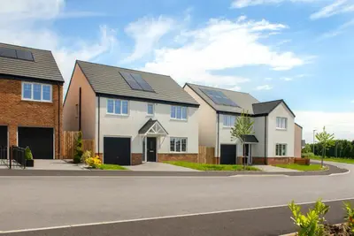
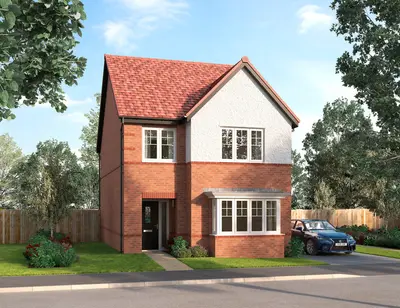
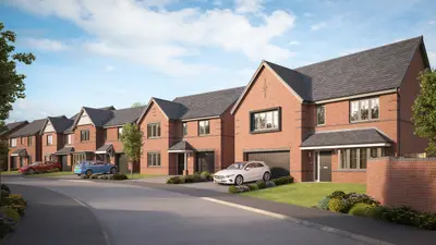
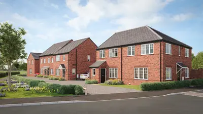
Hackett Grange is a new build property development by Avant Homes Midlands, situated on Nottingham Road in the highly sought-after village of Radcliffe on Trent, Nottinghamshire (NG12 2DW). The development comprises a collection of 2, 3, 4, and 5 bedroom homes, offering a mix of terraced, semi-detached, and detached house types. Specific homes, such as the 2-bedroom terraced plots (e.
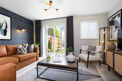
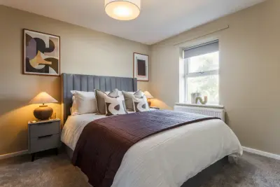
g.Each new home at Hackett Grange is designed to a modern specification, featuring kitchens with integrated appliances, fashionable tiling, and classic French doors. Properties are characterised by their spacious rooms and the provision of off-street parking for residents. The mix of two, three, four, and five-bedroom layouts is intended to suit a range of buyers, from first-time homeowners to those seeking family homes or looking to downsize. Interested parties are advised to contact the developer directly for specific floorplans and the full list of integrated specifications for individual house styles. The Radcliffe on Trent location is positioned approximately 15 minutes by car from Nottingham city centre and benefits from its proximity to the market town of Bingham. Commuter access is excellent, with the A52 providing a direct link to Nottingham and other major routes. Public Transport: Rail: Radcliffe (Notts) train station is a short distance from the development (approximately 0.7 miles). East Midlands Railway services from this station offer a rapid commute, with journey times to Nottingham train station taking approximately 11 minutes. Bus: The Trentbarton Mainline bus service operates a frequent route between the village and Nottingham station, with services from Vicarage Lane running as often as every 10 minutes, and a journey time of around 19 minutes. The Nottinghamshire County Council Fleet Services Route 33 also connects the area to Nottingham. Local Amenities and Education: Radcliffe on Trent village provides a variety of amenities, including local pubs, restaurants, and services. Named local amenities include the popular Italian-style restaurant Cafe Piano on Main Road, and The Plough pub. Local education is covered by Radcliffe on Trent Infant School and Radcliffe on Trent Junior School, both located on Cropwell Road. The village also hosts essential services like the Buttercross Veterinary Centre. The RSPCA Animal Centre is located on Nottingham Road, close to the development postcode. g., Plot 86). Viewing appointments and further detail on completion status can be arranged directly through Avant Homes Midlands. Prospective buyers should note that while Avant Homes has previously been recognised with a 5-star HBF Customer Satisfaction rating, recent industry data (as of July 2023) indicated a shift to a three-star customer satisfaction performance. Independent customer feedback has, at times, highlighted concerns regarding build quality and the post-sale snagging process. Buyers are advised to conduct due diligence and request full details on Avant Homes' current warranty and customer service charter before reservation.
- Developer
- Avant Homes
- City
- Nottinghamshire
- Neighbourhood
- Radcliffe on Trent
- Postcode
- NG12 2DW
- Address
- Nottingham Road, Radcliffe on Trent, Nottinghamshire
- Tenure
- For sale
Questions about Hackett Grange
›Who is the developer of Hackett Grange?
Hackett Grange is an Avant Homes development in Radcliffe on Trent, Nottinghamshire. Avant Homes has 63 developments listed on Homello.
›What are house prices like in Nottingham?
The median sold price in Nottingham was £240,000 over the last 12 months (8,980 sales, +0.0% on the year before), or £268 per square foot, from HM Land Registry data. The house prices in Nottingham page has the trend, prices by property type and every street.
Location
Nottingham Road, Radcliffe on Trent, Nottinghamshire, NG12 2DW
Nearest stations
- Radcliffe Station 0.7 milesEast Midlands
- Netherfield Station 1.7 milesEast Midlands
- Carlton Station 1.8 milesEast Midlands
- Burton Joyce Station 2.8 milesEast Midlands
Nearest schools
- Radcliffe-on-Trent Junior School 0.6 milesPrimary · ages 7–11 Good
- South Nottinghamshire Academy 0.8 milesSecondary · ages 11–18 Good
- Radcliffe-on-Trent Infant and Nursery School 0.9 milesPrimary · ages 3–7 Good
- Rivendell Flying High Academy 1.6 milesPrimary · ages 3–11
Nearest supermarkets
- The Co-operative Food Convenience store 0.6 miles
- Tesco Express Convenience store 0.6 miles
- Morrisons Superstore 1.3 miles
- Sainsburys Superstore 1.3 miles
Eating out nearby
Within half a mile: 1 restaurant or cafe, 1 pub or bar.
- The Chestnut 0.4 milesPub or bar
- St Marys Church 0.5 milesRestaurant or cafe
- Dash Events 0.5 milesRestaurant or cafe
- Costa 0.5 milesRestaurant or cafe
Straight-line distances; actual routes will be longer. Stations from NaPTAN, with their lines powered by TfL Open Data; schools from the Department for Education register, with the latest Ofsted signal; supermarkets from Geolytix Retail Points; places to eat from the Food Standards Agency's register of food businesses.
Area insights
The Rushcliffe neighbourhood around this development.
Sources: HM Land Registry price paid data, Police.uk, Historic England, ONS Census 2021, Ofcom Connected Nations, Environment Agency. Planning offices.

We have not been able to confirm current prices here recently.
Checked on the Avant Homes website on 28 October 2026.