Forbes Place by Colby River · Stoneywood Brae, Aberdeen AB21 9FA
Completed
Colby River has 5 developments on Homello.
About Forbes Place
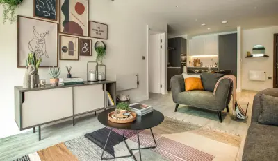
Forbes Place is a professionally managed rental community at Stoneywood Brae in Aberdeen. Colby River markets furnished studios and one- and two-bedroom apartments, together with three-bedroom townhouses. The Stoneywood location is convenient for nearby employment areas and local shops, with Aberdeen International Airport and the D2 and ABZ business parks within the wider area.
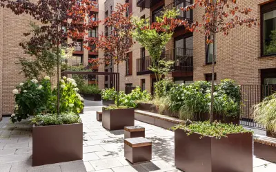
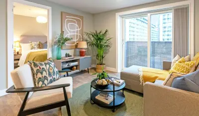
The published offer includes broadband, a pet-friendly approach, parking and landscaped gardens. Apartments have private balconies or terraces according to their layout. The three-storey townhouses provide a different arrangement, including a ground-floor garage and living accommodation above. This entry describes the named Forbes Place community rather than the surrounding Stoneywood housing neighbourhood. Individual home specification, parking arrangements and current availability should be checked with the operator when arranging a viewing.
- Developer
- Colby River
- City
- Aberdeen
- Neighbourhood
- Aberdeen
- Postcode
- AB21 9FA
- Address
- Stoneywood Brae
- Tenure
- Build to rent
Facilities
- Broadband
- Pet friendly
- Parking
- Garden
- Private balcony (Apartments: balcony or terrace varies by layout)
Questions about Forbes Place
›Who is the developer of Forbes Place?
Forbes Place is a Colby River development in Aberdeen. Colby River has 5 developments listed on Homello.
›Are homes available to rent at Forbes Place?
Forbes Place is marked "now selling", completed. Use the enquiry button to check current availability with Colby River.
Location
Stoneywood Brae, AB21 9FA
Nearest stations
- Dyce Station 1.6 milesScotRail
- Aberdeen Station 4.0 milesCrossCountry, LNER, ScotRail
Nearest schools
- Berwick St Mary's Church of England Primary School 97.0 milesPrimary · ages 2–11 Good
- Holy Trinity Church of England Primary School 97.7 milesPrimary · ages 3–11 Good
- St Cuthberts Catholic Primary School, Berwick 98.3 milesPrimary · ages 3–11
- Tweedmouth West Primary School 98.4 milesPrimary · ages 4–11
Nearest supermarkets
- Marks and Spencer Foodhall Supermarket 0.3 miles
- Lidl Supermarket 0.3 miles
- The Co-operative Food Convenience store 0.3 miles
- Morrisons Daily Convenience store 0.5 miles
Eating out nearby
Within half a mile: 1 restaurant or cafe, 3 pubs and bars, 4 takeaways.
- Bankhead Inn 0.2 milesPub or bar
- Sandys Fish and Chips 0.2 milesTakeaway
- Bankhead Avenue Chinese Carry Out 0.3 milesTakeaway
- Rayn Food 0.4 milesTakeaway
Straight-line distances; actual routes will be longer. Stations from NaPTAN, with their lines powered by TfL Open Data; schools from the Department for Education register, with the latest Ofsted signal; supermarkets from Geolytix Retail Points; places to eat from the Food Standards Agency's register of food businesses.
Area insights
The neighbourhood around this development.
Sources: HM Land Registry price paid data, Police.uk, Historic England, ONS Census 2021, Ofcom Connected Nations, Environment Agency. Planning offices.
Register for launch pricing and availability.
Details last confirmed on 21 October 2026.