Anchor Works by ila · Dumballs Road, Cardiff CF10 5LT
Completed
ila has 12 developments on Homello. Homes in Cardiff sold for a median £275,000 over the last year, £302 per sq ft; see house prices in Cardiff.
About Anchor Works
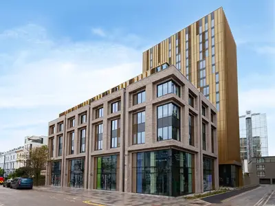
Anchor Works is ila’s professionally managed rental development on Dumballs Road in Cardiff. Its published apartment range includes studios and one- and two-bedroom homes, with shared facilities intended for working, relaxing and meeting neighbours. The location sits between Cardiff city centre and the Bay, within walking distance of Cardiff Central and Cardiff Bay stations.
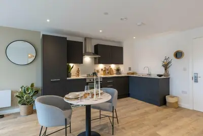
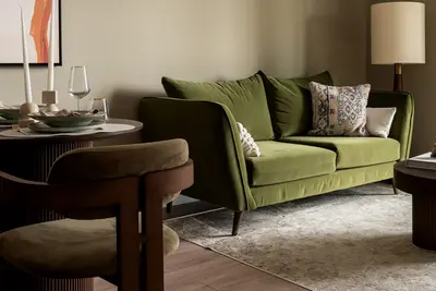
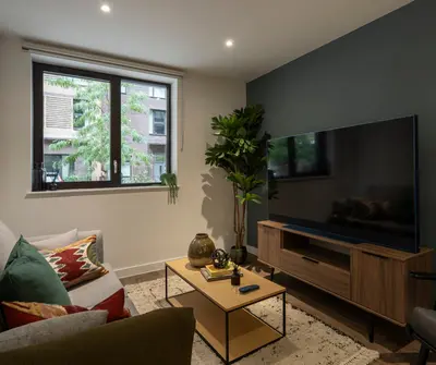
The scheme lists a gym, co-working area, residents’ lounge and shared kitchen, together with a courtyard and reception. An on-site team and maintenance support are part of the resident offer, with the app used for support requests and tenancy administration. Pets are welcome. Resident events and local discounts are also advertised. Nearby destinations include Mermaid Quay, the city’s arcades, Bute Park and the Wales Millennium Centre.
- Developer
- ila
- City
- Cardiff
- Neighbourhood
- Cardiff
- Postcode
- CF10 5LT
- Address
- Dumballs Road
- Tenure
- Build to rent
Facilities
- Gym
- Co-working
- Residents’ lounge
- Residents’ kitchen
- Garden (Courtyard)
- On-site management
- On-site maintenance
- Pet friendly
Questions about Anchor Works
›Who is the developer of Anchor Works?
Anchor Works is an ila development in Cardiff. ila has 12 developments listed on Homello.
›Are homes available to rent at Anchor Works?
Anchor Works is marked "now selling", completed. Use the enquiry button to check current availability with ila.
›What are house prices like in Cardiff?
The median sold price in Cardiff was £275,000 over the last 12 months (4,215 sales, +1.9% on the year before), or £302 per square foot, from HM Land Registry data. The house prices in Cardiff page has the trend, prices by property type and every street.
Location
Dumballs Road, CF10 5LT
Nearest stations
- Cardiff Bay Station 0.4 milesTransport for Wales
- Cardiff Central Station 0.5 milesCrossCountry, Great Western, Transport for Wales
- Grangetown Station 0.7 milesTransport for Wales
- Cardiff Queen Street Station 0.8 milesTransport for Wales
Nearest schools
- St Mary The Virgin C.I.W. Primary School 0.3 milesWelsh-medium/LA
- St Cuthbert's R.C. Primary School 0.3 milesWelsh-medium/LA
- Grange Town Primary 0.5 milesWelsh-medium/LA
- Mount Stuart Primary 0.5 milesWelsh-medium/LA
Nearest supermarkets
- The Co-operative Food Convenience store 0.2 miles
- Morrisons Daily Convenience store 0.3 miles
- Spar Convenience store 0.4 miles
- The Co-operative Food Convenience store 0.5 miles
Eating out nearby
Within half a mile: 39 restaurants and cafes, 2 pubs and bars, 6 takeaways.
- Bae Coffi 0.1 milesRestaurant or cafe
- Ffwrnes Pizza 0.1 milesRestaurant or cafe
- The Depot 0.1 milesPub or bar
- Dirty Bird 0.1 milesRestaurant or cafe
Straight-line distances; actual routes will be longer. Stations from NaPTAN, with their lines powered by TfL Open Data; schools from the Department for Education register, with the latest Ofsted signal; supermarkets from Geolytix Retail Points; places to eat from the Food Standards Agency's register of food businesses.
Area insights
The Cardiff neighbourhood around this development.
Sources: HM Land Registry price paid data, Police.uk, Historic England, ONS Census 2021, Ofcom Connected Nations, Environment Agency. Planning offices.

Register for launch pricing and availability.
Details last confirmed on 21 October 2026.