Woodlands by Taylor Wimpey · Old Vicarage Lane, Swindon, Wiltshire, SN3 4SH
Taylor Wimpey has 252 developments on Homello. Homes in Swindon sold for a median £285,000 over the last year, £316 per sq ft; see house prices in Swindon.
About Woodlands
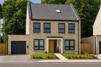
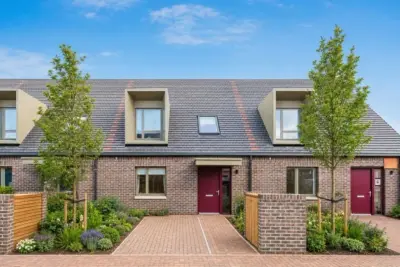
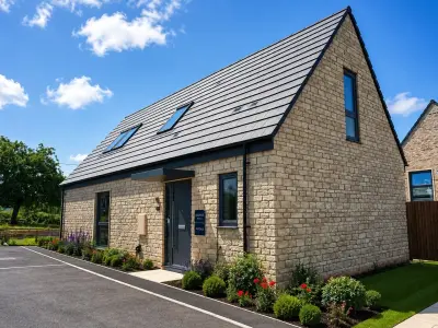
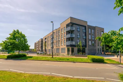
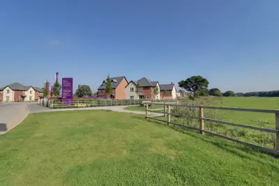
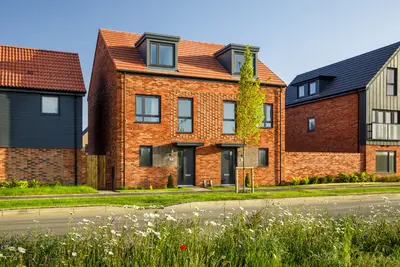
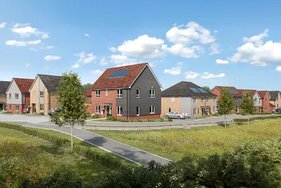
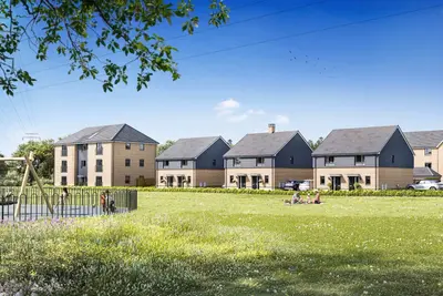
Woodlands is a significant new build homes development by Taylor Wimpey, located on Old Vicarage Lane in the village of South Marston, Swindon, Wiltshire (SN3 4SH). This site forms part of the wider Swindon New Eastern Villages (NEV) expansion, a major community scheme that will deliver new infrastructure and facilities. The development’s first phase, known as Skylark at The Woodlands, consists of 134 properties, including 31 designated as affordable housing.
The development is currently launching in 2025, with homes being released in phases throughout the year. Taylor Wimpey is an established developer with a strong track record, having secured a 5-Star rating in the 2025 Home Builders Federation (HBF) customer satisfaction scheme, an accolade reflecting that over 90% of customers would recommend the company to a friend. The Woodlands offers a diverse mix of new build homes, ranging from one and two-bedroom apartments to spacious family houses with up to five bedrooms. All properties are being constructed with a strong focus on energy efficiency and sustainability. Specific features include modern insulation standards and the incorporation of energy-saving technologies such as Photovoltaic (PV) panels and electric vehicle (EV) charging points on select plots, aiming to deliver lower long-term running costs compared to older properties. Within the development, Taylor Wimpey is delivering new public open space, a Community Woodland, a new playground, and dedicated allotment spaces to encourage community interaction and sustainable living. The wider NEV masterplan includes a new two-form entry primary school, a neighbourhood centre with retail and employment space, and multiple sports pitches. Woodlands benefits from excellent strategic transport links. It is situated just off the A420, providing direct road access toward Oxford, and is a short drive from Junction 15 of the M4 motorway for connectivity to London and Bristol. Swindon Train Station is a short drive away, offering fast and frequent Great Western Railway (GWR) services. Fastest typical peak journey times are approximately 50 to 59 minutes to London Paddington, around 36 minutes to Oxford, and an express journey time of 30-35 minutes to Bristol Temple Meads. Local amenities are accessible in South Marston village, including the Carpenters Arms and The Carriers Arms, both well-regarded local pubs. Food retail is supported by Roves Farm Shop, Butchery & Café, located approximately three miles from the development. For families, the existing South Marston Church of England Primary School, located on Old Vicarage Lane, was recently praised in its January 2025 inspection for its inclusivity and work to strengthen the curriculum. Bus services, including routes 23, 65, 66, and S6, run through South Marston, connecting to Swindon Town Centre and Oxford. The Woodlands development is scheduled for a 2025 launch. Specific house types, floor plans, and the associated price list for the initial release are to be confirmed by the developer. 00. Interested parties should register with Taylor Wimpey to receive updates on specific plot releases, property specifications, and to arrange viewing appointments when the show homes open.
- Developer
- Taylor Wimpey
- City
- Wiltshire
- Neighbourhood
- Swindon
- Postcode
- SN3 4SH
- Address
- Old Vicarage Lane, Swindon, Wiltshire, SN3 4SH
- Tenure
- For sale
Questions about Woodlands
›Who is the developer of Woodlands?
Woodlands is a Taylor Wimpey development in Swindon, Wiltshire. Taylor Wimpey has 252 developments listed on Homello.
›What are house prices like in Swindon?
The median sold price in Swindon was £285,000 over the last 12 months (3,530 sales, −2.4% on the year before), or £316 per square foot, from HM Land Registry data. The house prices in Swindon page has the trend, prices by property type and every street.
Location
Old Vicarage Lane, Swindon, Wiltshire, SN3 4SH
Nearest stations
- Swindon Station 3.2 milesGreat Western
Nearest schools
- South Marston Church of England Primary School <0.1 milesPrimary · ages 4–11
- Grange Infants' School 1.2 milesPrimary · ages 5–7
- Grange Junior School 1.3 milesPrimary · ages 7–11
- Maranatha Christian School 1.4 milesIndependent · ages 3–19
Nearest supermarkets
- Sainsburys Superstore 0.9 miles
- Aldi Supermarket 1.4 miles
- The Co-operative Food Convenience store 1.5 miles
- Morrisons Daily Convenience store 1.7 miles
Eating out nearby
Within half a mile: 1 pub or bar.
- The Rat Trap 0.3 milesPub or bar
- Carriers Arms 0.5 milesPub or bar
- Bakery 79 - South Marston 0.7 milesRestaurant or cafe
- The Snack & Sandwich Co Ltd (@ Gable Cross Police Station) 0.8 milesRestaurant or cafe
Straight-line distances; actual routes will be longer. Stations from NaPTAN, with their lines powered by TfL Open Data; schools from the Department for Education register, with the latest Ofsted signal; supermarkets from Geolytix Retail Points; places to eat from the Food Standards Agency's register of food businesses.
Area insights
The Swindon neighbourhood around this development.
Sources: HM Land Registry price paid data, Police.uk, Historic England, ONS Census 2021, Ofcom Connected Nations, Environment Agency. Planning offices.

We have not been able to confirm current prices here recently.
Checked on the Taylor Wimpey website on 28 October 2026.