Windermere Grange by Taylor Wimpey · Coniston Crescent, Stourport-on-Severn, Worcestershire DY13 8JU
Taylor Wimpey has 193 developments on Homello. Homes in Stourport-on-Severn sold for a median £263,931 over the last year, £278 per sq ft; see house prices in Stourport-on-Severn.
About Windermere Grange
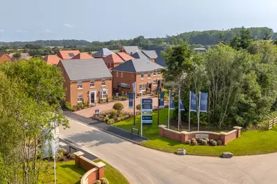
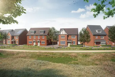
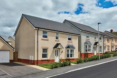
Windermere Grange is a new build homes development by Taylor Wimpey West Midlands, located off Coniston Crescent in the historic Worcestershire town of Stourport-on-Severn (DY13 8JU). The development is scheduled to deliver a total of 110 new residences, comprising a mix of two, three, and four-bedroom houses. The scheme has been designed to complement the local character, incorporating a central landscaped amenity area and an area for natural play, with mature woodland retained at the frontage.
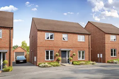
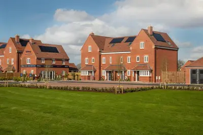
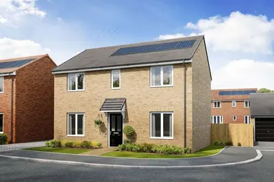
Taylor Wimpey, the developer, is a major national builder and has retained a 5-star rating for customer satisfaction from the Home Builders Federation (HBF), reflecting that over 90% of their customers would recommend them to a friend. The collection includes a range of property styles suitable for various buyers, including the three-bedroom Easedale and Trusdale, and four-bedroom detached homes such as the Wortham. The properties are built to modern specifications, offering potential buyers the opportunity to personalise kitchens and bathrooms with a high-quality range of options and colour palettes. Standard features include Zanussi appliances (oven and gas hob), modern white sanitaryware with Ideal Standard taps, and a choice of Porcelanosa ceramic wall tiles in bathrooms and en-suites. Focused on energy efficiency and sustainability, selected new build homes at Windermere Grange are equipped with practical features such as PV panels, triple glazing, and provisions for EV charging points. External space includes a fully turfed and landscaped front garden, with turf and a slabbed area in the rear garden, enclosed by a fence. Windermere Grange is situated in Stourport-on-Severn, a riverside Georgian town known for its historic canal basins and lively leisure facilities on the River Severn. The town centre, with its range of independent shops, cafés, restaurants, and pubs, is easily accessible. Nearby family amenities include the picturesque Riverside Meadows, offering open green space, and the Treasure Island Amusement Centre. For education, primary and secondary schools are located approximately half a mile from the development site. The wider area provides access to natural attractions such as the Wyre Forest National Nature Reserve and the West Midlands Safari Park. Transport Links: The development offers strong regional travel links. The nearest railway stations are Hartlebury (2.8 miles) and Kidderminster (3 miles). Direct train services from Kidderminster provide rapid connections, with the fastest services to Worcester taking approximately 18-20 minutes. Birmingham Airport is situated under an hour’s drive away, and major road links are accessible via the A451 and A449. Pricing for the new build homes at Windermere Grange begins from £439,995, which currently applies to a four-bedroom detached house type. A range of other 4-bedroom detached homes are also available at similar prices. For current and specific pricing on two and three-bedroom new build homes, interested parties should contact the sales executive directly. Viewing is strictly by appointment only. The development is managed by Taylor Wimpey West Midlands.
- Developer
- Taylor Wimpey
- City
- Worcestershire
- Neighbourhood
- Stourport-on-Severn
- Postcode
- DY13 8JU
- Address
- Coniston Crescent, Stourport-on-Severn, Worcestershire
- Tenure
- For sale
Questions about Windermere Grange
›Who is the developer of Windermere Grange?
Windermere Grange is a Taylor Wimpey development in Stourport-on-Severn, Worcestershire. Taylor Wimpey has 193 developments listed on Homello.
›How much do homes at Windermere Grange cost?
Prices at Windermere Grange start from around £439,995 (taken from the developer's marketing, so treat it as a guide).
›What are house prices like in Stourport-on-Severn?
The median sold price in Stourport-on-Severn was £263,931 over the last 12 months (343 sales, +2.3% on the year before), or £278 per square foot, from HM Land Registry data. The house prices in Stourport-on-Severn page has the trend, prices by property type and every street.
Location
Coniston Crescent, Stourport-on-Severn, Worcestershire, DY13 8JU
Nearest stations
- Hartlebury Station 2.8 miles
- Kidderminster Station 3.0 miles
- Blakedown Station 5.9 miles
- Hagley Station 7.6 miles
Nearest schools
- Burlish Park Primary School 0.2 milesPrimary · ages 3–11
- The Stourport High School and Sixth Form College 0.3 milesSecondary · ages 11–18
- Stourport Primary Academy 0.5 milesPrimary · ages 2–11
- St Wulstan's Catholic Primary School 0.6 milesPrimary · ages 4–11
Straight-line distances; actual routes will be longer. Stations from NaPTAN; schools from the Department for Education register, with the latest Ofsted signal.
Area insights
The Wyre Forest neighbourhood around this development.
Sources: HM Land Registry price paid data, EPC register, Police.uk, Historic England, ONS Census 2021, Ofcom Connected Nations, Environment Agency. Planning offices.
Register for launch pricing and availability.