West Craigs Quarter by David Wilson Homes · Norwal Drive, Edinburgh, City of Edinburgh EH12 0EP
David Wilson Homes has 140 developments on Homello.
About West Craigs Quarter
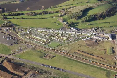
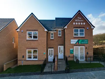
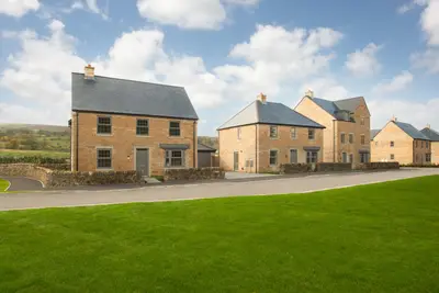
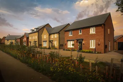
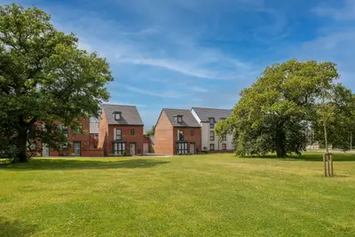
West Craigs Quarter is a new build homes development by five-star housebuilder David Wilson Homes, situated off Norwal Drive in the West Edinburgh area of EH12. The development forms part of the wider West Craigs new community, offering a blend of luxury houses and apartments designed for modern family living. Available properties include a range of 3 and 4-bedroom houses, with current pricing starting from approximately $\textsterling$369,995 for a 3-bedroom property and extending up to approximately $\textsterling$685,995 for the larger 4-bedroom detached house types.
The developer, David Wilson Homes, is a subsidiary of Barratt Developments PLC, which has a sustained track record, having been awarded the maximum five stars in the Home Builders Federation's National New Home Customer Satisfaction Survey every year since 2010. The development features various house styles, including the 3-bedroom 'Meldrum' end-terraced house, and several 4-bedroom detached styles such as the 'Falkland', 'Durris', 'Dalmally', and 'Craighall'. A typical 4-bedroom detached home, such as the 'Falkland' or 'Craighall', includes an open-plan kitchen/family/dining area, a utility room, a separate lounge, a downstairs WC, and a single integral garage. All properties are designed with a focus on generous internal space, with specific floorplans available from the developer showing layouts featuring double bedrooms and an en-suite to the main bedroom. For example, the 3-bedroom 'Meldrum' house type offers a combined Kitchen/Family/Dining area measuring 5420mm x 2919mm (17'9" x 9'6"). West Craigs Quarter is positioned to provide convenient access to Edinburgh's main transport networks. The development is situated close to the Edinburgh City Bypass (A720) and is accessible via Turnhouse Road from Glasgow Road (A8). Public transport links include frequent Lothian Buses services on Maybury Road, offering routes directly into the city centre. For rail and tram connections, the development is approximately 1 mile from Edinburgh Gateway main line rail and tram station, with additional nearby stations at South Gyle (1.8 miles) and Edinburgh Park (2 miles). Future plans for the wider West Craigs area include a footbridge to provide more direct access to Edinburgh Gateway. Local amenities are comprehensive, with The Gyle Shopping Centre, Morrisons, Tesco Extra, and B&M all nearby. For leisure, the David Lloyd gym is located approximately 1.4 miles away. The surrounding masterplan includes significant on-site community infrastructure, featuring a new primary school, a nursery, a health centre, a proposed café, and two dedicated 5-acre public parks, all being constructed by The City of Edinburgh Council. Existing local schools include East Craigs Primary School (approx. 1 mile) and Craigmount High School (approx. 1 mile), which is undergoing extension. The development currently has a selection of 3 and 4-bedroom new build homes available for immediate or near-term occupancy, with specific plots ready to move into. David Wilson Homes offers various schemes for potential buyers, including Part Exchange, Movemaker, Low Deposit Schemes, and the Own New - Rate Reducer. Full house type specifications, current pricing, and viewing arrangements for the show homes are available directly from the sales office, which should also be contacted for confirmation on the completion status of the on-site community facilities (e.g., school/health centre).
- Developer
- David Wilson Homes
- City
- City of Edinburgh
- Neighbourhood
- Edinburgh
- Postcode
- EH12 0EP
- Address
- Norwal Drive, Edinburgh, City of Edinburgh
- Tenure
- For sale & shared ownership
Questions about West Craigs Quarter
›Who is the developer of West Craigs Quarter?
West Craigs Quarter is a David Wilson Homes development in Edinburgh, City of Edinburgh. David Wilson Homes has 140 developments listed on Homello.
Location
Norwal Drive, Edinburgh, City of Edinburgh, EH12 0EP
Nearest stations
- Edinburgh Gateway Station 0.5 milesScotRail · Edinburgh Trams
- Gogarburn Station 0.6 milesEdinburgh Trams
- Gyle Centre Station 0.7 milesEdinburgh Trams
- Ingliston Park & Ride Station 1.2 milesEdinburgh Trams
Nearest schools
- Kielder Primary School and Nursery 57.5 milesPrimary · ages 2–11 Needs attention
- Bewcastle School 63.6 milesPrimary · ages 3–11 Good
- Shankhill CofE Primary School 65.9 milesPrimary · ages 3–11 Good
- Longtown Primary School 66.3 milesPrimary · ages 3–11
Nearest supermarkets
- Morrisons Superstore 0.7 miles
- Tesco Express Convenience store 0.8 miles
- Marks and Spencer Superstore 0.9 miles
- Tesco Express Convenience store 1.0 miles
Eating out nearby
- Grosvenor Maybury Casino 0.7 milesRestaurant or cafe
- Flightcare Multiservices 0.7 milesRestaurant or cafe
- Bt (british Telecom) 0.8 milesRestaurant or cafe
- Aramark 0.8 milesRestaurant or cafe
Straight-line distances; actual routes will be longer. Stations from NaPTAN, with their lines powered by TfL Open Data; schools from the Department for Education register, with the latest Ofsted signal; supermarkets from Geolytix Retail Points; places to eat from the Food Standards Agency's register of food businesses.
Area insights
The neighbourhood around this development.
Sources: HM Land Registry price paid data, Police.uk, Historic England, ONS Census 2021, Ofcom Connected Nations, Environment Agency. Planning offices.
Register for launch pricing and availability.