Trevalyn Place by Castle Green Homes · Rossett Road, Rossett, Wrexham LL12 0ED
Under construction
Castle Green Homes has 3 developments on Homello. Homes in Wrexham sold for a median £200,000 over the last year, £227 per sq ft; see house prices in Wrexham.
About Trevalyn Place
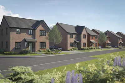
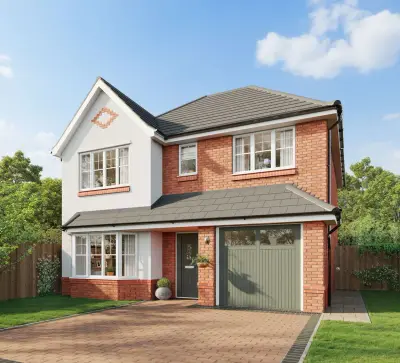
Trevalyn Place is a Castle Green Homes development on Rossett Road in the village of Rossett, between Wrexham and Chester. The current private-sale selection includes three- and four-bedroom houses, with layouts ranging from semi-detached homes to larger detached designs. Some finished properties are available for an earlier move, while other plots remain under construction.
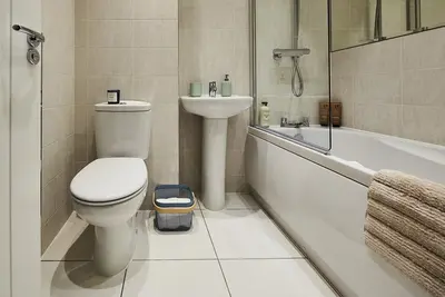
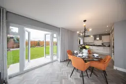
Show homes allow buyers to compare room arrangements and finishes, and the builder’s Willow system offers specification choices where the build stage permits. Kitchens, living areas and garden access vary by house type, so details should be checked for the chosen plot. Rossett’s shops, pubs and community services provide everyday convenience, with wider employment and leisure options in the surrounding cities.
- Developer
- Castle Green Homes
- City
- Wrexham
- Neighbourhood
- Rossett
- Postcode
- LL12 0ED
- Address
- Rossett Road, Rossett
- Tenure
- For sale
Questions about Trevalyn Place
›Who is the developer of Trevalyn Place?
Trevalyn Place is a Castle Green Homes development in Rossett, Wrexham. Castle Green Homes has 3 developments listed on Homello.
›Is Trevalyn Place still selling?
Trevalyn Place is marked "now selling", under construction. Use the enquiry button to check current availability with Castle Green Homes.
›What are house prices like in Wrexham?
The median sold price in Wrexham was £200,000 over the last 12 months (1,518 sales, +1.0% on the year before), or £227 per square foot, from HM Land Registry data. The house prices in Wrexham page has the trend, prices by property type and every street.
Location
Rossett Road, Rossett, LL12 0ED
Nearest stations
- Caergwrle Station 3.9 milesTransport for Wales
- Cefn-y-Bedd Station 3.9 milesTransport for Wales
- Hope Station 4.1 milesTransport for Wales
- Gwersyllt Station 4.2 milesTransport for Wales
Nearest schools
- St Peter's CIW Voluntary Controlled Primary School 0.1 milesWelsh-medium/LA
- Darland High School 0.2 milesWelsh-medium/LA
- The Rofft C.P. School 1.7 milesWelsh-medium/LA
- All Saints Primary School 2.3 milesWelsh-medium/LA
Nearest supermarkets
- The Co-operative Food Convenience store 0.3 miles
- The Co-operative Food Convenience store 1.6 miles
- Spar Convenience store 2.2 miles
- Aldi Supermarket 2.5 miles
Eating out nearby
Within half a mile: 5 restaurants and cafes, 1 takeaway.
- Hwb Yr Orsedd 0.2 milesRestaurant or cafe
- Rossett Sun Wah 0.2 milesTakeaway
- Fouzis cafe bar 0.2 milesRestaurant or cafe
- Golden Lion 0.4 milesRestaurant or cafe
Straight-line distances; actual routes will be longer. Stations from NaPTAN, with their lines powered by TfL Open Data; schools from the Department for Education register, with the latest Ofsted signal; supermarkets from Geolytix Retail Points; places to eat from the Food Standards Agency's register of food businesses.
Area insights
The Wrexham neighbourhood around this development.
Sources: HM Land Registry price paid data, Police.uk, Historic England, ONS Census 2021, Ofcom Connected Nations, Environment Agency. Planning offices.
Register for launch pricing and availability.
Details last confirmed on 22 October 2026.