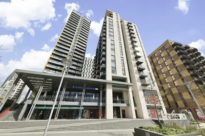
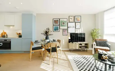
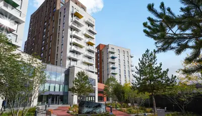
The Oakgate by Get Living · Randalls Way, Leatherhead, Surrey KT22 7TW
Completed
Get Living has 6 developments on Homello. Homes in Leatherhead sold for a median £640,000 over the last year, £544 per sq ft; see house prices in Leatherhead.
About The Oakgate
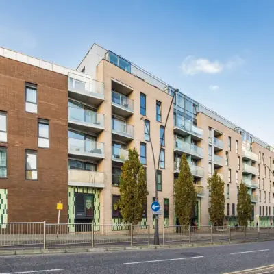
The Oakgate is Get Living’s rental neighbourhood on Randalls Way in Leatherhead, Surrey. It contains 214 homes, with one-, two- and three-bedroom apartments currently marketed as move-in ready. The location is close to Leatherhead station and the town centre, with the countryside of the Surrey Hills accessible beyond the town.
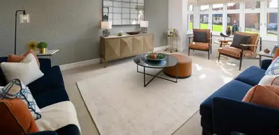
Residents can use a gym, co-working space and shared lounge, alongside private courtyard gardens and a children’s play area. Wi-Fi is included and the operator lists concierge, on-site maintenance, parcel storage and bike storage. Pets are welcome under the operator’s policy. More than 100 car parking spaces are offered for rent, with electric charging points also advertised; availability and charges should be confirmed separately. The shared facilities are intended as an extension of the individual apartments.
- Developer
- Get Living
- City
- Surrey
- Neighbourhood
- Leatherhead
- Postcode
- KT22 7TW
- Address
- Randalls Way
- Total homes
- 214
- Tenure
- Build to rent
Facilities
- Gym
- Co-working
- Residents’ lounge
- Garden (Private courtyard gardens)
- Play area
- Broadband (Wi-Fi included)
- Concierge
- On-site maintenance
- Parcel storage
- Bike storage
- Pet friendly
- Parking (Available to rent; confirm charges and availability)
- EV charging (Confirm current arrangements and charges)
Questions about The Oakgate
›Who is the developer of The Oakgate?
The Oakgate is a Get Living development in Leatherhead, Surrey. Get Living has 6 developments listed on Homello.
›Are homes available to rent at The Oakgate?
The Oakgate is marked "now selling", completed. Use the enquiry button to check current availability with Get Living.
›What are house prices like in Leatherhead?
The median sold price in Leatherhead was £640,000 over the last 12 months (615 sales, −3.8% on the year before), or £544 per square foot, from HM Land Registry data. The house prices in Leatherhead page has the trend, prices by property type and every street.
Location
Randalls Way, KT22 7TW
Nearest stations
- Leatherhead Station 0.2 milesSouthern, South Western
- Ashtead Station 1.8 milesSouthern, South Western
- Bookham Station 2.2 milesSouth Western
- Cobham & Stoke d'Abernon Station 2.6 milesSouth Western
Nearest schools
- Leatherhead Trinity School and Nursery 0.4 milesPrimary · ages 2–11
- Therfield School 0.4 milesSecondary · ages 11–18 Good
- St John's School 0.6 milesIndependent · ages 11–18
- Fox Grove School 0.7 milesages 4–19
Nearest supermarkets
- Marks and Spencer BP Convenience store 0.3 miles
- Morrisons Daily Convenience store 0.3 miles
- Lidl Supermarket 0.4 miles
- Sainsburys Large supermarket 0.5 miles
Eating out nearby
Within half a mile: 20 restaurants and cafes, 3 pubs and bars, 10 takeaways.
- The Mulberry 0.1 milesRestaurant or cafe
- Puccino's Leatherhead 0.2 milesRestaurant or cafe
- Golden Plaice 0.3 milesTakeaway
- Papa Johns 0.3 milesTakeaway
Straight-line distances; actual routes will be longer. Stations from NaPTAN, with their lines powered by TfL Open Data; schools from the Department for Education register, with the latest Ofsted signal; supermarkets from Geolytix Retail Points; places to eat from the Food Standards Agency's register of food businesses.
Area insights
The Mole Valley neighbourhood around this development.
Sources: HM Land Registry price paid data, Police.uk, Historic England, ONS Census 2021, Ofcom Connected Nations, Environment Agency. Planning offices.
Register for launch pricing and availability.
Details last confirmed on 21 October 2026.