The Farriers by Packaged Living / Aviva Investors / Colby River · Simmental Way, Whitehouse, Milton Keynes, Buckinghamshire MK8 1LS
Completed
Packaged Living / Aviva Investors / Colby River has 2 developments on Homello. Homes in Milton Keynes sold for a median £345,000 over the last year, £369 per sq ft; see house prices in Milton Keynes.
About The Farriers
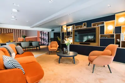
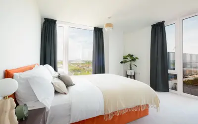
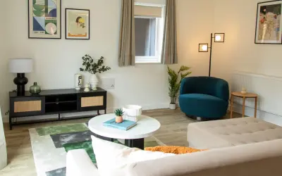
The Farriers is a professionally managed rental neighbourhood in the Whitehouse area of Milton Keynes, with its operator’s address on Simmental Way. The scheme contains 95 rental homes within the wider Whitehouse Park development. The advertised range includes two-, three- and four-bedroom houses, with current homes available to rent.
Private gardens give households outdoor space of their own. The published rental offer includes superfast broadband, EV charging, maintenance and repairs, and a pet-friendly approach. Homes also feature smart locks and an energy-efficient specification. Nearby schools, green spaces and routes towards Milton Keynes city centre provide the local setting. The wider Whitehouse masterplan is substantially larger than this rental community; its homes must not be counted as additional Farriers units. Individual specifications and availability vary.
- Developer
- Packaged Living / Aviva Investors / Colby River
- City
- Buckinghamshire
- Neighbourhood
- Milton Keynes
- Postcode
- MK8 1LS
- Address
- Simmental Way, Whitehouse
- Total homes
- 95
- Tenure
- Build to rent
Facilities
- Garden (Private gardens)
- Broadband
- EV charging
- Maintenance and repairs
- Pet friendly
Questions about The Farriers
›Who is the developer of The Farriers?
The Farriers is a Packaged Living / Aviva Investors / Colby River development in Milton Keynes, Buckinghamshire. Packaged Living / Aviva Investors / Colby River has 2 developments listed on Homello.
›Are homes available to rent at The Farriers?
The Farriers is marked "now selling", completed. Use the enquiry button to check current availability with Packaged Living / Aviva Investors / Colby River.
›What are house prices like in Milton Keynes?
The median sold price in Milton Keynes was £345,000 over the last 12 months (2,885 sales, −4.2% on the year before), or £369 per square foot, from HM Land Registry data. The house prices in Milton Keynes page has the trend, prices by property type and every street.
Location
Simmental Way, Whitehouse, MK8 1LS
Nearest stations
- Milton Keynes Central Station 2.0 milesAvanti West Coast, West Midlands
- Wolverton Station 2.2 milesWest Midlands
- Bletchley Station 4.6 milesWest Midlands
- Fenny Stratford Station 5.1 milesWest Midlands
Nearest schools
- Watling Primary School 0.1 milesPrimary · ages 3–11
- Watling Academy 0.1 milesSecondary · ages 11–18
- Whitehouse Primary School 0.4 milesPrimary · ages 2–11
- Fairfields Primary School 0.6 milesPrimary · ages 2–11
Nearest supermarkets
- Tesco Express Convenience store 1.0 miles
- Morrisons Daily Convenience store 1.1 miles
- The Co-operative Food Convenience store 1.1 miles
- Marks and Spencer BP Convenience store 1.3 miles
Eating out nearby
Within half a mile: 1 restaurant or cafe.
- Lilly Cafe 0.2 milesRestaurant or cafe
- Mk11 0.5 milesRestaurant or cafe
- Ramgarhia Sabha Lunch Club 0.5 milesRestaurant or cafe
- MK Dons SET 0.6 milesRestaurant or cafe
Straight-line distances; actual routes will be longer. Stations from NaPTAN, with their lines powered by TfL Open Data; schools from the Department for Education register, with the latest Ofsted signal; supermarkets from Geolytix Retail Points; places to eat from the Food Standards Agency's register of food businesses.
Area insights
The Milton Keynes neighbourhood around this development.
Sources: HM Land Registry price paid data, Police.uk, Historic England, ONS Census 2021, Ofcom Connected Nations, Environment Agency. Planning offices.
Register for launch pricing and availability.
Details last confirmed on 21 October 2026.