The Earls by Persimmon Homes · The Earls, Blindwells, Prestonpans, East Lothian, EH32 9SP
Persimmon Homes has 229 developments on Homello.
About The Earls
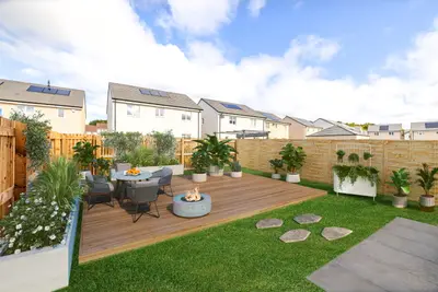
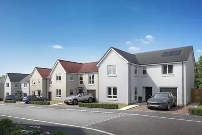
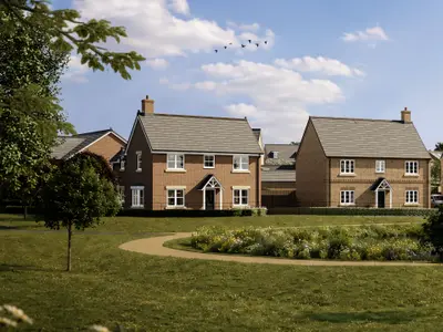
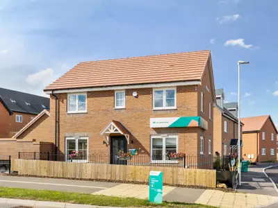
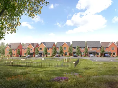
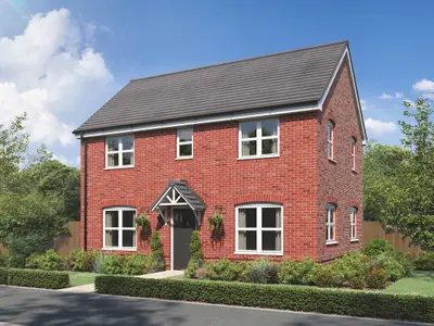
The Earls is a new build residential development by Persimmon Homes, located within the new, integrated community of Blindwells, Prestonpans, East Lothian, EH32 9SP. This site is a component of the wider Blindwells masterplan, which is set to deliver 1,600 new homes alongside new local facilities, essential services, and extensive green spaces. The development offers a selection of two, three, and four-bedroom homes, including both end-terrace and detached house styles.
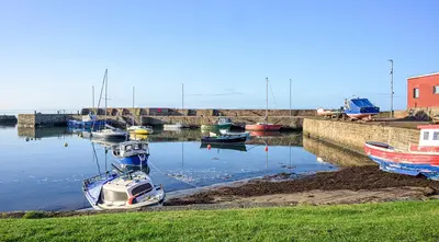
Persimmon Homes, established in 1972, is one of the UK's most successful housebuilders, with a commitment to high-quality new homes, and this investment in East Lothian is part of that track record. The Blindwells site aims to establish a thriving new community strategically positioned to balance coastal living with rapid access to the capital. The development features several distinct house types. This design is generously-proportioned and features an internal garage, a large kitchen and utility area with outside access, and a spacious lounge with French doors leading to the garden. Buyers reserving a property can utilise Persimmon’s ‘Finishing Touches’ options to select internal styling, including carpets, kitchen appliances, and external features like turf or paving. All properties benefit from modern, energy-efficient designs aimed at reducing household running costs. Transport Links: The development offers superb connectivity for commuters. The nearest rail link is Prestonpans Train Station, located approximately 1.2 miles away. Direct services run to Edinburgh Waverley, with an average journey time of just 14 minutes. Rail services run at a circa 30-minute peak-time frequency on weekdays. For car travel, Blindwells is situated around 12 miles east of Edinburgh City Centre, accessible via a circa 30-minute drive, benefiting from excellent access to the A1. The Prestonpans station also offers a free car park with 165 spaces. Local Amenities and Education: The wider Blindwells masterplan is committed to delivering a new town centre that will eventually include a health centre, gym, family pub/restaurant, cafes, and boutique shops around a central body of water named The Princes Loch. A new on-site primary school is planned for the 2024/25 school session; until then, pupils are temporarily bussed to Cockenzie Primary School, while secondary education is served by Preston Lodge High School. Existing local facilities are available in the nearby coastal town of Prestonpans, which is a half-hour stroll away, offering a Lidl supermarket, convenience stores, and a medical centre. Further shopping and restaurants are available in Tranent, just 1 mile south. Leisure options include the nearby beach, the John Muir coastal trail, and Meadowmill Sports Centre. Prospective buyers can inquire about tailored purchasing schemes offered by Persimmon Homes, such as Flexi Boost, Part Exchange, and Deposit Unlock. To obtain the most accurate plot-specific pricing, confirm current availability, or arrange an on-site viewing, it is necessary to contact the developer's on-site sales advisor directly.
- Developer
- Persimmon Homes
- City
- East Lothian
- Neighbourhood
- Prestonpans
- Postcode
- EH32 9SP
- Address
- The Earls, Blindwells, Prestonpans, East Lothian, EH32 9SP
- Tenure
- For sale
Questions about The Earls
›Who is the developer of The Earls?
The Earls is a Persimmon Homes development in Prestonpans, East Lothian. Persimmon Homes has 229 developments listed on Homello.
Location
The Earls, Blindwells, Prestonpans, East Lothian, EH32 9SP
Nearest stations
- Prestonpans Station 1.2 milesScotRail
- Longniddry Station 2.6 milesScotRail
- Wallyford Station 2.9 milesScotRail
- Musselburgh Station 5.2 milesScotRail
Nearest schools
- Norham St Ceolwulfs CofE Controlled Primary School 34.7 milesPrimary · ages 3–11
- Longridge Towers School 37.2 milesIndependent · ages 3–19
- Berwick St Mary's Church of England Primary School 38.0 milesPrimary · ages 2–11 Good
- Holy Trinity Church of England Primary School 38.5 milesPrimary · ages 3–11 Good
Nearest supermarkets
- Aldi Supermarket 0.9 miles
- Asda Supermarket Supermarket 0.9 miles
- The Co-operative Food Convenience store 1.0 miles
- The Co-operative Food Supermarket 1.1 miles
Eating out nearby
- Elibc 0.6 milesRestaurant or cafe
- Tranent Villa 0.8 milesTakeaway
- Thomsons Of Tranent 0.8 milesRestaurant or cafe
- The Fraser Centre Community Trust 0.8 milesRestaurant or cafe
Straight-line distances; actual routes will be longer. Stations from NaPTAN, with their lines powered by TfL Open Data; schools from the Department for Education register, with the latest Ofsted signal; supermarkets from Geolytix Retail Points; places to eat from the Food Standards Agency's register of food businesses.
Area insights
The neighbourhood around this development.
Sources: HM Land Registry price paid data, Police.uk, Historic England, ONS Census 2021, Ofcom Connected Nations, Environment Agency. Planning offices.

We have not been able to confirm current prices here recently.