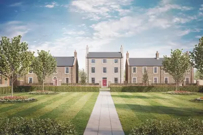
The Drive at Westburn by Bellway Homes · Off Stamfordham Road, Westerhope, Newcastle upon Tyne, Tyne and Wear NE5 1PE
Bellway Homes has 241 developments on Homello. Homes in Newcastle upon Tyne sold for a median £205,500 over the last year, £230 per sq ft; see house prices in Newcastle upon Tyne.
About The Drive at Westburn
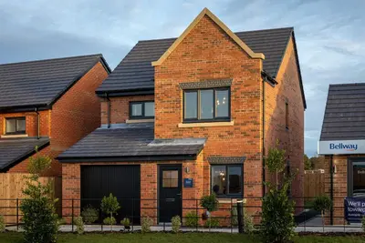
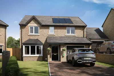
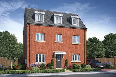
The Drive at Westburn is a new build development by Bellway Homes, located off Stamfordham Road in the suburban area of Westerhope, Newcastle upon Tyne, Tyne and Wear (NE5 1PE). This development is part of the larger Callerton Park community, a collection of new neighbourhoods planned for the western edge of the city. The site comprises a mix of 2, 3, and 4-bedroom new build homes, including both house types and bungalows, designed under Bellway’s 'Artisan Collection.'
Indicative pricing from the initial release phases positioned properties for a range of buyers. The developer, Bellway Homes, holds a consistently strong industry reputation, having achieved 5-star builder status from the Home Builders Federation (HBF) for multiple consecutive years, indicating that over 90% of customers would recommend them. The new build homes at The Drive at Westburn are designed with practical, energy-efficient living in mind. Standard features across the range include parking or a private garage for every home, and an EV charging point, addressing modern transport requirements. The properties feature turf to all front gardens, and the development incorporates a dedicated children’s play area. The house types include specific designs such as ‘The Lorimer’ (a 4-bedroom family home featuring two en-suite shower rooms) and ‘The Sawyer’ (a 3-bedroom layout including an en-suite to the main bedroom). The contemporary design focuses on open-plan living, with many properties featuring open-plan kitchen, dining, and family areas. The Westerhope location provides a balance of suburban tranquility with excellent commuter access. The development is approximately a 15-minute drive from the heart of Newcastle City Centre and is strategically positioned for easy access to major road networks, including the A1, A696, and A19. Specific public transport options include the Callerton Parkway Metro station, which is a short five-minute drive away and offers park-and-ride facilities for travel across Newcastle and the surrounding areas, including Newcastle Airport. Local bus routes also provide direct connections into the city centre. Local amenities are readily accessible. Westerhope village centre is located approximately one mile away, providing essential services such as supermarkets, pubs, and convenience stores. For leisure, the West Denton Leisure Centre is an eight-minute bike ride away, and Westerhope Golf Club is adjacent to the development site. Retail options are further enhanced by Kingston Court Retail Park, situated five miles away. The area is well-served by schools, including Milecastle Primary School (0.2 miles) and Knop Law Primary School (0.3 miles). For older pupils, Ponteland High School and Sixth Form is a five-minute drive away. All homes within the initial release of The Drive at Westburn are currently reserved. Prospective homebuyers are advised to contact the Bellway Homes North East sales office directly for the latest information on any potential new phases, future release dates, or cancellations. The developer may also be able to provide details on available properties at their nearby new build developments, such as Roman Court and Falcon Grove. The marketing suite's opening hours are typically Monday, Thursday, Friday, Saturday, and Sunday; viewing appointments are encouraged.
- Developer
- Bellway Homes
- City
- Tyne and Wear
- Neighbourhood
- Westerhope
- Postcode
- NE5 1PE
- Address
- Off Stamfordham Road, Westerhope, Newcastle upon Tyne, Tyne and Wear
- Tenure
- For sale
Sold prices at The Drive at Westburn
Since first completions in 2019, 12 homes here have resold, at a median of £185,000 (£272 per sq ft), +8% on their first-sale prices.That is 18% above the Newcastle upon Tyne median of £230 per sq ft.
| Address | Sold | Kind | Price |
|---|---|---|---|
| 112, Broadfield Meadows NE5 1PE | Jun 2026 | Resale +19% | £237,250 · £302/sq ft |
| 52, Broadfield Meadows NE5 1PE | May 2026 | Resale +11% | £235,000 · £299/sq ft |
| 94, Broadfield Meadows NE5 1PE | Dec 2025 | Resale +8% | £185,000 · £296/sq ft |
| 50, Broadfield Meadows NE5 1PE | Oct 2025 | Resale +9% | £230,000 · £293/sq ft |
| 12, Broadfield Meadows NE5 1PE | Oct 2025 | Resale +15% | £310,000 · £269/sq ft |
| 92, Broadfield Meadows NE5 1PE | Jul 2025 | Resale +8% | £185,000 · £296/sq ft |
| 96, Broadfield Meadows NE5 1PE | Jun 2025 | Resale +15% | £152,000 · £214/sq ft |
| 100, Broadfield Meadows NE5 1PE | Feb 2025 | Resale +3% | £179,000 · £287/sq ft |
All sold prices in Newcastle upon Tyne →
Sales at the development's postcode and its listings' postcodes, as recorded by HM Land Registry; neighbouring addresses in the same postcode can be included.
Questions about The Drive at Westburn
›Who is the developer of The Drive at Westburn?
The Drive at Westburn is a Bellway Homes development in Westerhope, Tyne and Wear. Bellway Homes has 241 developments listed on Homello.
›How much do homes at The Drive at Westburn cost?
The developer has not published current prices. Homes here first sold at a median of £249,995 according to HM Land Registry.
›What have homes at The Drive at Westburn sold for?
12 homes at The Drive at Westburn have been resold since first completions in 2019, at a median of £185,000 (£272 per square foot), up 8% on what they first sold for. That is 18% above the Newcastle upon Tyne median of £230 per square foot.
›What are house prices like in Newcastle upon Tyne?
The median sold price in Newcastle upon Tyne was £205,500 over the last 12 months (4,494 sales, −2.1% on the year before), or £230 per square foot, from HM Land Registry data. The house prices in Newcastle upon Tyne page has the trend, prices by property type and every street.
Location
Off Stamfordham Road, Westerhope, Newcastle upon Tyne, Tyne and Wear, NE5 1PE
Nearest stations
- Bank Foot Station 1.4 milesTyne and Wear Metro
- Callerton Parkway Station 1.6 milesTyne and Wear Metro
- Kingston Park Station 1.9 milesTyne and Wear Metro
- Newcastle Airport Station 2.1 milesTyne and Wear Metro
Nearest schools
- Westerhope Primary School 0.5 milesPrimary · ages 3–11
- Callerton Academy 0.6 milesSecondary · ages 11–16
- Simonside Primary School 0.6 milesPrimary · ages 3–11 Good
- Milecastle Primary School 0.6 milesPrimary · ages 4–11 Good
Nearest supermarkets
- The Co-operative Food Convenience store 0.1 miles
- Tesco Express Convenience store 0.8 miles
- Heron Convenience store 0.8 miles
- Heron Convenience store 0.9 miles
Eating out nearby
- The Wicker Chair Coffee House And Bistro 0.5 milesRestaurant or cafe
- Hillheads chippy 0.6 milesTakeaway
- King Chef 0.6 milesRestaurant or cafe
- Thompsons Deli 0.6 milesRestaurant or cafe
Straight-line distances; actual routes will be longer. Stations from NaPTAN, with their lines powered by TfL Open Data; schools from the Department for Education register, with the latest Ofsted signal; supermarkets from Geolytix Retail Points; places to eat from the Food Standards Agency's register of food businesses.
Area insights
The Newcastle upon Tyne neighbourhood around this development.
Sources: HM Land Registry price paid data, Police.uk, Historic England, ONS Census 2021, Ofcom Connected Nations, Environment Agency. Planning offices.

We have not been able to confirm current prices here recently.