The Copse by Leaf Living · London Road, Peterborough, Cambridgeshire PE2 7JU
Completed
Leaf Living has 2 developments on Homello. Homes in Peterborough sold for a median £255,000 over the last year, £270 per sq ft; see house prices in Peterborough.
About The Copse
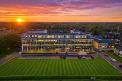
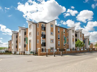
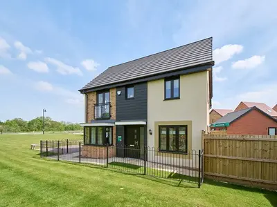
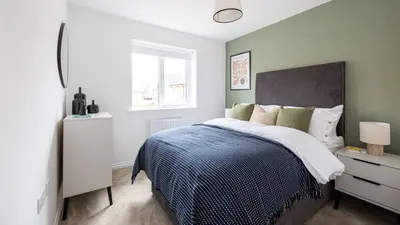
The Copse is Leaf Living’s rental neighbourhood on London Road in Peterborough, previously marketed through the operator’s Orton Copse web address. The advertised home range includes two-, three- and four-bedroom houses, combining traditional architectural styling with modern interiors. The location offers access to Peterborough’s shops, leisure facilities and railway station, with the River Nene and surrounding green spaces providing outdoor options.
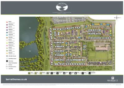
The scheme-specific feature list includes private gardens, allocated parking and pet-friendly homes. Broadband is included in the advertised offer, with the exact package and terms to be confirmed when enquiring. The operator provides viewing and availability information through the current community page. The layout, parking space, garden and individual home specification should be checked against the selected property.
- Developer
- Leaf Living
- City
- Cambridgeshire
- Neighbourhood
- Peterborough
- Postcode
- PE2 7JU
- Address
- London Road
- Tenure
- Build to rent
Facilities
- Broadband (Included; confirm package and terms)
- Garden (Private gardens)
- Parking (Allocated; confirm individual home provision)
- Pet friendly (Confirm the current pet policy)
Questions about The Copse
›Who is the developer of The Copse?
The Copse is a Leaf Living development in Peterborough, Cambridgeshire. Leaf Living has 2 developments listed on Homello.
›Are homes available to rent at The Copse?
The Copse is marked "now selling", completed. Use the enquiry button to check current availability with Leaf Living.
›What are house prices like in Peterborough?
The median sold price in Peterborough was £255,000 over the last 12 months (2,888 sales, −0.2% on the year before), or £270 per square foot, from HM Land Registry data. The house prices in Peterborough page has the trend, prices by property type and every street.
Location
London Road, PE2 7JU
Nearest stations
- Peterborough Station 1.6 milesCrossCountry, East Midlands, Grand Central, Greater Anglia, Great Northern, Hull Trains, LNER, Lumo, Thameslink
Nearest schools
- St Botolph's Church of England Primary School 0.5 milesPrimary · ages 4–11
- Leighton Primary and Preschool 0.5 milesPrimary · ages 2–11 Good
- Nene Park Academy 0.7 milesSecondary · ages 11–19 Good
- Lime Academy Orton 0.7 milesages 2–19
Nearest supermarkets
- The Co-operative Food Convenience store 0.3 miles
- Spar Convenience store 0.6 miles
- Budgens Supermarket 0.7 miles
- Lidl Supermarket 0.7 miles
Eating out nearby
Within half a mile: 4 restaurants and cafes, 2 pubs and bars, 2 takeaways.
- Big Sky 0.2 milesRestaurant or cafe
- Noble Eater 0.3 milesTakeaway
- Lawrence David 0.3 milesRestaurant or cafe
- The Ramblewood Inn 0.3 milesPub or bar
Straight-line distances; actual routes will be longer. Stations from NaPTAN, with their lines powered by TfL Open Data; schools from the Department for Education register, with the latest Ofsted signal; supermarkets from Geolytix Retail Points; places to eat from the Food Standards Agency's register of food businesses.
Area insights
The Peterborough neighbourhood around this development.
Sources: HM Land Registry price paid data, Police.uk, Historic England, ONS Census 2021, Ofcom Connected Nations, Environment Agency. Planning offices.

Register for launch pricing and availability.
Details last confirmed on 21 October 2026.