Stephenson Grange, Holmewood by Lovell Homes · Chesterfield Road, Holmewood, Chesterfield, S42 5TG, Derbyshire
Lovell Homes has 47 developments on Homello. Homes in Chesterfield sold for a median £205,998 over the last year, £237 per sq ft; see house prices in Chesterfield.
About Stephenson Grange, Holmewood
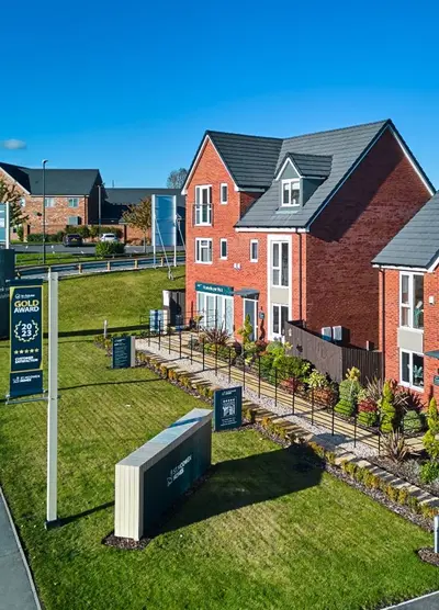
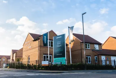
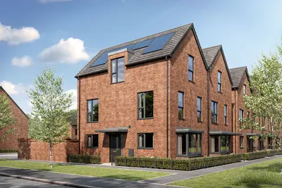
The Stephenson Grange development by Lovell Homes is a fully reserved new build community of 156 properties situated on Chesterfield Road in the village of Holmewood, Chesterfield, Derbyshire (S42 5TG). All new homes at this development are currently reserved, but the established community provides a reference point for those interested in Lovell Homes' build quality or potential resales in the area. Development Overview The development comprises a mix of 2, 3, and 4-bedroom house types, including examples such as the two-bedroom 'Fairhaven', three-bedroom 'Lansdown', and four-bedroom 'Ravensworth', which were offered for open market sale alongside affordable housing units.
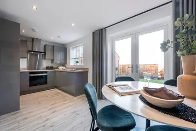
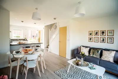
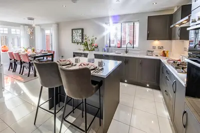
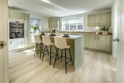
The scheme was developed as a joint venture with Together Housing Group and Lovell Partnerships, with 38 of the total 156 homes allocated for affordable rent or Shared Ownership schemes. Construction of the properties was expected to be completed by 2023. Lovell Homes, the developer, is a five-star rated housebuilder, having achieved the highest rating in the Home Builders Federation (HBF) 2021 National New Homes Customer Satisfaction Survey. Property Details The new build properties at Stephenson Grange were designed for contemporary living, featuring open-plan kitchen/dining areas, a range of integrated appliances, and modern finishes throughout. All houses were provided with two dedicated off-street parking spaces. Purchasers were given the option to personalise their homes via the 'Lovell Inspirations' range of upgrades, subject to the build stage at the time of reservation. Standard property designs focus on practical, spacious rooms with an emphasis on quality construction and energy efficiency. Location and Transport Benefits Stephenson Grange is strategically located for both local amenities and commuter access. The development is situated approximately ten minutes by car from the M1 motorway, providing direct links to the wider region via Junction 29. This junction facilitates efficient road travel to major cities, with Nottingham (approx. 22 miles) accessible in under 30 minutes drive and Sheffield (approx. 18 miles) also easily reached. The village centre of Holmewood is within walking distance of the development and provides a range of essential public amenities including a doctor's surgery, post office, library, and local shops. For rail commuters, Chesterfield Station is approximately five miles away, an eight-minute drive, and is served by direct local bus routes from the village, with a journey time of around 17 minutes. From Chesterfield, the average express train journey time to Sheffield is approximately 12–16 minutes, connecting residents to mainline services. The area benefits from natural green spaces, including the nearby Five Pits Trail, a dedicated walking and cycling path, and the Williamthorpe Ponds Nature Reserve, while the Derbyshire Peak District National Park is only a short drive away. Local schools in the vicinity include Heath Primary School and secondary education options such as Outwood Academy Newbold and Brookfield Community School. Practical Information The Stephenson Grange development is now fully completed, with all new build homes reserved. Prospective homebuyers interested in resales within the community or in other available new build homes by Lovell in the region should contact the developer directly for current availability and viewing arrangements.
- Developer
- Lovell Homes
- City
- Derbyshire
- Neighbourhood
- Chesterfield
- Postcode
- S42 5TG
- Address
- Chesterfield Road, Holmewood, Chesterfield, S42 5TG
- Tenure
- For sale
Questions about Stephenson Grange, Holmewood
›Who is the developer of Stephenson Grange, Holmewood?
Stephenson Grange, Holmewood is a Lovell Homes development in Chesterfield, Derbyshire. Lovell Homes has 47 developments listed on Homello.
›What are house prices like in Chesterfield?
The median sold price in Chesterfield was £205,998 over the last 12 months (2,474 sales, −1.9% on the year before), or £237 per square foot, from HM Land Registry data. The house prices in Chesterfield page has the trend, prices by property type and every street.
Location
Chesterfield Road, Holmewood, Chesterfield, S42 5TG
Nearest stations
- Chesterfield Station 4.1 milesCrossCountry, East Midlands, Northern
- Alfreton Station 6.2 milesEast Midlands, Northern
- Sutton Parkway Station 7.2 milesEast Midlands
- Kirkby in Ashfield Station 7.7 milesEast Midlands
Nearest schools
- Heath Primary School 0.9 milesPrimary · ages 3–11 Good
- North Wingfield Primary and Nursery Academy 1.0 milesPrimary · ages 3–11
- Temple Normanton Primary Academy 1.1 milesPrimary · ages 3–11
- Grassmoor Primary School 1.3 milesPrimary · ages 3–11 Good
Nearest supermarkets
- Tesco Express Convenience store 0.1 miles
- Spar Convenience store 0.1 miles
- The Co-operative Food PFS Convenience store 1.0 miles
- Asda Express Convenience store 1.3 miles
Eating out nearby
Within half a mile: 2 restaurants and cafes, 5 takeaways.
- Kikis Fish Bar 0.1 milesTakeaway
- Star Kebab And Fish Bar 0.2 milesTakeaway
- The Meal 0.3 milesTakeaway
- Greenland 0.4 milesTakeaway
Straight-line distances; actual routes will be longer. Stations from NaPTAN, with their lines powered by TfL Open Data; schools from the Department for Education register, with the latest Ofsted signal; supermarkets from Geolytix Retail Points; places to eat from the Food Standards Agency's register of food businesses.
Area insights
The North East Derbyshire neighbourhood around this development.
Sources: HM Land Registry price paid data, Police.uk, Historic England, ONS Census 2021, Ofcom Connected Nations, Environment Agency. Planning offices.

We have not been able to confirm current prices here recently.