St Patricks Vale by Gleeson Homes · Station Road, Aspatria, Cumbria CA7 2AJ
Completed · status unconfirmed
Gleeson Homes has 69 developments on Homello. Homes in Wigton sold for a median £193,622 over the last year, £197 per sq ft; see house prices in Wigton.
About St Patricks Vale
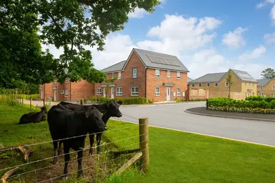
St Patricks Vale is a new build homes development by Gleeson Homes, located on Station Road in Aspatria, Cumbria (CA7 2AJ). The development focuses on providing affordable, low-cost housing options for first-time buyers, second steppers, and downsizers in the West Cumbrian area. The collection comprises 2, 3, and 4 bedroom properties on a Freehold basis.
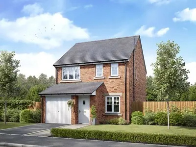
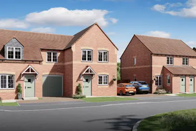
The majority of the development is now complete, with over 90% of homes sold. Currently available homes consist primarily of 3-bedroom and 4-bedroom house types. Pricing for 3-bedroom homes starts from £174,995, while 4-bedroom homes are available from £249,995. The development features several house styles, including the Tyrone (a 3-bedroom semi-detached option starting at £174,995) and the 4-bedroom Dublin detached house. A popular larger home, the 4-bedroom Blessington detached style, incorporates an integral garage, a separate utility room, and an en-suite bathroom to the main bedroom. All properties are accompanied by a full 10-year warranty, consisting of a two-year Gleeson warranty and a further eight years of insurance cover provided by NHBC. Selected new build homes on the site include tangible external features as standard, such as turf to the front and rear gardens, full 6ft timber fencing, and an external water tap. Internally, Gleeson homes are finished with standard specifications that may include Porcelanosa tiling in the family bathroom and French doors leading to the garden from the living room or kitchen-diner, depending on the house style. Homebuyers should note that as a budget-focused builder, customers often choose to budget for upgrades to elements like flooring and kitchen specifications. St Patricks Vale is situated in a highly practical location for commuters, being a short three-minute walk from Aspatria train station. This station provides regular direct rail services to Carlisle, Whitehaven, and Barrow-in-Furness. Road access is facilitated by the A596 running through the town centre, connecting the development to Workington in approximately 25 minutes and Carlisle in less than 35 minutes. Local bus routes also offer regular services to Carlisle, Workington, and Wigton. Residents benefit from Aspatria’s local amenities, with the town centre just a four-minute walk from the development. Named local services include a Co-Op, SPAR convenience store, Boots pharmacy, Post Office, doctors’ surgery, and an opticians. The location boasts scenic views of Skiddaw mountain and is only a 20-minute drive from the western fringe of the Lake District National Park. The popular Cumbrian town of Cockermouth, considered a gateway to the western Lake District, is less than a 15-minute drive away. Gleeson Homes specialises in delivering affordable housing solutions, a factor reflected in the starting price points. Potential buyers should be aware that Gleeson Homes' track record includes mixed customer feedback regarding post-completion service and initial snagging, which is common with low-cost builders. The Sales Centre and Show Homes at St Patricks Vale are open Thursday to Tuesday, 10am to 5pm, and interested parties should contact the site directly to arrange a viewing and discuss the current limited availability. Completion status and specific plot reservations should be confirmed with the Gleeson sales team.
- Developer
- Gleeson Homes
- City
- Cumbria
- Neighbourhood
- Aspatria
- Postcode
- CA7 2AJ
- Address
- Station Road, Aspatria
- Tenure
- For sale
Questions about St Patricks Vale
›Who is the developer of St Patricks Vale?
St Patricks Vale is a Gleeson Homes development in Aspatria, Cumbria. Gleeson Homes has 69 developments listed on Homello.
›How much do homes at St Patricks Vale cost?
Prices at St Patricks Vale start from around £174,995 (taken from the developer's marketing, so treat it as a guide).
›Is St Patricks Vale still selling?
St Patricks Vale is marked "now selling" (unconfirmed), completed. Use the enquiry button to check current availability with Gleeson Homes.
›What are house prices like in Wigton?
The median sold price in Wigton was £193,622 over the last 12 months (328 sales, −7.8% on the year before), or £197 per square foot, from HM Land Registry data. The house prices in Wigton page has the trend, prices by property type and every street.
Location
Station Road, Aspatria, CA7 2AJ
Nearest stations
- Aspatria Station 0.1 miles
Nearest schools
- Beacon Hill Community School 0.2 milesSecondary · ages 11–16
- Richmond Hill School 0.5 milesPrimary · ages 2–11 Good
- Plumbland CofE School 1.6 milesPrimary · ages 4–11 Good
- Oughterside Primary School 1.6 milesPrimary · ages 2–11
Straight-line distances; actual routes will be longer. Stations from NaPTAN; schools from the Department for Education register, with the latest Ofsted signal.
Area insights
The Allerdale neighbourhood around this development.
Sources: HM Land Registry price paid data, EPC register, Police.uk, Historic England, ONS Census 2021, Ofcom Connected Nations, Environment Agency. Planning offices.
Register for launch pricing and availability.