St Michaels Way by Persimmon Homes · St Michaels Way, A1018, South Ryhope, Sunderland, Tyne and Wear SR2 0GW
Persimmon Homes has 167 developments on Homello. Homes in Sunderland sold for a median £155,000 over the last year, £177 per sq ft; see house prices in Sunderland.
About St Michaels Way
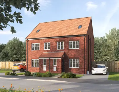
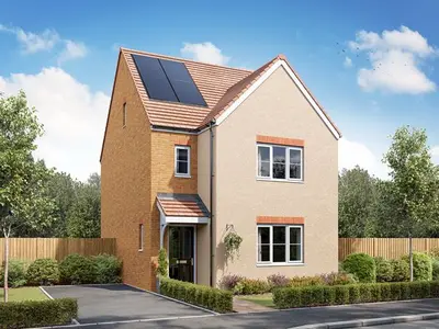
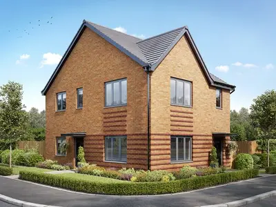
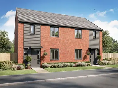
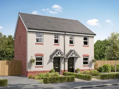
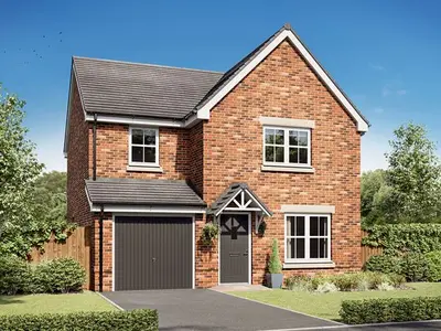
St Michaels Way is a new build homes development by national housebuilder Persimmon Homes, located just off the A1018 in South Ryhope, Sunderland, Tyne and Wear (SR2 0GW). This established development offers a range of two, three, four, and five-bedroom homes designed to cater to various buyer profiles, from first-time homeowners to growing families looking to upsize. The site is situated approximately four miles south of Sunderland city centre, bordering the Durham Heritage Coastline.
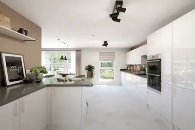
Current prices for available properties at St Michaels Way start from £194,995. Persimmon Homes, the developer, focuses on delivering traditional family housing at affordable price points, prioritising value and quality for homebuyers. St Michaels Way features a variety of house styles, including detached and semi-detached properties. Current availability includes the three-bedroom semi-detached house type, ‘The Barton’, with plots recently priced at £209,995, and the four-bedroom detached style, ‘The Hornsea’, with plots available for £284,995. Typical features found in the larger homes include an open-plan kitchen/dining area, a separate living room, a utility room, a downstairs WC, and storage cupboards. The main bedroom (Bedroom 1) in some house types is fitted with an en-suite facility. Many of the homes are offered on a Freehold basis, though buyers should confirm the tenure of their chosen plot. St Michaels Way is positioned to balance village tranquillity with convenient access to urban hubs and coastal amenities. The development is designed to be family-friendly, featuring two dedicated play parks on-site and surrounded by green space. For essential amenities, a well-stocked Asda supermarket is less than a five-minute drive away, with an Iceland, local convenience stores, and eateries also available within Ryhope village. Reputable local schools are a key feature of the area, making it attractive to families. Transport links are strong, with the site being located on the A1018. The village is approximately 3.2 miles from Sunderland and 1.8 miles from the town of Seaham. Regular bus services, such as the Go North East route, connect Ryhope to Sunderland city centre in approximately 12 minutes, with services running frequently. For rail travel, Sunderland’s mainline station provides access to the Tyne & Wear Metro system. Journeys from Sunderland to Newcastle city centre take just over 20 minutes by train, and Newcastle International Airport is reachable in approximately 30 minutes by car or about an hour via the Metro. The development is also within walking distance of Seaham Hall Beach, providing direct access to the local coastline. New build homes at St Michaels Way are currently priced from £194,995. The developer, Persimmon Homes, offers a range of financial assistance schemes on selected plots, which may include the Own New Rate Reducer Scheme, Part Exchange, Home Change, Deposit Unlock, and discounts for Key Workers, NHS staff, and the Armed Forces. Interested parties are strongly advised to contact the Persimmon Homes St Michaels Way sales office directly for the latest availability, plot-specific pricing, completion status, and to discuss eligibility for any of the available purchasing schemes. Viewing arrangements should be made via the developer.
- Developer
- Persimmon Homes
- City
- Tyne and Wear
- Neighbourhood
- South Ryhope
- Postcode
- SR2 0GW
- Address
- St Michaels Way, A1018, South Ryhope, Sunderland, Tyne and Wear
- Tenure
- For sale
New homes from Persimmon Homes
Questions about St Michaels Way
›Who is the developer of St Michaels Way?
St Michaels Way is a Persimmon Homes development in South Ryhope, Tyne and Wear. Persimmon Homes has 167 developments listed on Homello.
›How much do homes at St Michaels Way cost?
Prices at St Michaels Way start from £284,995.
›Is St Michaels Way still selling?
St Michaels Way is marked "now selling". Use the enquiry button to check current availability with Persimmon Homes.
›What are house prices like in Sunderland?
The median sold price in Sunderland was £155,000 over the last 12 months (1,777 sales, −3.7% on the year before), or £177 per square foot, from HM Land Registry data. The house prices in Sunderland page has the trend, prices by property type and every street.
Location
St Michaels Way, A1018, South Ryhope, Sunderland, Tyne and Wear, SR2 0GW
Nearest stations
- Seaham Station 1.6 miles
- Park Lane (Tyne and Wear Metro Station) Station 3.0 miles
- Sunderland Station 3.2 miles
- University (Tyne and Wear Metro Station) Station 3.2 miles
Nearest schools
- St Paul's CofE Primary School 0.6 milesPrimary · ages 3–11
- St Patrick's Catholic Primary School, Ryhope 0.7 milesPrimary · ages 4–11
- Ryhope Junior School 1.0 milesPrimary · ages 7–11 Expected standard
- Ryhope Infant School Academy 1.0 milesPrimary · ages 2–7 Good
Straight-line distances; actual routes will be longer. Stations from NaPTAN; schools from the Department for Education register, with the latest Ofsted signal.
Area insights
The Sunderland neighbourhood around this development.
Sources: HM Land Registry price paid data, EPC register, Police.uk, Historic England, ONS Census 2021, Ofcom Connected Nations, Environment Agency. Planning offices.
6 live listings at this development