Sonnet Park by Persimmon Homes · Sonnet Park, Banbury Road, Stratford-upon-Avon, Warwickshire, CV37 7GY
status unconfirmed
Persimmon Homes has 229 developments on Homello. Homes in Stratford-upon-Avon sold for a median £375,000 over the last year, £364 per sq ft; see house prices in Stratford-upon-Avon.
About Sonnet Park
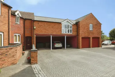
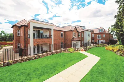
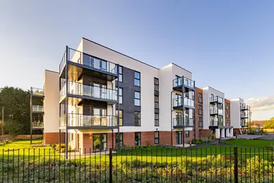
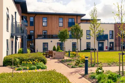
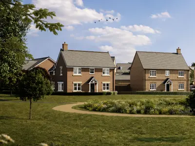
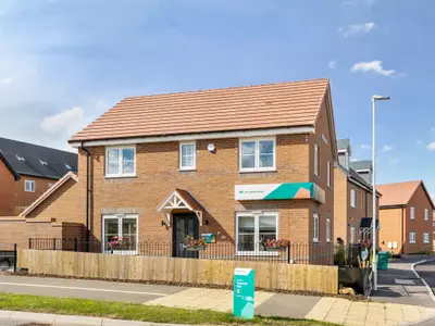
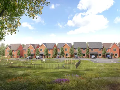
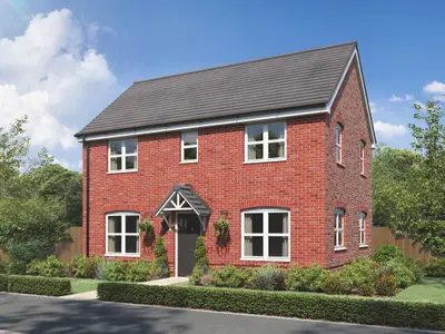
Development Overview Sonnet Park is a new build development by Persimmon Homes, located on Banbury Road just under two miles from the historic centre of Stratford-upon-Avon, Warwickshire. The development is designed to provide a mix of two, three, and four-bedroom new build homes, comprising detached, semi-detached, and three-storey townhouse styles. The site borders open countryside while maintaining easy access to key town amenities.
Persimmon Homes currently holds a 5-star rating from the Home Builder’s Federation (HBF), meaning over 90% of their customers would recommend them to a friend. However, prospective buyers should conduct independent research, as general third-party reviews of the developer's build quality and aftercare across their wider portfolio are mixed. The homes benefit from a 10-year NHBC warranty. Property Details Properties available at Sonnet Park feature modern layouts and specifications designed for contemporary living. Recent sales have provided a concrete pricing context for the development. The three-bedroom 'Barnwood' house type includes an open-plan kitchen/diner, a separate utility room, a downstairs WC, and a dual-aspect living room with French doors leading to the garden. Many three-bedroom styles, such as 'The Danbury', and the four-bedroom 'The Whinfell' townhouse, incorporate a main bedroom with an en suite bathroom. Smaller two-bedroom homes, such as the 'Alnmouth' which was recently sold in September 2024, are suited for first-time buyers and feature an open-plan kitchen/living area and two allocated parking spaces. 05. Location and Transport Sonnet Park offers direct local connectivity with a bus stop situated immediately outside the development. Stratford-upon-Avon train station is approximately 2.8 miles away, operating regular rail services to major regional hubs, including Warwick and Birmingham. Road links provide practical journey times by car, including Wellesbourne (13 minutes), Warwick (20 minutes), Redditch (35 minutes), and Birmingham (48 minutes). Local amenities are easily accessible, with a Co-op Food (0.9 miles), Tesco Express (1.2 miles), Waitrose (1.5 miles), and a larger Tesco Superstore (2.7 miles) all nearby. The town centre, offering the Royal Shakespeare Theatre and a variety of independent shops and dining options, is only a 7-minute drive away. Local schooling options include Bridge Town Primary School, Alveston C of E Primary School, King Edward VI Grammar School, and Stratford Girls Grammar School. On-site contributions to the development include a new play area and a footpath/cycleway. Practical Information As of late 2024, the Sonnet Park new build development is in its final phases and is currently listed as largely sold out by the developer. Prospective homebuyers should contact Persimmon Homes directly to inquire about any potential late-stage releases, cancellations, or resales. Viewing availability and the specific completion status of individual plots, as well as details regarding any part-exchange schemes, should be confirmed with the development's sales team.
- Developer
- Persimmon Homes
- City
- Warwickshire
- Neighbourhood
- Stratford-upon-Avon
- Postcode
- CV37 7GY
- Address
- Sonnet Park, Banbury Road, Stratford-upon-Avon, Warwickshire, CV37 7GY
- Tenure
- For sale
Questions about Sonnet Park
›Who is the developer of Sonnet Park?
Sonnet Park is a Persimmon Homes development in Stratford-upon-Avon, Warwickshire. Persimmon Homes has 229 developments listed on Homello.
›Can I still buy a home at Sonnet Park?
Sonnet Park is sold out, and Persimmon Homes is no longer marketing homes there.
›What are house prices like in Stratford-upon-Avon?
The median sold price in Stratford-upon-Avon was £375,000 over the last 12 months (799 sales, −2.6% on the year before), or £364 per square foot, from HM Land Registry data. The house prices in Stratford-upon-Avon page has the trend, prices by property type and every street.
Location
Sonnet Park, Banbury Road, Stratford-upon-Avon, Warwickshire, CV37 7GY
Nearest stations
- Stratford-upon-Avon Station 2.1 milesChiltern, West Midlands
- Stratford-upon-Avon Parkway Station 3.2 milesChiltern, West Midlands
- Wilmcote Station 4.7 milesChiltern, West Midlands
- Bearley Station 5.7 milesChiltern, West Midlands
Nearest schools
- Bridgetown Primary School 1.0 milesPrimary · ages 4–11
- The Croft Preparatory School 1.2 milesIndependent · ages 2–11
- Alveston CofE Primary School 1.4 milesPrimary · ages 4–11 Good
- King Edward VI School 1.6 milesSecondary · ages 11–18
Nearest supermarkets
- The Co-operative Food Convenience store 0.6 miles
- Waitrose Large supermarket 0.9 miles
- Tesco Express Convenience store 1.1 miles
- Little Waitrose Shell Convenience store 1.3 miles
Eating out nearby
Within half a mile: 1 restaurant or cafe.
- Warwickshire Golf Sim <0.1 milesRestaurant or cafe
- Costa Coffee 1.0 milesRestaurant or cafe
- The Old Tramway 1.2 milesPub or bar
- Good With Custard 1.3 milesTakeaway
Straight-line distances; actual routes will be longer. Stations from NaPTAN, with their lines powered by TfL Open Data; schools from the Department for Education register, with the latest Ofsted signal; supermarkets from Geolytix Retail Points; places to eat from the Food Standards Agency's register of food businesses.
Area insights
The Stratford-on-Avon neighbourhood around this development.
Sources: HM Land Registry price paid data, Police.uk, Historic England, ONS Census 2021, Ofcom Connected Nations, Environment Agency. Planning offices.

Resales appear under "On the market now" when listed; sold prices below.