Sibbalds Wynd by Taylor Wimpey · Sibbalds Brae, Bathgate, West Lothian EH48 2DU
Taylor Wimpey has 252 developments on Homello.
About Sibbalds Wynd
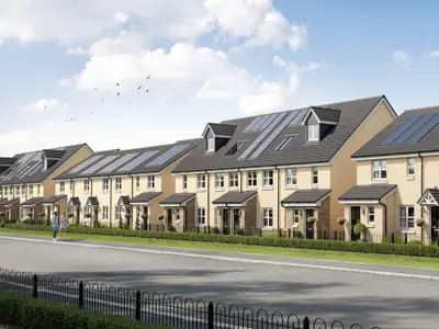
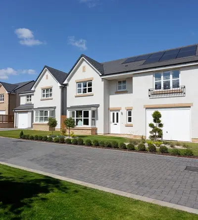
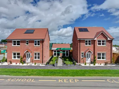
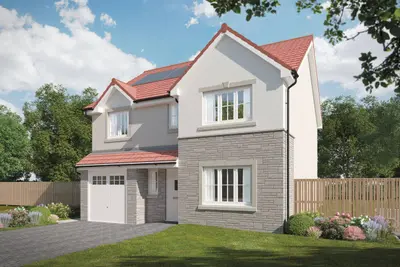
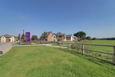
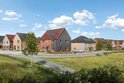
Sibbalds Wynd is a new build homes development by Taylor Wimpey East Scotland, located at Sibbalds Brae in Bathgate, West Lothian (EH48 2DU). The scheme is designed to integrate with the existing local area, providing a total of 189 high-quality residences, which includes 29 designated affordable homes. The development offers a diverse range of 2, 3, 4, and 5 bedroom properties, catering to first-time buyers, growing families, and downsizers.
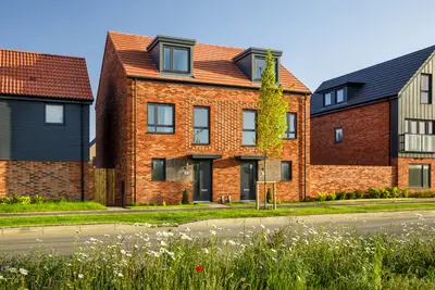
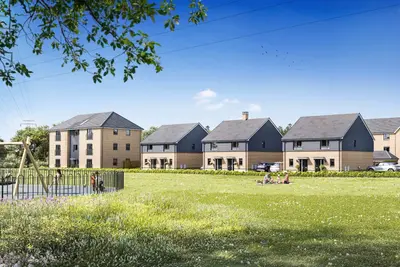
The developer, Taylor Wimpey, is one of the UK’s largest housebuilders, holding a 5-star customer satisfaction rating from the Home Builders Federation, indicating that 9 out of 10 customers would recommend them. Available new build homes include various styles such as semi-detached, end-terrace, and detached houses. Specific available house types include the 3-bedroom semi-detached 'The Baxter' (approx. 818 sq ft) and 'The Boswell' (approx. 859 sq ft), as well as the 4-bedroom detached 'The Drummond' (approx. 1,205 sq ft) and 'The Fraser' (approx. 1,271 sq ft). Current show homes, including the 'Chalmers' (3-bed) and 'Hume' (4-bed) types, are open for viewings. The design focuses on flexible layouts for modern lifestyles, with features like open-plan kitchen/diners in models such as 'The Blair'. In line with modern sustainability requirements, all homes include energy-efficient features, such as PV panels and EV charging capability, aiming to reduce running costs. Sibbalds Wynd benefits from its location on the edge of Bathgate, offering excellent connectivity. Commuters are well-served by nearby Bathgate train station, which provides frequent ScotRail services. The direct train journey to Edinburgh Waverley is approximately 25 to 27 minutes. Road links are also convenient, with easy access to the M8 motorway for travel to both Edinburgh and Glasgow. Specific local transport infrastructure includes new bus stops planned on Sibbalds Brae, serving local routes such as the 21, X18, 29, and 5. Local amenities are readily accessible, with a retail park nearby housing major stores including Lidl, Aldi, Home Bargains, B&M, and Argos, in addition to Morrisons (approx. 1.1mi) and a Tesco Superstore (approx. 2.2mi). The immediate area provides green space, with 10 acres of open space within the development itself, alongside cycle and pedestrian links, and proximity to the Little Boghead Nature Park. Local schooling is supported by Windyknowe Primary School (approx. 0.1mi) and Bathgate Academy (approx. 2.3mi). Taylor Wimpey offers incentives on selected plots, which may include contributions to deposit, flooring, or appliance packages. The developer also operates purchasing schemes such as Easymover, Part Exchange, and an Armed Forces Discount. Prospective homebuyers are advised to contact Taylor Wimpey's Sales Executive directly for the most current pricing on two-bedroom and five-bedroom house types, specific plot specifications, and to arrange a viewing appointment for the show homes.
- Developer
- Taylor Wimpey
- City
- West Lothian
- Neighbourhood
- Bathgate
- Postcode
- EH48 2DU
- Address
- Sibbalds Brae, Bathgate, West Lothian
- Total homes
- 189
- Tenure
- For sale
Questions about Sibbalds Wynd
›Who is the developer of Sibbalds Wynd?
Sibbalds Wynd is a Taylor Wimpey development in Bathgate, West Lothian. Taylor Wimpey has 252 developments listed on Homello.
›What type of homes are at Sibbalds Wynd?
Sibbalds Wynd offers houses, 189 homes in total. Homes are sold outright by Taylor Wimpey.
Location
Sibbalds Brae, Bathgate, West Lothian, EH48 2DU
Nearest stations
- Bathgate Station 1.2 milesScotRail
- Armadale Station 1.4 milesScotRail
- Blackridge Station 3.4 milesScotRail
- Addiewell Station 4.4 milesScotRail
Nearest schools
- Longtown Primary School 67.2 milesPrimary · ages 3–11
- Bowness-on-Solway Primary School 67.7 milesPrimary · ages 3–11
- Shankhill CofE Primary School 68.0 milesPrimary · ages 3–11 Good
- Fir Ends Primary School 70.7 milesPrimary · ages 3–11
Nearest supermarkets
- The Co-operative Food Convenience store 0.7 miles
- Aldi Supermarket 0.8 miles
- Morrisons Superstore 0.9 miles
- Iceland Supermarket 0.9 miles
Eating out nearby
Within half a mile: 1 restaurant or cafe.
- Armadale Speedway Hospitality / Tea BAr 0.5 milesRestaurant or cafe
- Vim & Vigour 0.6 milesRestaurant or cafe
- Gerry's Takeaway Fish & Chicken Bar Pizzeria 0.8 milesTakeaway
- Leisureland Cafe 0.8 milesRestaurant or cafe
Straight-line distances; actual routes will be longer. Stations from NaPTAN, with their lines powered by TfL Open Data; schools from the Department for Education register, with the latest Ofsted signal; supermarkets from Geolytix Retail Points; places to eat from the Food Standards Agency's register of food businesses.
Area insights
The neighbourhood around this development.
Sources: HM Land Registry price paid data, Police.uk, Historic England, ONS Census 2021, Ofcom Connected Nations, Environment Agency. Planning offices.

We have not been able to confirm current prices here recently.
Checked on the Taylor Wimpey website on 28 October 2026.