Seely Fields by Avant Homes · Birchwood Lane, Somercotes, Derbyshire DE55 4NF
status unconfirmed
Avant Homes has 63 developments on Homello. Homes in Alfreton sold for a median £195,000 over the last year, £226 per sq ft; see house prices in Alfreton.
About Seely Fields
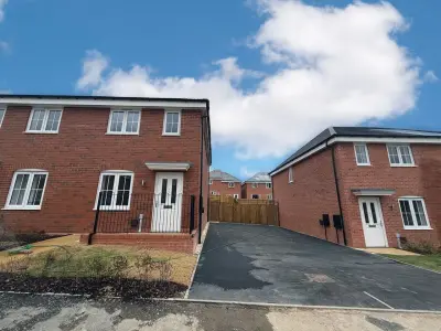
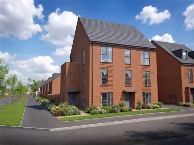
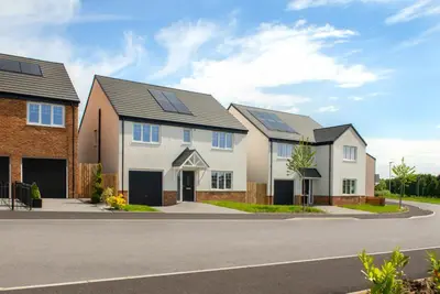
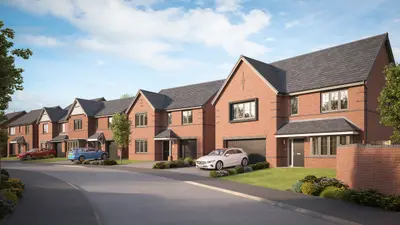
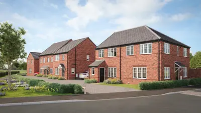
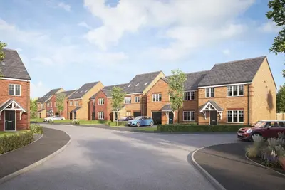
Seely Fields is a new build development by Avant Homes East Midlands, located on Birchwood Lane, Somercotes, Derbyshire, DE55 4NF. The community comprises 16 different house types from the developer's energy-efficient range, offering a mix of terraced, semi-detached, and detached new build homes. Eligible buyers may be able to access Discount Market Sale (DMS) homes, offering a 20% reduction on the market value price.
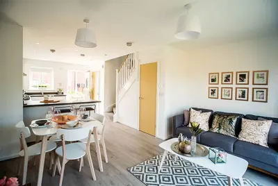
Avant Homes, the developer, has previously achieved a 5-star rating in the Home Builders Federation's (HBF) customer satisfaction survey. However, prospective buyers should note that recent HBF data (July 2023) has indicated a drop to a three-star customer satisfaction rating, with scores below the industry average. Customer feedback often praises the architectural design, while sometimes noting issues with snagging and post-completion customer service. The development features two- to five-bedroom houses, including the three-bedroom semi-detached Baildon and the four-bedroom detached Horbury showhome. The larger, five-bedroom Thornton model is highlighted for its adaptable layout. Standard features in many house types include an open-plan kitchen and dining area with integrated appliances, classic French doors leading to the rear garden, and a separate lounge. The four-bedroom Horbury showhome, currently available for viewing, demonstrates the layout, which incorporates a large living room, a flexible snug ideal for a study or playroom, and a utility room on the ground floor. All principal bedrooms typically benefit from an en-suite shower room. Seely Fields is situated in Somercotes, a village that offers convenient access to major towns and transport links. Alfreton town centre is a quick 6-minute drive away. For rail commuters, Alfreton train station is an 8-minute drive from the development, providing regular train services to Nottingham, Leeds, and Liverpool. A local Stagecoach East Midlands 152 bus route runs hourly outside the development, connecting to Alfreton and Swanwick. Major road networks provide access to Derby and Nottingham. Local amenities include the Somercotes Medical Centre, located approximately 0.7 miles away. Retail options are available at the Designer Outlet East Midlands, which is a 10-minute drive from the site. For leisure, Alfreton Park is accessible nearby, and two golf courses, Alfreton Golf Course and Ormonde Fields Golf Club, are within a 9 to 13-minute drive. Primary and Infant education is provided locally by Somercotes Infant & Nursery School and Somerlea Park Junior School, both less than a 10-minute walk away. Secondary schools, including David Nieper Academy, are within a 5-mile radius. The marketing suite and showhomes are open for prospective buyers to visit. For current property availability, specific plot prices, incentives such as My Move Made Easy, and details on the Discount Market Sale scheme, interested parties should contact the Avant Homes sales team directly.
- Developer
- Avant Homes
- City
- Derbyshire
- Neighbourhood
- Somercotes
- Postcode
- DE55 4NF
- Address
- Birchwood Lane, Somercotes, Derbyshire
- Tenure
- For sale
Questions about Seely Fields
›Who is the developer of Seely Fields?
Seely Fields is an Avant Homes development in Somercotes, Derbyshire. Avant Homes has 63 developments listed on Homello.
›Is Seely Fields still selling?
Seely Fields is marked "now selling" (unconfirmed). Use the enquiry button to check current availability with Avant Homes.
›What are house prices like in Alfreton?
The median sold price in Alfreton was £195,000 over the last 12 months (718 sales, −4.9% on the year before), or £226 per square foot, from HM Land Registry data. The house prices in Alfreton page has the trend, prices by property type and every street.
Location
Birchwood Lane, Somercotes, Derbyshire, DE55 4NF
Nearest stations
- Alfreton Station 1.4 milesEast Midlands, Northern
- Kirkby in Ashfield Station 4.4 milesEast Midlands
- Langley Mill Station 4.5 milesEast Midlands, Northern
- Sutton Parkway Station 5.1 milesEast Midlands
Nearest schools
- Somercotes Infant and Nursery School 0.6 milesPrimary · ages 3–7
- Somerlea Park Junior School 0.6 milesPrimary · ages 7–11 Expected standard
- Riddings Junior School 0.9 milesPrimary · ages 7–11
- Riddings Infant and Nursery School 0.9 milesPrimary · ages 3–7
Nearest supermarkets
- The Co-operative Food Convenience store 0.6 miles
- Iceland Supermarket 0.9 miles
- Aldi Supermarket 0.9 miles
- The Co-operative Food Convenience store 0.9 miles
Eating out nearby
Within half a mile: 1 pub or bar.
- Old English Gentleman 0.5 milesPub or bar
- Mayflower 0.5 milesTakeaway
- Devonshire Arms 0.5 milesPub or bar
- The Curry Lounge 0.6 milesRestaurant or cafe
Straight-line distances; actual routes will be longer. Stations from NaPTAN, with their lines powered by TfL Open Data; schools from the Department for Education register, with the latest Ofsted signal; supermarkets from Geolytix Retail Points; places to eat from the Food Standards Agency's register of food businesses.
Area insights
The Amber Valley neighbourhood around this development.
Sources: HM Land Registry price paid data, Police.uk, Historic England, ONS Census 2021, Ofcom Connected Nations, Environment Agency. Planning offices.

We have not been able to confirm current prices here recently.
Checked on the Avant Homes website on 28 October 2026.