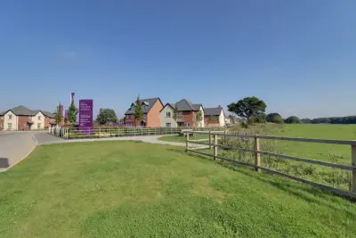
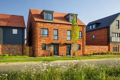
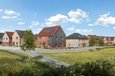
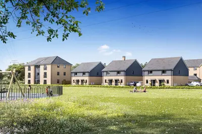
Regis Park by Taylor Wimpey · Sefter Road, Pagham, Bognor Regis, West Sussex, PO21 3EE
Under construction
Taylor Wimpey has 252 developments on Homello. Homes in Bognor Regis sold for a median £320,000 over the last year, £352 per sq ft; see house prices in Bognor Regis.
About Regis Park
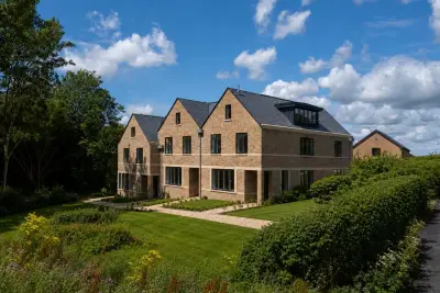
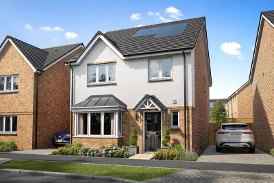
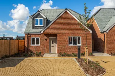
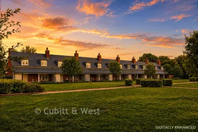
Regis Park is a new build homes development by Taylor Wimpey Southern Counties, located off Sefter Road in the coastal village of Pagham, West Sussex, PO21 3EE. The development, which is currently under construction with available 'ready-to-go-homes,' will ultimately comprise 250 new residences, offering a mix of 1, 2, 3, and 4 bedroom properties, including apartments and various house styles. Taylor Wimpey, the developer, holds a current Five-Star Home Builders Federation (HBF) rating, with 96% of customers surveyed in 2024 stating they would recommend the builder to a friend.
The development features a variety of house types designed for different buyer profiles. All new build properties at Regis Park come with a 10-Year NHBC Warranty for long-term assurance. A strong focus on sustainability includes features such as PV panels, waste water heat recovery, and triple glazing, alongside provision for Electric Vehicle (EV) charging points on selected homes, which contributes to potentially lower running costs. Regis Park is situated approximately two miles west of Bognor Regis and four miles from the historic city of Chichester, providing a balance of coastal living and market town access. Local amenities in Pagham village are extensive, including a pharmacy, post office, convenience stores, pubs, cafes, and a dental surgery, all within easy reach. The location benefits from excellent access to green and coastal spaces, being within walking distance of Pagham Beach and the Pagham Harbour nature reserve. For families, the development is positioned near Rose Green Infant School (0.3 miles) and Rose Green Junior School (0.2 miles). Transport links are facilitated by nearby bus stops on Hook Lane and Rose Green Road, with the Number 600 route connecting Elmer, Bognor Regis, and Chichester, and the Number 62 servicing Bognor Regis Railway Station. Bognor Regis Railway Station is approximately 4.8km away (18-minute cycle) and offers regular Southern Rail services, including a fastest direct journey time to London Victoria of 1 hour 40 minutes. The development itself includes public open spaces, a dedicated children's play area, and a new Scout hut. 32. Viewing appointments can be made by contacting the Taylor Wimpey Southern Counties sales team for the latest availability and plot-specific features.
- Developer
- Taylor Wimpey
- City
- West Sussex
- Neighbourhood
- Bognor Regis
- Postcode
- PO21 3EE
- Address
- Sefter Road, Pagham, Bognor Regis, West Sussex, PO21 3EE
- Total homes
- 9
- Tenure
- For sale
Questions about Regis Park
›Who is the developer of Regis Park?
Regis Park is a Taylor Wimpey development in Bognor Regis, West Sussex. Taylor Wimpey has 252 developments listed on Homello.
›Is Regis Park still selling?
Regis Park: under construction. Use the enquiry button to check current availability with Taylor Wimpey.
›What are house prices like in Bognor Regis?
The median sold price in Bognor Regis was £320,000 over the last 12 months (1,064 sales, −1.5% on the year before), or £352 per square foot, from HM Land Registry data. The house prices in Bognor Regis page has the trend, prices by property type and every street.
›What type of homes are at Regis Park?
Regis Park offers houses and apartments, 9 homes in total. Homes are sold outright by Taylor Wimpey.
Location
Sefter Road, Pagham, Bognor Regis, West Sussex, PO21 3EE
Nearest stations
- Bognor Regis Station 2.2 milesSouthern
- Chichester Station 4.0 milesSouthern
- Barnham Station 4.8 milesSouthern
- Fishbourne Station 5.3 milesSouthern
Nearest schools
- Rose Green Junior School 0.2 milesPrimary · ages 7–11 Good
- Rose Green Infant School 0.3 milesPrimary · ages 4–7 Good
- Nyewood CofE Junior School 1.4 milesPrimary · ages 7–11 Good
- Nyewood CofE Infant School 1.4 milesPrimary · ages 5–7 Good
Nearest supermarkets
- The Co-operative Food Convenience store 0.3 miles
- The Co-operative Food Convenience store 0.4 miles
- Tesco Express Convenience store 0.6 miles
- The Co-operative Food Convenience store 1.3 miles
Eating out nearby
Within half a mile: 3 restaurants and cafes, 2 takeaways.
- Rose Green Fryer 0.2 milesTakeaway
- Apple Tree Lounge 0.4 milesRestaurant or cafe
- China garden 0.5 milesTakeaway
- Chatterbox Café 0.5 milesRestaurant or cafe
Straight-line distances; actual routes will be longer. Stations from NaPTAN, with their lines powered by TfL Open Data; schools from the Department for Education register, with the latest Ofsted signal; supermarkets from Geolytix Retail Points; places to eat from the Food Standards Agency's register of food businesses.
Area insights
The Arun neighbourhood around this development.
Sources: HM Land Registry price paid data, Police.uk, Historic England, ONS Census 2021, Ofcom Connected Nations, Environment Agency. Planning offices.

We have not been able to confirm current prices here recently.
Checked on the Taylor Wimpey website on 28 October 2026.