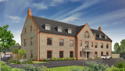
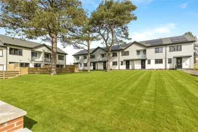
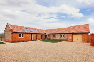
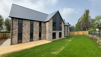
Prince's Park by Charles Church · Prince's Park, Salhouse Road, Rackheath, Norwich, Norfolk NR13 6PG
Charles Church has 80 developments on Homello. Homes in Norwich sold for a median £285,000 over the last year, £305 per sq ft; see house prices in Norwich.
About Prince's Park
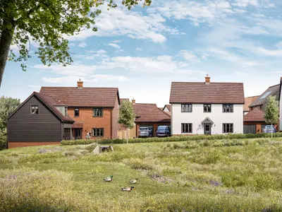
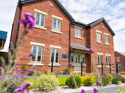
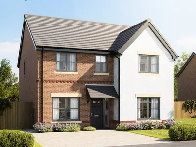
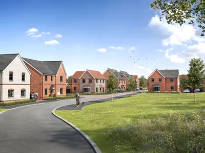
Prince's Park is a new build homes development by Charles Church, the premium brand of Persimmon plc, situated in the semi-rural but well-connected location of Rackheath, Norwich, Norfolk (NR13 6PG). The development is now in its final phase, advertised as a ‘LAST CHANCE TO BUY’, with availability focused on executive-style detached family houses. The final phase of the Prince’s Park development consists predominantly of five-bedroom new build homes.
This specific house type is a substantial family residence featuring an integral double garage and three bathrooms. The ground floor layout includes a spacious, dual-aspect living room with French doors to the garden, and a separate L-shaped kitchen/dining/family room, also with French doors. Practical elements include a dedicated study and a separate utility room with direct access to the garage. Upstairs, the master bedroom benefits from a private en-suite bathroom, while a ‘Jack and Jill’ en-suite serves bedrooms two and three, leaving a family bathroom for the remaining two bedrooms. All properties at Prince's Park come with a 10-year new build warranty. While Charles Church operates as the premium brand of its parent company and often advertises a 5-star HBF rating, prospective buyers are advised to conduct due diligence, as with any major purchase, and to confirm specific build specifications and customer service records for this local site. Prince's Park is situated in New Rackheath, less than five miles from the historic and commercial centre of Norwich, which is reachable in approximately a 10-minute drive via the A1151. Essential local amenities, including a convenience store, pharmacy, and post office, are within a short walking distance of the site. Larger supermarkets like Lidl and Tesco Extra are also easily accessible, located approximately three miles away. The location is excellent for commuters and families seeking a balance between country life and city convenience. Transport Links: The nearest rail link is Salhouse station, only 1.6 miles away, offering regular Greater Anglia services with a direct journey time of just 12-13 minutes into Norwich. The Konectbus City5 route provides public transport directly from Rackheath to Norwich City Centre, running services up to every 30 minutes with a total journey time of under half an hour. The 5B service ensures evening and Sunday connections remain available. Furthermore, Norwich International Airport is a short 15-minute drive (7.6 miles) away. Education and Leisure: For families, Rackheath Primary School (one-form entry) is located a short walk from the development, with the highly-regarded Thorpe St Andrew School and Sixth Form being approximately an 8-minute drive away. The development also benefits from proximity to the Norfolk Broads; Wroxham, the ‘Capital of the Broads,’ is just 4.7 miles away, offering waterside dining and boat hire opportunities. Access to the Mousehold Heath nature reserve is also available via the City5 bus route. Available schemes for qualifying buyers may include Part Exchange, Deposit Boost, and Own New Rate Reducer, which are offered on selected plots only (contact the developer for details and specific terms). Due to the limited remaining availability, prospective purchasers should contact the Charles Church sales advisor directly for the latest plot-specific pricing, completion status, and to arrange an immediate viewing of the show homes and final properties for sale.
- Developer
- Charles Church
- City
- Norfolk
- Neighbourhood
- Rackheath
- Postcode
- NR13 6PG
- Address
- Prince's Park, Salhouse Road, Rackheath, Norwich, Norfolk
- Tenure
- For sale
Questions about Prince's Park
›Who is the developer of Prince's Park?
Prince's Park is a Charles Church development in Rackheath, Norfolk. Charles Church has 80 developments listed on Homello.
›What are house prices like in Norwich?
The median sold price in Norwich was £285,000 over the last 12 months (5,384 sales, +0.0% on the year before), or £305 per square foot, from HM Land Registry data. The house prices in Norwich page has the trend, prices by property type and every street.
Location
Prince's Park, Salhouse Road, Rackheath, Norwich, Norfolk, NR13 6PG
Nearest stations
- Salhouse Station 1.1 milesGreater Anglia
- Brundall Gardens Station 3.3 milesGreater Anglia
- Norwich Station 3.8 milesEast Midlands, Greater Anglia
- Hoveton & Wroxham Station 3.9 milesGreater Anglia
Nearest schools
- Rackheath Primary School 0.1 milesPrimary · ages 4–11 Good
- White House Farm 1.5 milesPrimary · ages 4–11
- Little Plumstead Church of England Primary Academy 1.8 milesPrimary · ages 4–11 Expected standard
- Salhouse CofE Primary School 1.9 milesPrimary · ages 2–11
Nearest supermarkets
- Lidl Large supermarket 1.7 miles
- Tesco Extra Superstore 1.7 miles
- Makro Superstore 2.0 miles
- Tesco Express Convenience store 2.1 miles
Eating out nearby
Within half a mile: 1 restaurant or cafe, 1 pub or bar, 1 takeaway.
- The Sole And Heel 0.1 milesPub or bar
- Jason's Fish And Chips 0.3 milesTakeaway
- Jump For Joy 0.3 milesRestaurant or cafe
- B-24 Cafe 0.6 milesRestaurant or cafe
Straight-line distances; actual routes will be longer. Stations from NaPTAN, with their lines powered by TfL Open Data; schools from the Department for Education register, with the latest Ofsted signal; supermarkets from Geolytix Retail Points; places to eat from the Food Standards Agency's register of food businesses.
Area insights
The Broadland neighbourhood around this development.
Sources: HM Land Registry price paid data, Police.uk, Historic England, ONS Census 2021, Ofcom Connected Nations, Environment Agency. Planning offices.

We have not been able to confirm current prices here recently.