Langmead Place by Cala Homes · Water Lane (Main entrance) & Dappers Lane, Angmering, West Sussex BN16 4EJ
Under construction · status unconfirmed
Cala Homes has 83 developments on Homello. Homes in Angmering sold for a median £423,000 over the last year, £396 per sq ft; see house prices in Angmering.
About Langmead Place
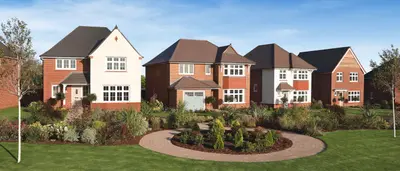
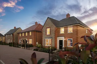
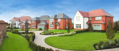
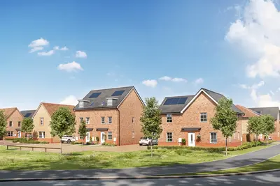
Langmead Place is a new build homes development by Cala Homes in the picturesque West Sussex village of Angmering, with its main entrance situated at Water Lane and Dappers Lane (BN16 4EJ). The scheme is part of a larger strategic allocation that will ultimately deliver 525 new dwellings, in partnership with Bellway Homes, including 158 affordable units. The development focuses on an exclusive collection of high-quality, energy-efficient 2, 3, and 4 bedroom houses.
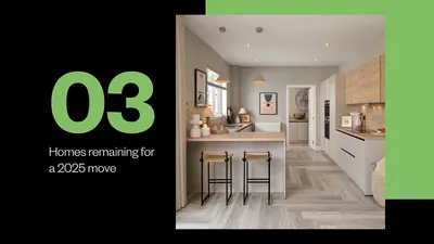
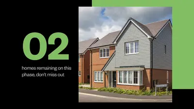
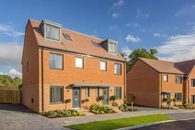
Cala Homes has a strong industry track record, having achieved the maximum Five-Star rating for customer satisfaction from the Home Builders Federation (HBF) for seven consecutive years, based on the independent National New Homes Survey. Langmead Place offers a mix of property styles, including Detached, End-Terraced, Semi-Detached, and Terrace houses. All new build homes are designed for low-maintenance and energy-efficient living, benefiting from superior insulation and modern features. The high specification is included in the purchase price, meaning buyers do not need to budget for significant extras. Standard features across the collection include high specification integrated kitchen appliances, flooring throughout, and the provision of turf and a shed to the rear gardens. Crucially for modern buyers, all properties also benefit from electric car charging points. Specific floorplans and room dimensions for house types like the ‘Foxglove’ (approx. 1,154 sq ft for a 3-bed plot) should be requested directly from the developer. Angmering village provides a balance of coastal proximity and commuter connectivity. Angmering railway station is located approximately a 20-minute walk from the village centre, offering direct Southern Railway services. Commuter times include London Victoria in approximately 90 minutes and Brighton in approximately 30 minutes. The development is well-positioned for road links, offering easy access to the A27, with connections to the A24 and A259, and the M25 reachable in less than an hour. Local amenities within the village centre are easily accessible, including a Co-Op, a chemist, and a traditional butcher. Dining and social options include family-friendly pub restaurants such as The Spotted Dog and The Lamb, as well as the Bengal Tandoori and The Stone Room (Pizza). Larger supermarkets nearby include Sainsbury's, Waitrose, Aldi, and an Asda Superstore. Education is served by local primary and secondary schools within easy walking distance, with planning contributions also allocated towards education facilities, including a new secondary school in the district, and the expansion of the Coppice Surgery. The wider area offers leisure facilities such as the Out of Bounds activity centre and is close to local green spaces, a new orchard, and a network of footpaths. The development is actively under construction, with showhomes and a customer reception open daily from 10am-5pm by appointment. Availability currently focuses on 2, 3, and 4 bedroom houses, with Phase 1 plots nearing completion and Phase 2 expected to be released in Winter 2025. Interested homebuyers are advised to contact the Cala Homes sales team at Langmead Place directly to confirm the availability, exact specification, and floorplans for specific plots, and to arrange a viewing appointment.
- Developer
- Cala Homes
- City
- West Sussex
- Neighbourhood
- Angmering
- Postcode
- BN16 4EJ
- Address
- Water Lane (Main entrance) & Dappers Lane, Angmering
- Tenure
- For sale
Questions about Langmead Place
›Who is the developer of Langmead Place?
Langmead Place is a Cala Homes development in Angmering, West Sussex. Cala Homes has 83 developments listed on Homello.
›Is Langmead Place still selling?
Langmead Place is marked "now selling" (unconfirmed), under construction. Use the enquiry button to check current availability with Cala Homes.
›What are house prices like in Angmering?
The median sold price in Angmering was £423,000 over the last 12 months (112 sales, −0.2% on the year before), or £396 per square foot, from HM Land Registry data. The house prices in Angmering page has the trend, prices by property type and every street.
Location
Water Lane (Main entrance) & Dappers Lane, Angmering, BN16 4EJ
Nearest stations
- Angmering Station 1.0 milesSouthern
- Goring-by-Sea Station 2.3 milesSouthern
- Arundel Station 3.1 milesSouthern
- Littlehampton Station 3.1 milesSouthern
Nearest schools
- St Wilfrids Catholic Primary School 0.2 milesPrimary · ages 4–11 Expected standard
- St Margaret's CofE Primary School 0.4 milesPrimary · ages 4–11 Good
- The Angmering School 0.6 milesSecondary · ages 11–19
- East Preston Infant School 1.2 milesPrimary · ages 4–7 Good
Nearest supermarkets
- The Co-operative Food Convenience store 0.1 miles
- Sainsburys Superstore 1.0 miles
- The Co-operative Food Convenience store 1.1 miles
- Aldi Supermarket 1.2 miles
Eating out nearby
Within half a mile: 3 restaurants and cafes, 4 pubs and bars, 1 takeaway.
- The Lamb Inn 0.1 milesPub or bar
- Pete's Den 0.1 milesPub or bar
- Shafiques of Angmering 0.1 milesRestaurant or cafe
- Juna home and garden 0.1 milesRestaurant or cafe
Straight-line distances; actual routes will be longer. Stations from NaPTAN, with their lines powered by TfL Open Data; schools from the Department for Education register, with the latest Ofsted signal; supermarkets from Geolytix Retail Points; places to eat from the Food Standards Agency's register of food businesses.
Area insights
The Arun neighbourhood around this development.
Sources: HM Land Registry price paid data, Police.uk, Historic England, ONS Census 2021, Ofcom Connected Nations, Environment Agency. Planning offices.

We have not been able to confirm current prices here recently.
Checked on the Cala Homes website on 28 October 2026.