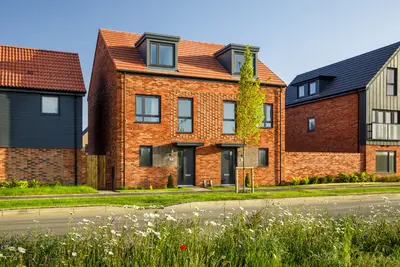
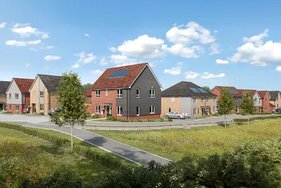
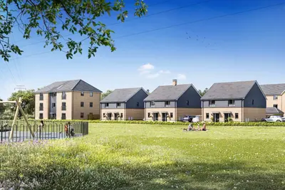
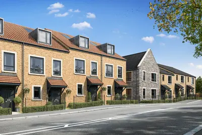
Land at Geilston Farm by Taylor Wimpey · Cardross, G82 5HG, Argyll and Bute
Taylor Wimpey has 252 developments on Homello.
About Land at Geilston Farm
Land at Geilston Farm is a proposed new build homes development by Taylor Wimpey West Scotland, located on Murrays Road, Cardross, Argyll and Bute, G82 5HG. This new neighbourhood is currently in the planning stage, with a formal application for planning permission in principle submitted to Argyll and Bute Council. The proposal details the delivery of up to 200 new homes, designed to meet local housing demand, including the projected need associated with the nearby Faslane naval base expansion.
A specific commitment has been made to include a 25% provision of affordable homes within the development mix. The masterplan emphasises integration with the existing landscape, incorporating substantial areas of green open space, landscaping, and Sustainable Urban Drainage (SUDS) ponds to manage water run-off and enhance the environment. As of the current planning status, specific house types, floor plans, and final pricing are yet to be released. Taylor Wimpey is expected to deliver an impressive choice of high-quality, energy-efficient homes, but potential homebuyers should contact the developer’s West Scotland office or register on their dedicated development website for the most accurate and up-to-date specifications and pricing ranges. Proposed site features include a focus on biodiversity, with planned enhancements such as bug hotels, bee bricks, and hedgehog highways. Furthermore, the development's location is intended to contribute to the proposed active travel route linking Cardross and Helensburgh, promoting walking and cycling. Land at Geilston Farm is positioned on the western edge of Cardross, situated between the A814 main road and the Helensburgh to Dumbarton railway line. The development is designed to function as a 20-minute-neighbourhood, providing easy access to local services. Commuter links are strong: Rail: Cardross train station is accessible from the site. Direct ScotRail services run to Glasgow Queen Street with an average journey time of approximately 38-39 minutes (fastest service around 31 minutes). The line also provides access to Helensburgh Central. Road: The adjacent A814 offers a direct route for drivers towards Dumbarton to the east and Helensburgh to the west. This road connects with the broader motorway network for travel into Glasgow. Bus: Local bus stops on the A814, such as at Westerhill and opposite Lyleston Farm, are served by the 206 route, providing regular services connecting Cardross with Helensburgh and Dumbarton. Essential local amenities are located within the village. Education is served by Cardross Primary School, the area’s sole non-denominational primary school, which caters to P1-P7 and incorporates an Early Learning and Childcare (ELC) facility. Retail and services include a Co-op store with an ATM and Amazon locker, the Cardross Post Office/Best-One (which also stocks local butcher produce), and Cardross Pharmacy. Local leisure and dining options include the Cardross Inn, Ardardan Farm Deli & Tearoom, Cardross Golf Club, and the National Trust for Scotland’s Geilston Garden. The development is managed by Taylor Wimpey West Scotland, a major UK housebuilder with published sector-leading targets to achieve Net Zero alignment for all its operations by 2035. Final commencement and completion dates are subject to the outcome of the planning application process by Argyll and Bute Council, which was under consideration at the time of publication. Prospective buyers are advised to formally register their interest with the developer for direct updates on property releases and confirmed pricing.
- Developer
- Taylor Wimpey
- City
- Argyll and Bute
- Neighbourhood
- Cardross
- Postcode
- G82 5HG
- Address
- Cardross, G82 5HG
- Total homes
- 200
- Tenure
- For sale
Facilities
- Green space
- Garden
Questions about Land at Geilston Farm
›Who is the developer of Land at Geilston Farm?
Land at Geilston Farm is a Taylor Wimpey development in Cardross, Argyll and Bute. Taylor Wimpey has 252 developments listed on Homello.
›What type of homes are at Land at Geilston Farm?
Land at Geilston Farm offers houses, 200 homes in total. Homes are sold outright by Taylor Wimpey.
Location
Cardross, G82 5HG
Nearest stations
- Craigendoran Station 1.2 milesScotRail
- Cardross Station 2.1 milesScotRail
- Helensburgh Central Station 2.2 milesScotRail
- Helensburgh Upper Station 2.5 milesScotRail
Nearest schools
- Bowness-on-Solway Primary School 91.8 milesPrimary · ages 3–11
- Silloth Primary School 92.4 milesPrimary · ages 3–11 Outstanding
- Solway Community School 92.5 milesSecondary · ages 11–16
- Holme St Cuthbert School 95.9 milesPrimary · ages 4–11 Good
Nearest supermarkets
- Morrisons Large supermarket 0.8 miles
- The Co-operative Food Convenience store 1.8 miles
- Tesco Express Esso Convenience store 1.9 miles
- Farmfoods Convenience store 2.1 miles
Eating out nearby
- Ardardan Estate 1.2 milesRestaurant or cafe
- Strathclyde Fire Brigade 1.5 milesRestaurant or cafe
- Drumfork Club 1.8 milesPub or bar
- Helensburgh Office's Cafe 2.0 milesRestaurant or cafe
Straight-line distances; actual routes will be longer. Stations from NaPTAN, with their lines powered by TfL Open Data; schools from the Department for Education register, with the latest Ofsted signal; supermarkets from Geolytix Retail Points; places to eat from the Food Standards Agency's register of food businesses.
Area insights
The neighbourhood around this development.
Sources: HM Land Registry price paid data, Police.uk, Historic England, ONS Census 2021, Ofcom Connected Nations, Environment Agency. Planning offices.

Register for launch pricing and availability.