Kenton Bank Meadows by Taylor Wimpey · Land East of A696 & West of Station Road, Kenton Bank Foot, Newcastle Upon Tyne, Tyne and Wear, NE13 8AG
Taylor Wimpey has 252 developments on Homello. Homes in Newcastle upon Tyne sold for a median £205,500 over the last year, £230 per sq ft; see house prices in Newcastle upon Tyne.
About Kenton Bank Meadows
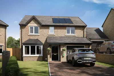
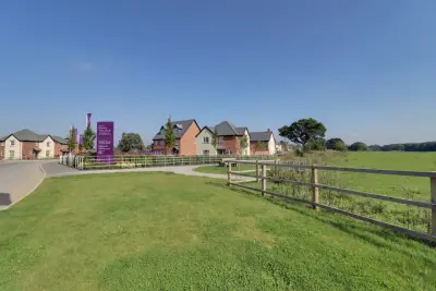
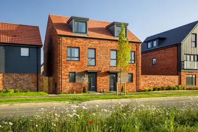
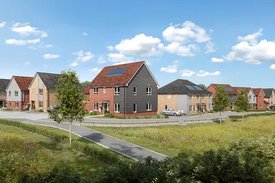
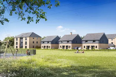
Kenton Bank Meadows is a new build development by Taylor Wimpey, located on land East of the A696 and West of Station Road in Kenton Bank Foot, Newcastle Upon Tyne, NE13 8AG. This exclusive community comprises 107 new homes, offering a collection of three- and four-bedroom properties designed for energy efficiency and modern family living. The development features a mix of semi-detached and detached house styles.
Each home is designed with sustainability in mind, incorporating features intended to reduce running costs and environmental impact, including PV solar panels, triple-glazed windows, and an electric vehicle (EV) charging point. The community masterplan includes landscaped communal areas and allotments. Kenton Bank Foot offers a balance of suburban living with direct access to Newcastle City Centre and key regional destinations. The development is strategically positioned for transport convenience. Bank Foot Metro Station is nearby, providing a direct connection to Newcastle International Airport in approximately 7 minutes, and to the city centre (Monument/Central Station) in around 19 minutes. High-frequency bus services, operated by Stagecoach North East, are accessible from Kenton Bank Foot, with services running every 30 minutes to Haymarket Barras Bridge, also taking approximately 19 minutes. Road connections are excellent, with Newcastle City Centre reachable by car in under 10 minutes, and the A696 providing a direct route to the A1(M). Residents benefit from proximity to established local amenities. Dining and leisure options within Kenton Bank Foot include the traditional pub and dining venue, The Twin Farms, and the Toby Carvery Kenton Bank. Shopping is well-served by local retailers and a short drive to nearby Kingston Park Retail Park for major supermarkets and retail outlets (specific major store names and locations should be confirmed with the sales team). Local education options include Kingston Park Primary School and secondary provision at Kenton School and Studio West. For high-achieving pupils, selective independent schools like Royal Grammar School and Dame Allan’s Schools are available in the wider Newcastle area. The developer, Taylor Wimpey, is a major national homebuilder with a track record of volume housebuilding. The company has been awarded a 4-star customer satisfaction rating by the Home Builders Federation (HBF), meaning over 90% of customers would recommend them. It should be noted that independent customer reviews for volume builders can be mixed, with some concerns occasionally raised about post-completion snagging and aftercare service. Potential buyers are advised to contact the Kenton Bank Meadows sales executive to confirm current plot availability, specific house types, exact square footage, and viewing arrangements for the show homes.
- Developer
- Taylor Wimpey
- City
- Tyne and Wear
- Neighbourhood
- Kenton Bank Foot
- Postcode
- NE13 8AG
- Address
- Land East of A696 & West of Station Road, Kenton Bank Foot, Newcastle Upon Tyne, Tyne and Wear, NE13 8AG
- Total homes
- 107
- Tenure
- For sale
Questions about Kenton Bank Meadows
›Who is the developer of Kenton Bank Meadows?
Kenton Bank Meadows is a Taylor Wimpey development in Kenton Bank Foot, Tyne and Wear. Taylor Wimpey has 252 developments listed on Homello.
›What are house prices like in Newcastle upon Tyne?
The median sold price in Newcastle upon Tyne was £205,500 over the last 12 months (4,494 sales, −2.1% on the year before), or £230 per square foot, from HM Land Registry data. The house prices in Newcastle upon Tyne page has the trend, prices by property type and every street.
›What type of homes are at Kenton Bank Meadows?
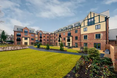
Kenton Bank Meadows offers houses and apartments, 107 homes in total. Homes are sold outright by Taylor Wimpey.
Location
Land East of A696 & West of Station Road, Kenton Bank Foot, Newcastle Upon Tyne, Tyne and Wear, NE13 8AG
Nearest stations
- Bank Foot Station 0.1 milesTyne and Wear Metro
- Kingston Park Station 0.6 milesTyne and Wear Metro
- Fawdon Station 1.4 milesTyne and Wear Metro
- Callerton Parkway Station 1.4 milesTyne and Wear Metro
Nearest schools
- Kingston Park Primary School 0.3 milesPrimary · ages 3–11
- Cheviot Primary School 0.7 milesPrimary · ages 3–11 Expected standard
- Simonside Primary School 0.8 milesPrimary · ages 3–11 Good
- Callerton Academy 0.8 milesSecondary · ages 11–16
Nearest supermarkets
- Aldi Supermarket 0.4 miles
- Marks and Spencer Superstore 0.5 miles
- The Food Warehouse Supermarket 0.5 miles
- Heron Convenience store 0.6 miles
Eating out nearby
Within half a mile: 2 restaurants and cafes, 1 pub or bar.
- Twin Farms 0.1 milesPub or bar
- Bullocksteads Hub 0.3 milesRestaurant or cafe
- Greggs 0.4 milesRestaurant or cafe
- Domino's Pizza 0.5 milesTakeaway
Straight-line distances; actual routes will be longer. Stations from NaPTAN, with their lines powered by TfL Open Data; schools from the Department for Education register, with the latest Ofsted signal; supermarkets from Geolytix Retail Points; places to eat from the Food Standards Agency's register of food businesses.
Area insights
The Newcastle upon Tyne neighbourhood around this development.
Sources: HM Land Registry price paid data, Police.uk, Historic England, ONS Census 2021, Ofcom Connected Nations, Environment Agency. Planning offices.

We have not been able to confirm current prices here recently.
Checked on the Taylor Wimpey website on 28 October 2026.