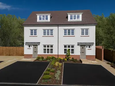
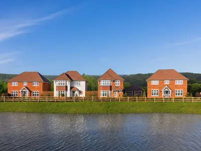
Hop Field Place by Redrow Homes · New Odiham Road, Alton, Hampshire GU34 1QG
Completed 2022 · status unconfirmed
Redrow Homes has 199 developments on Homello. Homes in Alton sold for a median £430,000 over the last year, £404 per sq ft; see house prices in Alton.
About Hop Field Place
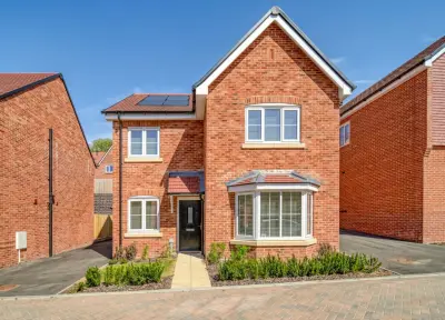
Hop Field Place is a completed new build development by Redrow Homes, situated on New Odiham Road in the Georgian market town of Alton, Hampshire (GU34 1QG). The development, named to reflect Alton’s local brewing and hop-growing history, is positioned west of the town centre, offering residents a blend of convenient commuter access and proximity to the open countryside that separates the North Wessex Downs and the South Downs National Park. The development is now Sold Out.
Available properties are exclusively through the resale market, but buyers interested in the build quality and location should note the development's characteristics. Redrow Homes holds a consistent reputation for design and customer satisfaction, having achieved a 5-star rating in the Home Builders Federation (HBF) customer satisfaction survey for 16 consecutive years. Hop Field Place primarily features 3 and 4-bedroom executive-style detached and semi-detached new build homes, built as part of Redrow’s award-winning Heritage Collection. Examples of property types on the development include the 3-bedroom Amberley and the 4-bedroom Cambridge, with some larger 5-bedroom Hampstead designs also forming part of the collection. Homes are characterised by traditional exteriors combined with spacious, modern interiors designed for contemporary family living. Typical four-bedroom detached residences feature a dedicated study, a separate utility room and cloakroom, and expansive open-plan kitchen/breakfast/dining areas with French doors opening to the garden. The principal bedrooms typically include integrated storage and en-suite shower rooms. The build standard includes above-average finishes and a focus on maximising natural light and space. The development is positioned for excellent local amenities and commuter links. Alton mainline train station is a short distance away, providing direct services to London Waterloo, with the fastest journey times clocking in at approximately 1 hour and 6 minutes (average journey is 1 hour 20 minutes). Major road connections are via the nearby A31, which links directly to Farnham, Winchester, the A3, and the M3 corridor for wider travel across the South East. Local amenities in Alton town centre include major retailers such as Sainsbury's, M&S Foodhall, Waitrose, Aldi, and Lidl, alongside a variety of local shops, pubs, and restaurants. The Alton Sports Centre offers a comprehensive range of facilities, including a swimming pool. For families, local educational provision includes Amery Hill School (Secondary 11-16) and Alton Infant School. As the original new build homes at Hop Field Place are sold out, current availability is restricted to resales. Recent market data indicates that three-bedroom semi-detached homes in the development have been marketed for approximately £475,000, while four-bedroom detached executive homes have a resale price indicator ranging from £700,000 to £725,000. Interested purchasers should contact local estate agents for current resale availability and specific property information. For details on any future Redrow developments in the Hampshire area, prospective buyers should contact the developer directly.
- Developer
- Redrow Homes
- City
- Hampshire
- Neighbourhood
- Alton
- Postcode
- GU34 1QG
- Address
- New Odiham Road, Alton, Hampshire GU34 1QG
- Total homes
- 180
- Completed
- 2022
- Tenure
- For sale
Questions about Hop Field Place
›Who is the developer of Hop Field Place?
Hop Field Place is a Redrow Homes development in Alton, Hampshire. Redrow Homes has 199 developments listed on Homello.
›Can I still buy a home at Hop Field Place?
Hop Field Place is sold out, and Redrow Homes is no longer marketing homes there.
›What are house prices like in Alton?
The median sold price in Alton was £430,000 over the last 12 months (457 sales, −2.3% on the year before), or £404 per square foot, from HM Land Registry data. The house prices in Alton page has the trend, prices by property type and every street.
›What type of homes are at Hop Field Place?
Hop Field Place offers houses, 180 homes in total, completed 2022. Homes are sold outright by Redrow Homes.
Location
New Odiham Road, Alton, Hampshire GU34 1QG
Nearest stations
- Alton Station 0.9 milesSouth Western
- Bentley Station 5.6 milesSouth Western
Nearest schools
- Amery Hill School 0.5 milesSecondary · ages 11–16 Good
- Saint Lawrence Church of England Primary School 0.5 milesPrimary · ages 4–11 Good
- The Butts Primary School 0.6 milesPrimary · ages 4–11
- Bushy Leaze Early Years Centre 0.7 milesNursery · ages 2–5 Outstanding
Nearest supermarkets
- Marks and Spencer Simply Food Supermarket 0.5 miles
- Iceland Supermarket 0.5 miles
- The Co-operative Food Convenience store 0.5 miles
- Sainsburys Superstore 0.7 miles
Eating out nearby
Within half a mile: 1 restaurant or cafe, 5 pubs and bars.
- CM Sports 0.4 milesPub or bar
- The Market Hotel 0.5 milesPub or bar
- The Lounge Bar 0.5 milesPub or bar
- Regency Cafe 0.5 milesRestaurant or cafe
Straight-line distances; actual routes will be longer. Stations from NaPTAN, with their lines powered by TfL Open Data; schools from the Department for Education register, with the latest Ofsted signal; supermarkets from Geolytix Retail Points; places to eat from the Food Standards Agency's register of food businesses.
Area insights
The East Hampshire neighbourhood around this development.
Sources: HM Land Registry price paid data, Police.uk, Historic England, ONS Census 2021, Ofcom Connected Nations, Environment Agency. Planning offices.

Resales appear under "On the market now" when listed; sold prices below.